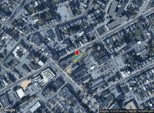
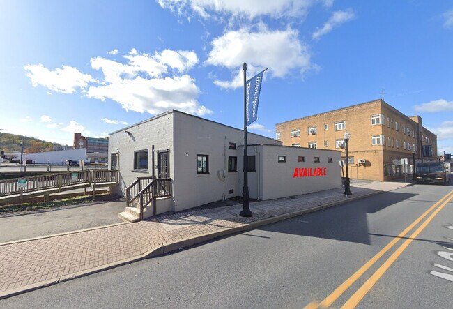
Property Record
27 N State St, Brownstown, PA 17508

NEARBY LISTINGS FOR SALE OR LEASE
Property Detail
27 N State St
Lancaster, PA
Shadowstone Manor Ph 02
260-16023-0-0000
27 N STATE ST
Commercialnec
Lancaster
X
Pennsylvania
42071C0191F
16a
2024
0.21 AC
2025
Lancaster County
013001
Philadelphia
3,119 SF
DEMOGRAPHICS near 27 N State St
1 Mile
3 Mile
5 Mile
2024 Total Population
13,551
33,369
56,260
2029 Population
13,691
33,632
56,494
Pop Growth 2024-2029
+ 1.03%
+ 0.79%
+ 0.42%
Average Age
40
41
40
2024 Total Households
5,481
13,146
21,254
HH Growth 2024-2029
+ 1.09%
+ 0.86%
+ 0.48%
Median Household Inc
$57,802
$66,523
$71,327
Avg Household Size
2.40
2.50
2.60
2024 Avg HH Vehicles
2.00
2.00
2.00
Median Home Value
$194,975
$224,378
$232,876
Median Year Built
1973
1977
1978
Nearby Places
Map Layers
Map Styles
 Street
 Aerial
- Restaurants
- Banks
- Shops
- Fitness
- Groceries
SALE & LEASE HISTORY
LISTING DATE
SALE/LEASE

Mar 06, 2017
For Lease
Jul 26, 2023
For Lease
Nearby Properties
Address
Land Use
TOTAL SIZE
Lot Size
Zoning
Address
Land Use
TOTAL SIZE
Lot Size
Zoning
251,634 SF
16.28 AC
Address
Land Use
TOTAL SIZE
Lot Size
Zoning
419,345 SF
48.05 AC
I-1
Address
Land Use
TOTAL SIZE
Lot Size
Zoning
226,686 SF
28 AC
RLD
Address
Land Use
TOTAL SIZE
Lot Size
Zoning
229,049 SF
26.80 AC
RLD
Address
Land Use
TOTAL SIZE
Lot Size
Zoning
203,091 SF
37.05 AC
Address
Land Use
TOTAL SIZE
Lot Size
Zoning
166,771 SF
10.76 AC
Address
Land Use
TOTAL SIZE
Lot Size
Zoning
155,373 SF
4.50 AC
Address
Land Use
TOTAL SIZE
Lot Size
Zoning
198,400 SF
36.90 AC
C-2
Address
Land Use
TOTAL SIZE
Lot Size
Zoning
90,600 SF
6.98 AC
Address
Land Use
TOTAL SIZE
Lot Size
Zoning
135,900 SF
11.79 AC
Address
Land Use
TOTAL SIZE
Lot Size
Zoning
1,350 SF
28.77 AC
Address
Land Use
TOTAL SIZE
Lot Size
Zoning
69,993 SF
Address
Land Use
TOTAL SIZE
Lot Size
Zoning
152,537 SF
17.20 AC
HC
Address
Land Use
TOTAL SIZE
Lot Size
Zoning
88,413 SF
5.30 AC
RMD
Address
Land Use
TOTAL SIZE
Lot Size
Zoning
85,104 SF
24.20 AC
Address
Land Use
TOTAL SIZE
Lot Size
Zoning
123,018 SF
14.30 AC
HC
Address
Land Use
TOTAL SIZE
Lot Size
Zoning
57,966 SF
6.03 AC
Address
Land Use
TOTAL SIZE
Lot Size
Zoning
145,069 SF
16.30 AC
LI
Address
Land Use
TOTAL SIZE
Lot Size
Zoning
75,760 SF
4.85 AC
RMD
Address
Land Use
TOTAL SIZE
Lot Size
Zoning
73,290 SF
12.83 AC
Address
Land Use
TOTAL SIZE
Lot Size
Zoning
92,217 SF
11.50 AC
C
Address
Land Use
TOTAL SIZE
Lot Size
Zoning
33,134 SF
0.42 AC
NC-2
Address
Land Use
TOTAL SIZE
Lot Size
Zoning
59,996 SF
6 AC
Address
Land Use
TOTAL SIZE
Lot Size
Zoning
55,896 SF
3.49 AC
Address
Land Use
TOTAL SIZE
Lot Size
Zoning
44,302 SF
9.58 AC
RLD
Address
Land Use
TOTAL SIZE
Lot Size
Zoning
51,954 SF
11.80 AC
R-1
Address
Land Use
TOTAL SIZE
Lot Size
Zoning
55,334 SF
5.70 AC
Address
Land Use
TOTAL SIZE
Lot Size
Zoning
96,337 SF
34.60 AC
I
Address
Land Use
TOTAL SIZE
Lot Size
Zoning
36,322 SF
7.70 AC
C-2
Address
Land Use
TOTAL SIZE
Lot Size
Zoning
50,888 SF
5.70 AC
RLD
The World's #1 Commercial Real Estate Marketplace
Connect with us
© 2025 CoStar Group
The information above has been obtained from sources believed reliable. While we do not doubt its accuracy we have not verified it and make no guarantee, warranty or representation about it. It is your responsibility to independently confirm its accuracy and completeness. Any projections, opinions, assumptions, or estimates used are for example only and do not represent the current or future performance of the property. The value of this transaction to you depends on tax and other factors which should be evaluated by your tax, financial, and legal advisors. You and your advisors should conduct a careful, independent investigation of the property to determine to your satisfaction the suitability of the property for your needs.