Property Record
27 Nod Rd, Avon, CT 06001
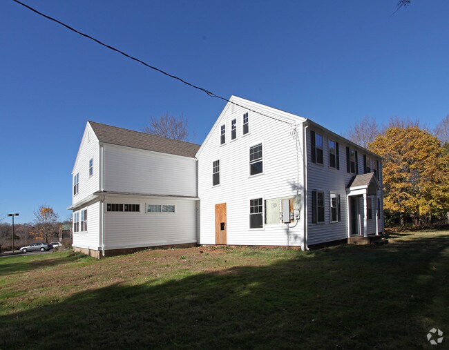


Property Detail
27 Nod Rd
Hartford-West Hartford-East Hartford, CT
HARTFORD
AVON-000009-000000-000329-000027
Connecticut
Commercialnec
3290027
AE The base floodplain where base flood elevations are provided. AE Zones are now used on new format FIRMs instead of A1-A30 Zones.
6.75 AC
2025
Avon
2025
Hartford
462201
NEARBY LISTINGS FOR SALE OR LEASE
DEMOGRAPHICS near 27 Nod Rd
1 mile
3 mile
5 mile
2025 Total Population
2,378
19,750
80,904
2030 Population
2,436
20,256
82,808
Pop Growth 2025-2030
+ 2.44%
+ 2.56%
+ 2.35%
Average Age
46
44
43
2025 Total Households
993
7,879
32,404
HH Growth 2025-2030
+ 2.42%
+ 2.70%
+ 2.43%
Median Household Inc
$134,239
$142,111
$144,461
Avg Household Size
2.40
2.40
2.40
2025 Avg HH Vehicles
2.00
2.00
2.00
Median Home Value
$583,856
$463,727
$443,972
Median Year Built
1983
1974
1970
Nearby Places
Map Layers
Map Styles
 Street
 Aerial
Layers
 Traffic
 Biking
Places
Listings with unknown addresses are not visible on the map
- Restaurants
- Banks
- Shops
- Fitness
- Groceries
PUBLIC TRANSPORTATION
COMMUTER RAIL
Hartford (Hartford Line - CONN DOT)
Drive
Walk
Distance
Hartford (Hartford Line - CONN DOT)
11 min
8.5 mi
Hartford Amtrak Station (Amtrak Hartford Line - Amtrak, Northeast Regional - Amtrak, Valley Flyer - Amtrak, Vermonter - Amtrak)
Drive
Walk
Distance
Hartford Amtrak Station (Amtrak Hartford Line - Amtrak, Northeast Regional - Amtrak, Valley Flyer - Amtrak, Vermonter - Amtrak)
11 min
8.7 mi
AIRPORT
Bradley International
Drive
Walk
Distance
Bradley International
37 min
17.5 mi
Freight Ports
Port of New Haven
Drive
Walk
Distance
Port of New Haven
52 min
39.2 mi
Nearby Properties
Address
Land Use
TOTAL SIZE
Lot Size
Zoning
Address
Land Use
TOTAL SIZE
Lot Size
Zoning
39.86 AC
R40
Address
Land Use
TOTAL SIZE
Lot Size
Zoning
234.01 AC
EL
Address
Land Use
TOTAL SIZE
Lot Size
Zoning
35.44 AC
HSFBC
Address
Land Use
TOTAL SIZE
Lot Size
Zoning
26,928 SF
14.77 AC
PAD
Address
Land Use
TOTAL SIZE
Lot Size
Zoning
16.40 AC
B-3
Address
Land Use
TOTAL SIZE
Lot Size
Zoning
49,881 SF
18 AC
R-40
Address
Land Use
TOTAL SIZE
Lot Size
Zoning
18.52 AC
R40
Address
Land Use
TOTAL SIZE
Lot Size
Zoning
21.24 AC
R40
Address
Land Use
TOTAL SIZE
Lot Size
Zoning
5,640 SF
106.10 AC
R-40
Address
Land Use
TOTAL SIZE
Lot Size
Zoning
46.60 AC
RU2A
Address
Land Use
TOTAL SIZE
Lot Size
Zoning
121,561 SF
4.56 AC
HSFBC
Address
Land Use
TOTAL SIZE
Lot Size
Zoning
21.86 AC
Address
Land Use
TOTAL SIZE
Lot Size
Zoning
48.90 AC
R-80
Address
Land Use
TOTAL SIZE
Lot Size
Zoning
18.05 AC
CR
Address
Land Use
TOTAL SIZE
Lot Size
Zoning
10.91 AC
AVC
Address
Land Use
TOTAL SIZE
Lot Size
Zoning
13.08 AC
CR
Address
Land Use
TOTAL SIZE
Lot Size
Zoning
21.06 AC
B-3
Address
Land Use
TOTAL SIZE
Lot Size
Zoning
112,351 SF
27.57 AC
RD
Address
Land Use
TOTAL SIZE
Lot Size
Zoning
61,272 SF
17.40 AC
R-13
Address
Land Use
TOTAL SIZE
Lot Size
Zoning
5.12 AC
Address
Land Use
TOTAL SIZE
Lot Size
Zoning
10 AC
RU2A
Address
Land Use
TOTAL SIZE
Lot Size
Zoning
6.57 AC
IP
Address
Land Use
TOTAL SIZE
Lot Size
Zoning
64,948 SF
9 AC
B-3
Address
Land Use
TOTAL SIZE
Lot Size
Zoning
20.11 AC
Address
Land Use
TOTAL SIZE
Lot Size
Zoning
4.02 AC
CP-A
Address
Land Use
TOTAL SIZE
Lot Size
Zoning
3.80 AC
Address
Land Use
TOTAL SIZE
Lot Size
Zoning
126,889 SF
13.73 AC
I-1
Address
Land Use
TOTAL SIZE
Lot Size
Zoning
19.72 AC
RD
Address
Land Use
TOTAL SIZE
Lot Size
Zoning
8.73 AC
Address
Land Use
TOTAL SIZE
Lot Size
Zoning
118,570 SF
13.73 AC
I-1
The World's #1 Commercial Real Estate Marketplace
Connect with us
© 2026 CoStar Group
The information above has been obtained from sources believed reliable. While we do not doubt its accuracy we have not verified it and make no guarantee, warranty or representation about it. It is your responsibility to independently confirm its accuracy and completeness. Any projections, opinions, assumptions, or estimates used are for example only and do not represent the current or future performance of the property. The value of this transaction to you depends on tax and other factors which should be evaluated by your tax, financial, and legal advisors. You and your advisors should conduct a careful, independent investigation of the property to determine to your satisfaction the suitability of the property for your needs.