Property Record
27 Reed St, Westbrook, ME 04092
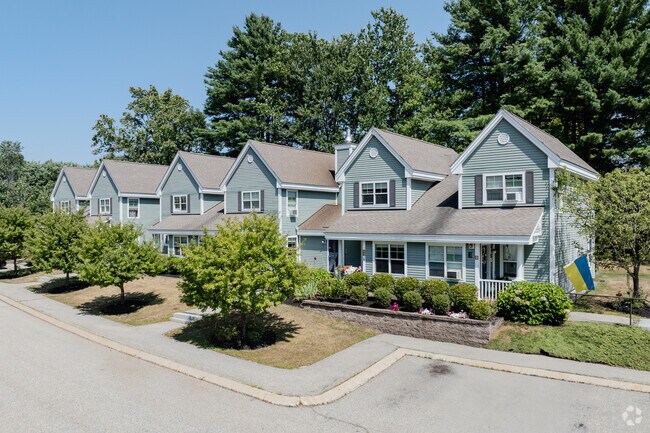

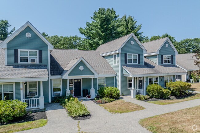
Property Detail
27 Reed St
WSBR-000056-000000-000042
Cumberland
Commercialnec
Maine
12
42
B and X Area of moderate flood hazard, usually the area between the limits of the 100-year and 500-year floods.
7.07 AC
2023
Outlying Cumberland County
2023
Portland/South Portland
002600
Portland-South Portland, ME
NEARBY LISTINGS FOR SALE OR LEASE
-
-
View all Westbrook listings for sale on LoopNet.com
DEMOGRAPHICS near 27 Reed St
1 mile
3 mile
5 mile
2025 Total Population
3,531
37,534
92,230
2030 Population
3,517
37,704
93,173
Pop Growth 2025-2030
(0.40%)
+ 0.45%
+ 1.02%
Average Age
41
42
41
2025 Total Households
1,391
16,027
41,128
HH Growth 2025-2030
(0.14%)
+ 0.59%
+ 1.18%
Median Household Inc
$107,382
$99,991
$93,022
Avg Household Size
2.50
2.30
2.10
2025 Avg HH Vehicles
2.00
2.00
2.00
Median Home Value
$409,550
$437,302
$471,454
Median Year Built
1974
1968
1959
Nearby Places
Map Layers
Map Styles
 Street
 Aerial
Layers
 Traffic
 Biking
Places
Listings with unknown addresses are not visible on the map
- Restaurants
- Banks
- Shops
- Fitness
- Groceries
PUBLIC TRANSPORTATION
COMMUTER RAIL
Drive
Walk
Distance
9 min
5.7 mi
AIRPORT
Portland International Jetport
Drive
Walk
Distance
Portland International Jetport
14 min
6.2 mi
Freight Ports
Portland, ME
Drive
Walk
Distance
Portland, ME
10 min
6.2 mi
Nearby Properties
Address
Land Use
TOTAL SIZE
Lot Size
Zoning
Address
Land Use
TOTAL SIZE
Lot Size
Zoning
10.08 AC
Address
Land Use
TOTAL SIZE
Lot Size
Zoning
55.70 AC
14
Address
Land Use
TOTAL SIZE
Lot Size
Zoning
78,396 SF
8.60 AC
Address
Land Use
TOTAL SIZE
Lot Size
Zoning
25.12 AC
Address
Land Use
TOTAL SIZE
Lot Size
Zoning
135,968 SF
7.02 AC
Address
Land Use
TOTAL SIZE
Lot Size
Zoning
173,617 SF
15.28 AC
Address
Land Use
TOTAL SIZE
Lot Size
Zoning
125,719 SF
18.79 AC
Address
Land Use
TOTAL SIZE
Lot Size
Zoning
9.23 AC
Address
Land Use
TOTAL SIZE
Lot Size
Zoning
141,420 SF
11.27 AC
TIF
Address
Land Use
TOTAL SIZE
Lot Size
Zoning
139,588 SF
0.85 AC
16
Address
Land Use
TOTAL SIZE
Lot Size
Zoning
33.07 AC
Address
Land Use
TOTAL SIZE
Lot Size
Zoning
17.95 AC
11
Address
Land Use
TOTAL SIZE
Lot Size
Zoning
17.72 AC
Address
Land Use
TOTAL SIZE
Lot Size
Zoning
19.08 AC
Address
Land Use
TOTAL SIZE
Lot Size
Zoning
10.16 AC
Address
Land Use
TOTAL SIZE
Lot Size
Zoning
206,165 SF
25.75 AC
Address
Land Use
TOTAL SIZE
Lot Size
Zoning
11.94 AC
Address
Land Use
TOTAL SIZE
Lot Size
Zoning
10.84 AC
Address
Land Use
TOTAL SIZE
Lot Size
Zoning
12.10 AC
Address
Land Use
TOTAL SIZE
Lot Size
Zoning
88,887 SF
21.44 AC
Address
Land Use
TOTAL SIZE
Lot Size
Zoning
11.96 AC
Address
Land Use
TOTAL SIZE
Lot Size
Zoning
115 SF
19.07 AC
Address
Land Use
TOTAL SIZE
Lot Size
Zoning
50,842 SF
Address
Land Use
TOTAL SIZE
Lot Size
Zoning
137,146 SF
13.66 AC
Address
Land Use
TOTAL SIZE
Lot Size
Zoning
193,698 SF
3.05 AC
Address
Land Use
TOTAL SIZE
Lot Size
Zoning
65,920 SF
9.85 AC
Address
Land Use
TOTAL SIZE
Lot Size
Zoning
303,156 SF
18.38 AC
Address
Land Use
TOTAL SIZE
Lot Size
Zoning
136 SF
11.76 AC
Address
Land Use
TOTAL SIZE
Lot Size
Zoning
13.88 AC
Address
Land Use
TOTAL SIZE
Lot Size
Zoning
116,949 SF
17.70 AC
The World's #1 Commercial Real Estate Marketplace
Connect with us
© 2026 CoStar Group
The information above has been obtained from sources believed reliable. While we do not doubt its accuracy we have not verified it and make no guarantee, warranty or representation about it. It is your responsibility to independently confirm its accuracy and completeness. Any projections, opinions, assumptions, or estimates used are for example only and do not represent the current or future performance of the property. The value of this transaction to you depends on tax and other factors which should be evaluated by your tax, financial, and legal advisors. You and your advisors should conduct a careful, independent investigation of the property to determine to your satisfaction the suitability of the property for your needs.