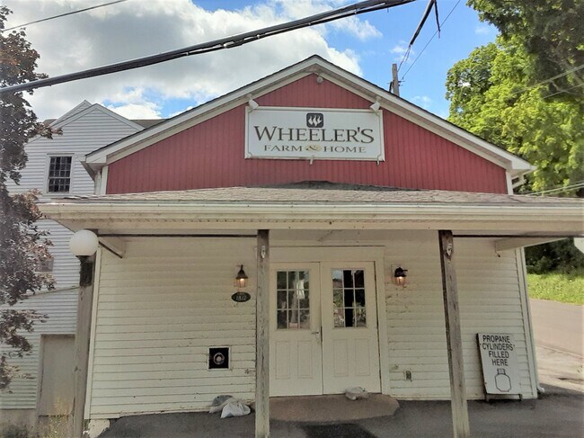
Property Record
27 S Main St, Jordan, NY 13080
NEARBY LISTINGS FOR SALE OR LEASE
-
-
View all Jordan listings for sale on LoopNet.com
Property Detail
27 S Main St
312803-009-000-0001-006-000-0000
FLS 46 & 58
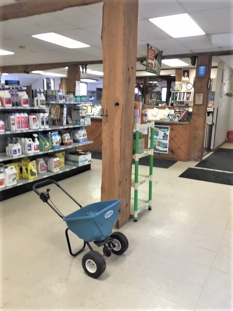
Warehouse
Onondaga
AE
New York
36067C0153F
6.000
2025
2.30 AC
2024
W Outer Onondaga County
012000
Syracuse
8,626 SF
Syracuse, NY
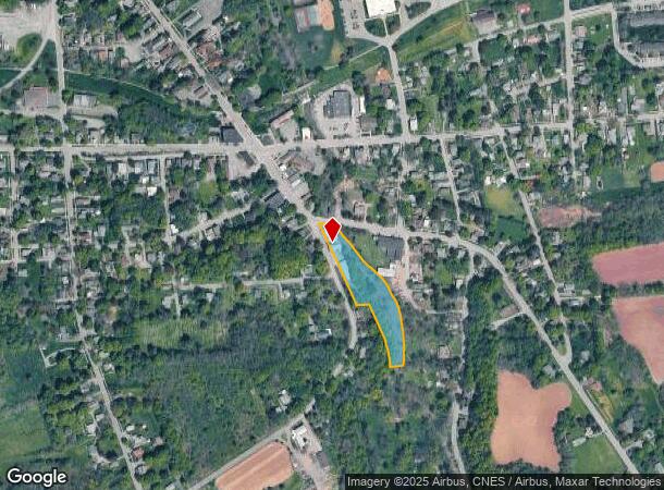
DEMOGRAPHICS near 27 S Main St
1 Mile
3 Mile
5 Mile
2024 Total Population
1,346
4,034
10,975
2029 Population
1,304
3,911
10,731
Pop Growth 2024-2029
(3.12%)
(3.05%)
(2.22%)
Average Age
44
45
45
2024 Total Households
572
1,718
4,572
HH Growth 2024-2029
(3.50%)
(3.32%)
(2.45%)
Median Household Inc
$69,084
$65,528
$66,206
Avg Household Size
2.40
2.30
2.30
2024 Avg HH Vehicles
2.00
2.00
2.00
Median Home Value
$149,423
$159,188
$159,381
Median Year Built
1948
1961
1971
Nearby Places
- Restaurants
- Banks
- Shops
- Fitness
- Groceries
PUBLIC TRANSPORTATION
AIRPORT
Syracuse Hancock International
DRIVE
WALK
Distance
Syracuse Hancock International
36 min
25.1 mi
SALE & LEASE HISTORY
LISTING DATE
SALE/LEASE

Jul 28, 2020
For Sale
Nearby Properties
Address
Land Use
TOTAL SIZE
Lot Size
Zoning
Address
Land Use
TOTAL SIZE
Lot Size
Zoning
305,558 SF
28.34 AC
9
Address
Land Use
TOTAL SIZE
Lot Size
Zoning
107,558 SF
57.12 AC
08 - GOVER
Address
Land Use
TOTAL SIZE
Lot Size
Zoning
185,026 SF
16.72 AC
9
Address
Land Use
TOTAL SIZE
Lot Size
Zoning
60,794 SF
39.61 AC
02 - SINGL
Address
Land Use
TOTAL SIZE
Lot Size
Zoning
52,922 SF
16.06 AC
07 - MIXED
Address
Land Use
TOTAL SIZE
Lot Size
Zoning
97,390 SF
31.92 AC
9
Address
Land Use
TOTAL SIZE
Lot Size
Zoning
10.90 AC
08 - GOVER
Address
Land Use
TOTAL SIZE
Lot Size
Zoning
Address
Land Use
TOTAL SIZE
Lot Size
Zoning
10,004 SF
4.03 AC
02 - SINGL
Address
Land Use
TOTAL SIZE
Lot Size
Zoning
12,810 SF
8.32 AC
06 - INDUS
Address
Land Use
TOTAL SIZE
Lot Size
Zoning
5,740 SF
2.36 AC
05 - COMME
Address
Land Use
TOTAL SIZE
Lot Size
Zoning
3,960 SF
21.70 AC
14
Address
Land Use
TOTAL SIZE
Lot Size
Zoning
840 SF
15.65 AC
HDR
Address
Land Use
TOTAL SIZE
Lot Size
Zoning
93.44 AC
08 - GOVER
Address
Land Use
TOTAL SIZE
Lot Size
Zoning
Address
Land Use
TOTAL SIZE
Lot Size
Zoning
11,295 SF
4.46 AC
04 - FARM
Address
Land Use
TOTAL SIZE
Lot Size
Zoning
35.03 AC
06 - INDUS
Address
Land Use
TOTAL SIZE
Lot Size
Zoning
4,668 SF
157.53 AC
04 - FARM
Address
Land Use
TOTAL SIZE
Lot Size
Zoning
6,932 SF
2.29 AC
05 - COMME
Address
Land Use
TOTAL SIZE
Lot Size
Zoning
3,680 SF
7.01 AC
03 - MULTI
Address
Land Use
TOTAL SIZE
Lot Size
Zoning
123,710 SF
6.56 AC
06 - INDUS
Address
Land Use
TOTAL SIZE
Lot Size
Zoning
9,000 SF
297.21 AC
AR
Address
Land Use
TOTAL SIZE
Lot Size
Zoning
39.18 AC
08 - GOVER
Address
Land Use
TOTAL SIZE
Lot Size
Zoning
10,976 SF
2.14 AC
05 - COMME
Address
Land Use
TOTAL SIZE
Lot Size
Zoning
Address
Land Use
TOTAL SIZE
Lot Size
Zoning
31.64 AC
08 - GOVER
Address
Land Use
TOTAL SIZE
Lot Size
Zoning
21,622 SF
5 AC
05 - COMME
Address
Land Use
TOTAL SIZE
Lot Size
Zoning
25,831 SF
8.31 AC
07 - MIXED
Address
Land Use
TOTAL SIZE
Lot Size
Zoning
7,432 SF
2.31 AC
05 - COMME
Address
Land Use
TOTAL SIZE
Lot Size
Zoning
9,100 SF
1.11 AC
05 - COMME
The World's #1 Commercial Real Estate Marketplace
Connect with us
© 2025 CoStar Group
The information above has been obtained from sources believed reliable. While we do not doubt its accuracy we have not verified it and make no guarantee, warranty or representation about it. It is your responsibility to independently confirm its accuracy and completeness. Any projections, opinions, assumptions, or estimates used are for example only and do not represent the current or future performance of the property. The value of this transaction to you depends on tax and other factors which should be evaluated by your tax, financial, and legal advisors. You and your advisors should conduct a careful, independent investigation of the property to determine to your satisfaction the suitability of the property for your needs.