Property Record
27 W 12Th St, Clintonville, WI 54929


NEARBY LISTINGS FOR SALE OR LEASE
Property Detail
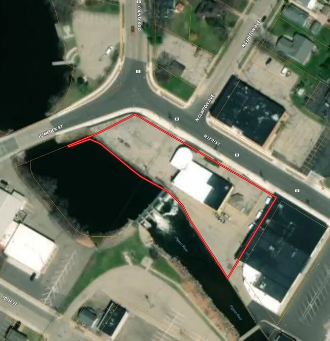
27 W 12Th St
30-23-71-158
Original Plat To The Village Now City Of
Commercialnec
PRT MILL RES LY N RIV & W PROP DESC V262P151ORIG PLAT V194P200 EX V276P60 V411P499 V429P357&358
AE
Waupaca
55135C0232D
Wisconsin
2023
1.40 AC
2024
Wisconsin North Area
101100
Other Market Areas
7,782 SF
DEMOGRAPHICS near 27 W 12Th St
1 Mile
3 Mile
5 Mile
2024 Total Population
4,941
5,893
7,286
2029 Population
4,990
5,940
7,310
Pop Growth 2024-2029
+ 0.99%
+ 0.80%
+ 0.33%
Average Age
42
42
43
2024 Total Households
2,258
2,656
3,204
HH Growth 2024-2029
+ 1.02%
+ 0.83%
+ 0.37%
Median Household Inc
$55,501
$55,634
$57,508
Avg Household Size
2.20
2.20
2.20
2024 Avg HH Vehicles
2.00
2.00
2.00
Median Home Value
$119,983
$126,416
$141,428
Median Year Built
1971
1973
1973
Nearby Places
Map Layers
Map Styles
 Street
 Aerial
- Restaurants
- Banks
- Shops
- Fitness
- Groceries
PUBLIC TRANSPORTATION
AIRPORT
Appleton International
DRIVE
WALK
Distance
Appleton International
54 min
34.8 mi
SALE & LEASE HISTORY
LISTING DATE
SALE/LEASE

Sep 12, 2024
For Sale
Jun 25, 2025
For Sale
Nearby Properties
Address
Land Use
TOTAL SIZE
Lot Size
Zoning
Address
Land Use
TOTAL SIZE
Lot Size
Zoning
19.95 AC
Address
Land Use
TOTAL SIZE
Lot Size
Zoning
Address
Land Use
TOTAL SIZE
Lot Size
Zoning
76,264 SF
6.27 AC
Address
Land Use
TOTAL SIZE
Lot Size
Zoning
30,128 SF
11.23 AC
Address
Land Use
TOTAL SIZE
Lot Size
Zoning
24,334 SF
22.62 AC
Address
Land Use
TOTAL SIZE
Lot Size
Zoning
40,661 SF
5.40 AC
Address
Land Use
TOTAL SIZE
Lot Size
Zoning
7.53 AC
Address
Land Use
TOTAL SIZE
Lot Size
Zoning
14.02 AC
Address
Land Use
TOTAL SIZE
Lot Size
Zoning
42 AC
A-G
Address
Land Use
TOTAL SIZE
Lot Size
Zoning
5,799 SF
2.50 AC
Address
Land Use
TOTAL SIZE
Lot Size
Zoning
20,876 SF
4.40 AC
Address
Land Use
TOTAL SIZE
Lot Size
Zoning
Address
Land Use
TOTAL SIZE
Lot Size
Zoning
16,580 SF
7.28 AC
Address
Land Use
TOTAL SIZE
Lot Size
Zoning
46,080 SF
3.39 AC
Address
Land Use
TOTAL SIZE
Lot Size
Zoning
29,670 SF
3.37 AC
Address
Land Use
TOTAL SIZE
Lot Size
Zoning
7.16 AC
Address
Land Use
TOTAL SIZE
Lot Size
Zoning
Address
Land Use
TOTAL SIZE
Lot Size
Zoning
9.52 AC
Address
Land Use
TOTAL SIZE
Lot Size
Zoning
33.22 AC
Address
Land Use
TOTAL SIZE
Lot Size
Zoning
13,650 SF
1.30 AC
Address
Land Use
TOTAL SIZE
Lot Size
Zoning
Address
Land Use
TOTAL SIZE
Lot Size
Zoning
14,348 SF
0.52 AC
Address
Land Use
TOTAL SIZE
Lot Size
Zoning
50,610 SF
8.52 AC
Address
Land Use
TOTAL SIZE
Lot Size
Zoning
21,618 SF
4.06 AC
Address
Land Use
TOTAL SIZE
Lot Size
Zoning
9.84 AC
Address
Land Use
TOTAL SIZE
Lot Size
Zoning
8,601 SF
1.77 AC
Address
Land Use
TOTAL SIZE
Lot Size
Zoning
Address
Land Use
TOTAL SIZE
Lot Size
Zoning
40 AC
A-G
Address
Land Use
TOTAL SIZE
Lot Size
Zoning
9,108 SF
97.07 AC
A-G
Address
Land Use
TOTAL SIZE
Lot Size
Zoning
0.17 AC
The World's #1 Commercial Real Estate Marketplace
Connect with us
© 2025 CoStar Group
The information above has been obtained from sources believed reliable. While we do not doubt its accuracy we have not verified it and make no guarantee, warranty or representation about it. It is your responsibility to independently confirm its accuracy and completeness. Any projections, opinions, assumptions, or estimates used are for example only and do not represent the current or future performance of the property. The value of this transaction to you depends on tax and other factors which should be evaluated by your tax, financial, and legal advisors. You and your advisors should conduct a careful, independent investigation of the property to determine to your satisfaction the suitability of the property for your needs.