Property Record
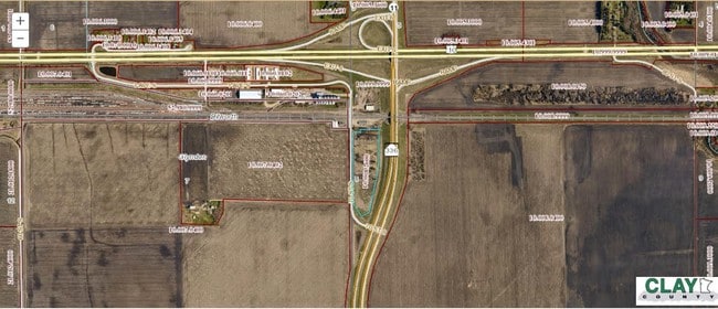
270 Highway 336 St S, Glyndon, MN 56547


This Property Is For Sale
NEARBY LISTINGS FOR SALE OR LEASE
Property Detail
270 Highway 336 St S
10-008-2600
10.21 AC W1/2 NW1/4 8-139-47 SECTION 08 TOWNSHIP 139 RANGE 047
Agriculturalland
Clay
X
Minnesota
27027C0482E
10.21 AC
2025
Fargo
2025
Other Market Areas
030112
Fargo, ND-MN
DEMOGRAPHICS near 270 Highway 336 St S
1 Mile
3 Mile
5 Mile
2024 Total Population
26
4,456
25,537
2029 Population
27
4,566
26,223
Pop Growth 2024-2029
+ 3.85%
+ 2.47%
+ 2.69%
Average Age
43
39
37
2024 Total Households
11
1,768
9,607
HH Growth 2024-2029
+ 9.09%
+ 2.66%
+ 2.87%
Median Household Inc
$99,999
$73,089
$70,902
Avg Household Size
2.30
2.50
2.50
2024 Avg HH Vehicles
3.00
2.00
2.00
Median Home Value
$166,666
$275,349
$238,709
Median Year Built
1966
1992
1989
Nearby Places
Map Layers
Map Styles
 Street
 Aerial
- Restaurants
- Banks
- Shops
- Fitness
- Groceries
PUBLIC TRANSPORTATION
COMMUTER RAIL
Fargo Amtrak Station (Empire Builder - Amtrak)
DRIVE
WALK
Distance
Fargo Amtrak Station (Empire Builder - Amtrak)
15 min
7.8 mi
AIRPORT
Hector International
DRIVE
WALK
Distance
Hector International
21 min
11.5 mi
Freight Ports
Port Milwaukee
DRIVE
WALK
Distance
Port Milwaukee
619 min
566.1 mi
Nearby Properties
Address
Land Use
TOTAL SIZE
Lot Size
Zoning
Address
Land Use
TOTAL SIZE
Lot Size
Zoning
17.75 AC
Address
Land Use
TOTAL SIZE
Lot Size
Zoning
189.14 AC
Address
Land Use
TOTAL SIZE
Lot Size
Zoning
1.51 AC
Address
Land Use
TOTAL SIZE
Lot Size
Zoning
200.83 AC
Address
Land Use
TOTAL SIZE
Lot Size
Zoning
20.62 AC
Address
Land Use
TOTAL SIZE
Lot Size
Zoning
557.73 AC
Address
Land Use
TOTAL SIZE
Lot Size
Zoning
2.56 AC
Address
Land Use
TOTAL SIZE
Lot Size
Zoning
315.96 AC
Address
Land Use
TOTAL SIZE
Lot Size
Zoning
455.30 AC
Address
Land Use
TOTAL SIZE
Lot Size
Zoning
17.64 AC
Address
Land Use
TOTAL SIZE
Lot Size
Zoning
408.17 AC
Address
Land Use
TOTAL SIZE
Lot Size
Zoning
Address
Land Use
TOTAL SIZE
Lot Size
Zoning
308.46 AC
Address
Land Use
TOTAL SIZE
Lot Size
Zoning
2.03 AC
Address
Land Use
TOTAL SIZE
Lot Size
Zoning
4.96 AC
Address
Land Use
TOTAL SIZE
Lot Size
Zoning
294.11 AC
Address
Land Use
TOTAL SIZE
Lot Size
Zoning
1.53 AC
Address
Land Use
TOTAL SIZE
Lot Size
Zoning
7.70 AC
Address
Land Use
TOTAL SIZE
Lot Size
Zoning
252.17 AC
Address
Land Use
TOTAL SIZE
Lot Size
Zoning
2.04 AC
Address
Land Use
TOTAL SIZE
Lot Size
Zoning
155.24 AC
Address
Land Use
TOTAL SIZE
Lot Size
Zoning
140 AC
Address
Land Use
TOTAL SIZE
Lot Size
Zoning
160 AC
Address
Land Use
TOTAL SIZE
Lot Size
Zoning
187.12 AC
Address
Land Use
TOTAL SIZE
Lot Size
Zoning
0.91 AC
Address
Land Use
TOTAL SIZE
Lot Size
Zoning
196.63 AC
Address
Land Use
TOTAL SIZE
Lot Size
Zoning
199.32 AC
Address
Land Use
TOTAL SIZE
Lot Size
Zoning
132.71 AC
Address
Land Use
TOTAL SIZE
Lot Size
Zoning
0.69 AC
Address
Land Use
TOTAL SIZE
Lot Size
Zoning
146.99 AC
The World's #1 Commercial Real Estate Marketplace
Connect with us
© 2025 CoStar Group
The information above has been obtained from sources believed reliable. While we do not doubt its accuracy we have not verified it and make no guarantee, warranty or representation about it. It is your responsibility to independently confirm its accuracy and completeness. Any projections, opinions, assumptions, or estimates used are for example only and do not represent the current or future performance of the property. The value of this transaction to you depends on tax and other factors which should be evaluated by your tax, financial, and legal advisors. You and your advisors should conduct a careful, independent investigation of the property to determine to your satisfaction the suitability of the property for your needs.