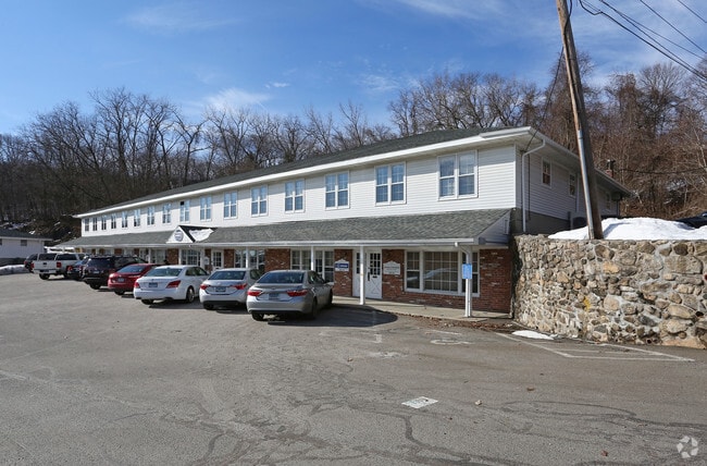
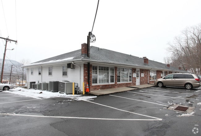
Property Record
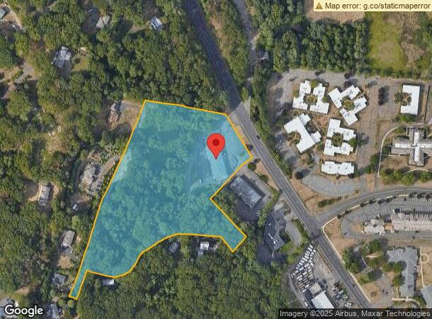
270 Amity Rd, Woodbridge, CT 06525
Current Lease Availabilities
NEARBY LISTINGS FOR SALE OR LEASE
Property Detail
270 Amity Rd
WOOD-002303-000030-000270
New Haven
Officebuilding
Connecticut
X
270
09009C0426H
7.29 AC
2025
Woodbridge
2025
Westchester/So Connecticut
160200
New Haven-Milford, CT
16,100 SF
DEMOGRAPHICS near 270 Amity Rd
1 Mile
3 Mile
5 Mile
2024 Total Population
4,026
56,165
199,131
2029 Population
4,018
55,491
197,988
Pop Growth 2024-2029
(0.20%)
(1.20%)
(0.57%)
Average Age
41
38
38
2024 Total Households
1,553
20,637
77,183
HH Growth 2024-2029
(0.19%)
(1.41%)
(0.54%)
Median Household Inc
$77,432
$72,919
$66,678
Avg Household Size
2.50
2.50
2.30
2024 Avg HH Vehicles
2.00
2.00
1.00
Median Home Value
$260,222
$271,377
$270,821
Median Year Built
1956
1952
1956
Nearby Places
- Restaurants
- Banks
- Shops
- Fitness
- Groceries
PUBLIC TRANSPORTATION
COMMUTER RAIL
New Haven-State Street Station (New Haven Line - Metro-North Commuter Railroad Company (Metro-North))
DRIVE
WALK
Distance
New Haven-State Street Station (New Haven Line - Metro-North Commuter Railroad Company (Metro-North))
9 min
4.6 mi
DRIVE
WALK
Distance
10 min
5.3 mi
AIRPORT
Tweed/New Haven
DRIVE
WALK
Distance
Tweed/New Haven
19 min
9.6 mi
Nearby Properties
Address
Land Use
TOTAL SIZE
Lot Size
Zoning
Address
Land Use
TOTAL SIZE
Lot Size
Zoning
302,262 SF
10.40 AC
RM1
Address
Land Use
TOTAL SIZE
Lot Size
Zoning
111,274 SF
22.62 AC
CEM
Address
Land Use
TOTAL SIZE
Lot Size
Zoning
9,767 SF
33.63 AC
RM1
Address
Land Use
TOTAL SIZE
Lot Size
Zoning
316,781 SF
9.20 AC
PDU 94
Address
Land Use
TOTAL SIZE
Lot Size
Zoning
57,339 SF
3.46 AC
RM2
Address
Land Use
TOTAL SIZE
Lot Size
Zoning
75,139 SF
3.54 AC
RM1
Address
Land Use
TOTAL SIZE
Lot Size
Zoning
6,784 SF
17.53 AC
RM1
Address
Land Use
TOTAL SIZE
Lot Size
Zoning
73,504 SF
7.97 AC
PDD 10
Address
Land Use
TOTAL SIZE
Lot Size
Zoning
78,579 SF
6.07 AC
RM2
Address
Land Use
TOTAL SIZE
Lot Size
Zoning
25 AC
A
Address
Land Use
TOTAL SIZE
Lot Size
Zoning
576 SF
RS2
Address
Land Use
TOTAL SIZE
Lot Size
Zoning
4,334 SF
70 AC
PARK
Address
Land Use
TOTAL SIZE
Lot Size
Zoning
46,962 SF
1.48 AC
RM1/RS
Address
Land Use
TOTAL SIZE
Lot Size
Zoning
86,644 SF
14 AC
PARK
Address
Land Use
TOTAL SIZE
Lot Size
Zoning
59,950 SF
3.29 AC
R4
Address
Land Use
TOTAL SIZE
Lot Size
Zoning
90,740 SF
1.97 AC
BA/RM1
Address
Land Use
TOTAL SIZE
Lot Size
Zoning
10.43 AC
M
Address
Land Use
TOTAL SIZE
Lot Size
Zoning
93,849 SF
3.16 AC
RM1
Address
Land Use
TOTAL SIZE
Lot Size
Zoning
89,436 SF
14.41 AC
R2
Address
Land Use
TOTAL SIZE
Lot Size
Zoning
13,204 SF
PDD 86
Address
Land Use
TOTAL SIZE
Lot Size
Zoning
146,678 SF
43.44 AC
A
Address
Land Use
TOTAL SIZE
Lot Size
Zoning
92,221 SF
3.90 AC
RM2
Address
Land Use
TOTAL SIZE
Lot Size
Zoning
53,974 SF
4.02 AC
RM1/RS
Address
Land Use
TOTAL SIZE
Lot Size
Zoning
2,180 SF
20.50 AC
PARK
Address
Land Use
TOTAL SIZE
Lot Size
Zoning
53.48 AC
A
Address
Land Use
TOTAL SIZE
Lot Size
Zoning
104,815 SF
14.50 AC
BA/RS2
Address
Land Use
TOTAL SIZE
Lot Size
Zoning
9,498 SF
8.85 AC
RS2
Address
Land Use
TOTAL SIZE
Lot Size
Zoning
56,573 SF
10.70 AC
RM1
Address
Land Use
TOTAL SIZE
Lot Size
Zoning
18,073 SF
2.81 AC
RM2
Address
Land Use
TOTAL SIZE
Lot Size
Zoning
203.57 AC
PARK
The World's #1 Commercial Real Estate Marketplace
Connect with us
© 2025 CoStar Group
The information above has been obtained from sources believed reliable. While we do not doubt its accuracy we have not verified it and make no guarantee, warranty or representation about it. It is your responsibility to independently confirm its accuracy and completeness. Any projections, opinions, assumptions, or estimates used are for example only and do not represent the current or future performance of the property. The value of this transaction to you depends on tax and other factors which should be evaluated by your tax, financial, and legal advisors. You and your advisors should conduct a careful, independent investigation of the property to determine to your satisfaction the suitability of the property for your needs.