Property Record
270 Fairview Rd, Ellenwood, GA 30294


NEARBY LISTINGS FOR SALE OR LEASE
Property Detail
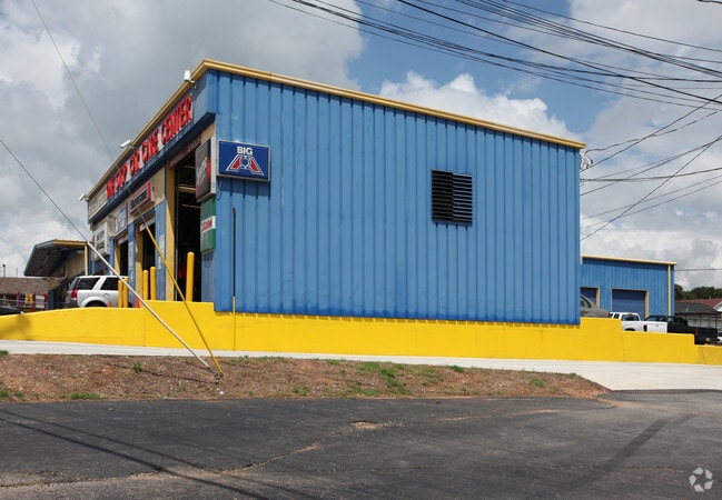
270 Fairview Rd
0025-01-030-001
Jmi Enterprises Inc
Autorepair
LD: 12LL: 198
X
Henry
13151C0080D
Georgia
2025
0.83 AC
2025
Forest Park/Morrow
070128
Atlanta
4,200 SF
Atlanta-Sandy Springs-Roswell, GA
DEMOGRAPHICS near 270 Fairview Rd
1 Mile
3 Mile
5 Mile
2024 Total Population
2,827
35,954
122,923
2029 Population
3,042
37,225
125,038
Pop Growth 2024-2029
+ 7.61%
+ 3.54%
+ 1.72%
Average Age
39
40
38
2024 Total Households
990
12,353
42,620
HH Growth 2024-2029
+ 7.58%
+ 3.62%
+ 1.72%
Median Household Inc
$69,124
$71,582
$66,099
Avg Household Size
2.90
2.90
2.80
2024 Avg HH Vehicles
2.00
2.00
2.00
Median Home Value
$201,737
$210,747
$196,690
Median Year Built
1982
1996
1993
Nearby Places
Map Layers
Map Styles
 Street
 Aerial
- Restaurants
- Banks
- Shops
- Fitness
- Groceries
PUBLIC TRANSPORTATION
AIRPORT
Hartsfield - Jackson Atlanta International
DRIVE
WALK
Distance
Hartsfield - Jackson Atlanta International
25 min
12.1 mi
SALE & LEASE HISTORY
LISTING DATE
SALE/LEASE

May 01, 2025
For Lease
Apr 17, 2024
For Sale
Nearby Properties
Address
Land Use
TOTAL SIZE
Lot Size
Zoning
Address
Land Use
TOTAL SIZE
Lot Size
Zoning
797,738 SF
54.98 AC
WH
Address
Land Use
TOTAL SIZE
Lot Size
Zoning
659,547 SF
31.20 AC
HI
Address
Land Use
TOTAL SIZE
Lot Size
Zoning
332,442 SF
28.80 AC
HI
Address
Land Use
TOTAL SIZE
Lot Size
Zoning
229,829 SF
24.15 AC
HI
Address
Land Use
TOTAL SIZE
Lot Size
Zoning
312,798 SF
21.38 AC
HI
Address
Land Use
TOTAL SIZE
Lot Size
Zoning
400,000 SF
42.87 AC
HI
Address
Land Use
TOTAL SIZE
Lot Size
Zoning
210,670 SF
14.80 AC
HI
Address
Land Use
TOTAL SIZE
Lot Size
Zoning
271,919 SF
17.89 AC
HI
Address
Land Use
TOTAL SIZE
Lot Size
Zoning
214,055 SF
55.08 AC
HI
Address
Land Use
TOTAL SIZE
Lot Size
Zoning
6,425 SF
64.33 AC
HI
Address
Land Use
TOTAL SIZE
Lot Size
Zoning
2,380 SF
41.50 AC
RS180
Address
Land Use
TOTAL SIZE
Lot Size
Zoning
234,192 SF
23 AC
HI
Address
Land Use
TOTAL SIZE
Lot Size
Zoning
80,431 SF
9.53 AC
C2
Address
Land Use
TOTAL SIZE
Lot Size
Zoning
101,848 SF
19.95 AC
C1
Address
Land Use
TOTAL SIZE
Lot Size
Zoning
5,320 SF
1,148.42 AC
X
Address
Land Use
TOTAL SIZE
Lot Size
Zoning
38,941 SF
38.90 AC
RS110
Address
Land Use
TOTAL SIZE
Lot Size
Zoning
68,272 SF
7.52 AC
C1
Address
Land Use
TOTAL SIZE
Lot Size
Zoning
4,288 SF
77.44 AC
M2
Address
Land Use
TOTAL SIZE
Lot Size
Zoning
82,557 SF
4.89 AC
C3
Address
Land Use
TOTAL SIZE
Lot Size
Zoning
53,745 SF
14.36 AC
PUD
Address
Land Use
TOTAL SIZE
Lot Size
Zoning
62,520 SF
18.01 AC
Address
Land Use
TOTAL SIZE
Lot Size
Zoning
5,168 SF
99.20 AC
C
Address
Land Use
TOTAL SIZE
Lot Size
Zoning
138,279 SF
26.47 AC
R2
Address
Land Use
TOTAL SIZE
Lot Size
Zoning
17,232 SF
2.18 AC
Address
Land Use
TOTAL SIZE
Lot Size
Zoning
54,142 SF
7.20 AC
C3
Address
Land Use
TOTAL SIZE
Lot Size
Zoning
13,320 SF
4.51 AC
OI
Address
Land Use
TOTAL SIZE
Lot Size
Zoning
131,929 SF
6.59 AC
C3
Address
Land Use
TOTAL SIZE
Lot Size
Zoning
10,517 SF
1.04 AC
C2
Address
Land Use
TOTAL SIZE
Lot Size
Zoning
12,996 SF
1.71 AC
C1
Address
Land Use
TOTAL SIZE
Lot Size
Zoning
19,127 SF
34.23 AC
RA
The World's #1 Commercial Real Estate Marketplace
Connect with us
© 2025 CoStar Group
The information above has been obtained from sources believed reliable. While we do not doubt its accuracy we have not verified it and make no guarantee, warranty or representation about it. It is your responsibility to independently confirm its accuracy and completeness. Any projections, opinions, assumptions, or estimates used are for example only and do not represent the current or future performance of the property. The value of this transaction to you depends on tax and other factors which should be evaluated by your tax, financial, and legal advisors. You and your advisors should conduct a careful, independent investigation of the property to determine to your satisfaction the suitability of the property for your needs.