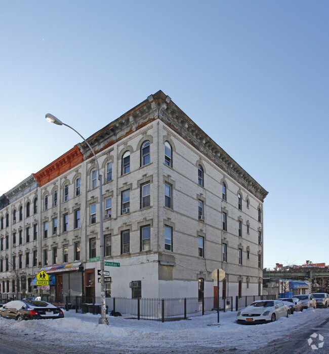
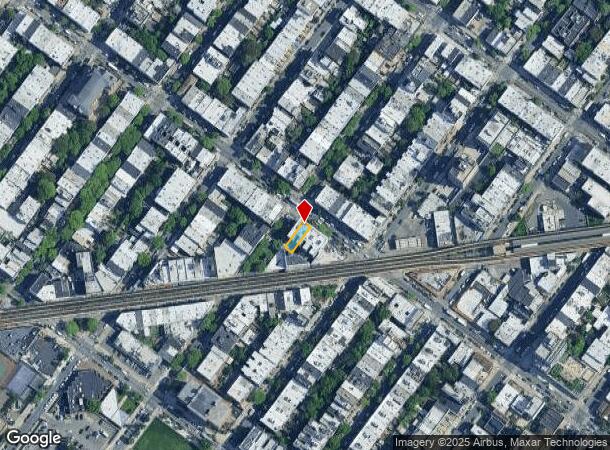
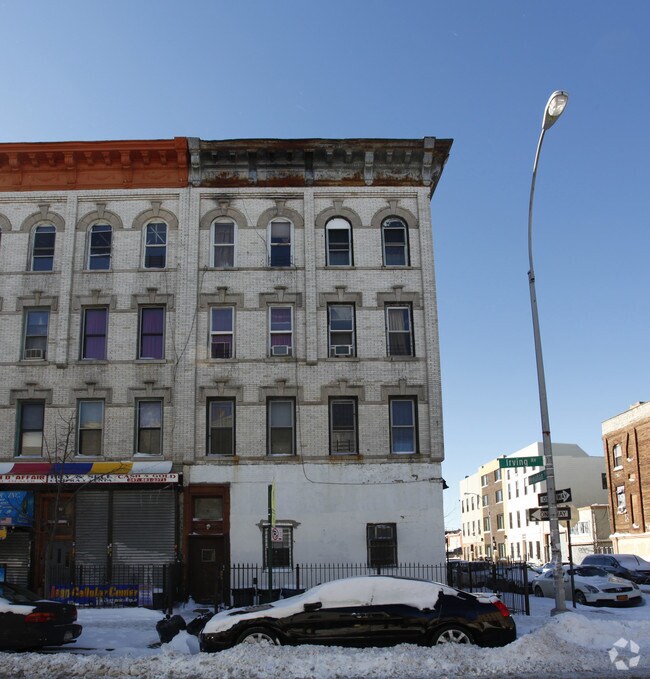
Property Record
270 Irving Ave, Brooklyn, NY 11237
NEARBY LISTINGS FOR SALE OR LEASE
Property Detail
270 Irving Ave
03318-0011
DOCID-2019080400030003
Multifamilydwelling
Kings
X
New York
3604970208F
11
2024
0.05 AC
2025
Bushwick
043300
Long Island (New York)
6,500 SF
New York-Jersey City-White Plains, NY-NJ
DEMOGRAPHICS near 270 Irving Ave
1 Mile
3 Mile
5 Mile
2024 Total Population
160,665
1,075,640
3,063,379
2029 Population
149,433
1,007,141
2,872,165
Pop Growth 2024-2029
(6.99%)
(6.37%)
(6.24%)
Average Age
36
37
39
2024 Total Households
57,775
396,323
1,215,106
HH Growth 2024-2029
(7.51%)
(6.80%)
(6.45%)
Median Household Inc
$69,923
$66,652
$78,229
Avg Household Size
2.60
2.60
2.40
2024 Avg HH Vehicles
.00
1.00
.00
Median Home Value
$912,341
$816,082
$787,731
Median Year Built
1947
1948
1949
Nearby Places
Map Layers
Map Styles
 Street
 Aerial
- Restaurants
- Banks
- Shops
- Fitness
- Groceries
PUBLIC TRANSPORTATION
TRANSIT/SUBWAY
Myrtle-Wyckoff Avenues (L - New York MTA Subway (The Subway), M - New York MTA Subway (The Subway))
DRIVE
WALK
Distance
Myrtle-Wyckoff Avenues (L - New York MTA Subway (The Subway), M - New York MTA Subway (The Subway))
1 min
4 min
0.2 mi
Knickerbocker Avenue (M Line) (M - New York MTA Subway (The Subway))
DRIVE
WALK
Distance
Knickerbocker Avenue (M Line) (M - New York MTA Subway (The Subway))
1 min
5 min
0.2 mi
DeKalb Avenue (L Line) (L - New York MTA Subway (The Subway))
DRIVE
WALK
Distance
DeKalb Avenue (L Line) (L - New York MTA Subway (The Subway))
2 min
9 min
0.4 mi
Seneca Avenue (M - New York MTA Subway (The Subway))
DRIVE
WALK
Distance
Seneca Avenue (M - New York MTA Subway (The Subway))
2 min
10 min
0.5 mi
Central Avenue (M - New York MTA Subway (The Subway))
DRIVE
WALK
Distance
Central Avenue (M - New York MTA Subway (The Subway))
2 min
12 min
0.6 mi
COMMUTER RAIL
East New York Station (Far Rockaway Branch - Long Island Rail Road, Long Beach Branch - Long Island Rail Road, West Hempstead Branch - Long Island Rail Road)
DRIVE
WALK
Distance
East New York Station (Far Rockaway Branch - Long Island Rail Road, Long Beach Branch - Long Island Rail Road, West Hempstead Branch - Long Island Rail Road)
7 min
2.5 mi
Nostrand Avenue Station (Far Rockaway Branch - Long Island Rail Road, Hempstead Branch - Long Island Rail Road, Long Beach Branch - Long Island Rail Road, West Hempstead Branch - Long Island Rail Road)
DRIVE
WALK
Distance
Nostrand Avenue Station (Far Rockaway Branch - Long Island Rail Road, Hempstead Branch - Long Island Rail Road, Long Beach Branch - Long Island Rail Road, West Hempstead Branch - Long Island Rail Road)
10 min
3.3 mi
AIRPORT
LaGuardia
DRIVE
WALK
Distance
LaGuardia
17 min
7.4 mi
John F Kennedy International
DRIVE
WALK
Distance
John F Kennedy International
20 min
11.0 mi
Newark Liberty International
DRIVE
WALK
Distance
Newark Liberty International
32 min
17.5 mi
Freight Ports
NY - Red Hook Container Terminal
DRIVE
WALK
Distance
NY - Red Hook Container Terminal
15 min
6.1 mi
Nearby Properties
Address
Land Use
TOTAL SIZE
Lot Size
Zoning
Address
Land Use
TOTAL SIZE
Lot Size
Zoning
2,812,739 SF
2.10 AC
C5-3
Address
Land Use
TOTAL SIZE
Lot Size
Zoning
7,058,736 SF
147.61 AC
M3-1
Address
Land Use
TOTAL SIZE
Lot Size
Zoning
835,231 SF
11.32 AC
R6
Address
Land Use
TOTAL SIZE
Lot Size
Zoning
512,755 SF
1.19 AC
R6
Address
Land Use
TOTAL SIZE
Lot Size
Zoning
296,915 SF
0.31 AC
C5-3
Address
Land Use
TOTAL SIZE
Lot Size
Zoning
503,608 SF
1.64 AC
R8
Address
Land Use
TOTAL SIZE
Lot Size
Zoning
493,889 SF
1.84 AC
R7-3
Address
Land Use
TOTAL SIZE
Lot Size
Zoning
264,691 SF
5.17 AC
M1-2
Address
Land Use
TOTAL SIZE
Lot Size
Zoning
1,000 SF
210.07 AC
R3-2
Address
Land Use
TOTAL SIZE
Lot Size
Zoning
1,572,198 SF
22.06 AC
M1-2
Address
Land Use
TOTAL SIZE
Lot Size
Zoning
826,915 SF
8.83 AC
M3-1
Address
Land Use
TOTAL SIZE
Lot Size
Zoning
446,763 SF
12.52 AC
R6
Address
Land Use
TOTAL SIZE
Lot Size
Zoning
1,150,500 SF
15.17 AC
R6
Address
Land Use
TOTAL SIZE
Lot Size
Zoning
363,205 SF
1.38 AC
M12R7A
Address
Land Use
TOTAL SIZE
Lot Size
Zoning
555,920 SF
2.61 AC
M1-2
Address
Land Use
TOTAL SIZE
Lot Size
Zoning
240,382 SF
0.24 AC
R9
Address
Land Use
TOTAL SIZE
Lot Size
Zoning
395,696 SF
1.56 AC
C6-2
Address
Land Use
TOTAL SIZE
Lot Size
Zoning
474,715 SF
1.72 AC
M14R8A
Address
Land Use
TOTAL SIZE
Lot Size
Zoning
458,778 SF
2.09 AC
R6
Address
Land Use
TOTAL SIZE
Lot Size
Zoning
490,600 SF
12.01 AC
M1-1
Address
Land Use
TOTAL SIZE
Lot Size
Zoning
564,564 SF
2.26 AC
R7-3
Address
Land Use
TOTAL SIZE
Lot Size
Zoning
432,024 SF
1.84 AC
M1-2
Address
Land Use
TOTAL SIZE
Lot Size
Zoning
257,660 SF
1.94 AC
R7A
Address
Land Use
TOTAL SIZE
Lot Size
Zoning
228,591 SF
0.82 AC
M1-2
Address
Land Use
TOTAL SIZE
Lot Size
Zoning
1,136,208 SF
30.25 AC
R5
Address
Land Use
TOTAL SIZE
Lot Size
Zoning
353,333 SF
1.99 AC
R6A
Address
Land Use
TOTAL SIZE
Lot Size
Zoning
291,041 SF
3.21 AC
R7-1
Address
Land Use
TOTAL SIZE
Lot Size
Zoning
780,000 SF
11.15 AC
R6
Address
Land Use
TOTAL SIZE
Lot Size
Zoning
88,700 SF
4.59 AC
M3-1
Address
Land Use
TOTAL SIZE
Lot Size
Zoning
821,016 SF
8.92 AC
R6
The World's #1 Commercial Real Estate Marketplace
Connect with us
© 2025 CoStar Group
The information above has been obtained from sources believed reliable. While we do not doubt its accuracy we have not verified it and make no guarantee, warranty or representation about it. It is your responsibility to independently confirm its accuracy and completeness. Any projections, opinions, assumptions, or estimates used are for example only and do not represent the current or future performance of the property. The value of this transaction to you depends on tax and other factors which should be evaluated by your tax, financial, and legal advisors. You and your advisors should conduct a careful, independent investigation of the property to determine to your satisfaction the suitability of the property for your needs.