Property Record
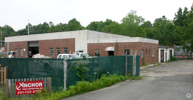
270 Knickerbocker Ave, Hillsdale, NJ 07642

NEARBY LISTINGS FOR SALE OR LEASE
Property Detail
270 Knickerbocker Ave
27-01212-0000-00013
1.37
Industrialgeneral
Bergen
X
New Jersey
34003C0093H
13
2024
1.37 AC
2025
Northeast Bergen
026200
Northern New Jersey
9,000 SF
New York-Jersey City-White Plains, NY-NJ
DEMOGRAPHICS near 270 Knickerbocker Ave
1 Mile
3 Mile
5 Mile
2024 Total Population
10,703
78,387
224,614
2029 Population
10,676
78,310
224,627
Pop Growth 2024-2029
(0.25%)
(0.10%)
+ 0.01%
Average Age
42
43
42
2024 Total Households
3,813
27,847
76,756
HH Growth 2024-2029
(0.39%)
(0.13%)
(0.04%)
Median Household Inc
$138,263
$149,359
$146,958
Avg Household Size
2.80
2.80
2.80
2024 Avg HH Vehicles
2.00
2.00
2.00
Median Home Value
$669,028
$699,267
$700,143
Median Year Built
1959
1962
1959
Nearby Places
Map Layers
Map Styles
 Street
 Aerial
- Restaurants
- Banks
- Shops
- Fitness
- Groceries
PUBLIC TRANSPORTATION
COMMUTER RAIL
Hillsdale (Pascack Valley Line - NJ Transit Commuter Rail (NJ Transit))
DRIVE
WALK
Distance
Hillsdale (Pascack Valley Line - NJ Transit Commuter Rail (NJ Transit))
3 min
10 min
0.5 mi
Woodcliff Lake (Pascack Valley Line - NJ Transit Commuter Rail (NJ Transit))
DRIVE
WALK
Distance
Woodcliff Lake (Pascack Valley Line - NJ Transit Commuter Rail (NJ Transit))
4 min
20 min
1.0 mi
AIRPORT
LaGuardia
DRIVE
WALK
Distance
LaGuardia
43 min
25.0 mi
Newark Liberty International
DRIVE
WALK
Distance
Newark Liberty International
39 min
27.6 mi
Westchester County
DRIVE
WALK
Distance
Westchester County
45 min
29.1 mi
Freight Ports
Maher Terminal
DRIVE
WALK
Distance
Maher Terminal
48 min
30.5 mi
Nearby Properties
Address
Land Use
TOTAL SIZE
Lot Size
Zoning
Address
Land Use
TOTAL SIZE
Lot Size
Zoning
19.96 AC
HSO
Address
Land Use
TOTAL SIZE
Lot Size
Zoning
131,384 SF
65 AC
EO
Address
Land Use
TOTAL SIZE
Lot Size
Zoning
Address
Land Use
TOTAL SIZE
Lot Size
Zoning
205,580 SF
21.18 AC
EO
Address
Land Use
TOTAL SIZE
Lot Size
Zoning
8.78 AC
HSO
Address
Land Use
TOTAL SIZE
Lot Size
Zoning
59 AC
AA
Address
Land Use
TOTAL SIZE
Lot Size
Zoning
23,572 SF
98.75 AC
CR
Address
Land Use
TOTAL SIZE
Lot Size
Zoning
Address
Land Use
TOTAL SIZE
Lot Size
Zoning
7.04 AC
SED
Address
Land Use
TOTAL SIZE
Lot Size
Zoning
Address
Land Use
TOTAL SIZE
Lot Size
Zoning
13 AC
EAO
Address
Land Use
TOTAL SIZE
Lot Size
Zoning
82.73 AC
Address
Land Use
TOTAL SIZE
Lot Size
Zoning
21.74 AC
SC
Address
Land Use
TOTAL SIZE
Lot Size
Zoning
9.29 AC
SED
Address
Land Use
TOTAL SIZE
Lot Size
Zoning
2,374 SF
1.80 AC
SOII
Address
Land Use
TOTAL SIZE
Lot Size
Zoning
71,166 SF
7.26 AC
B3
Address
Land Use
TOTAL SIZE
Lot Size
Zoning
1,620 SF
37.22 AC
R225
Address
Land Use
TOTAL SIZE
Lot Size
Zoning
3.33 AC
R3
Address
Land Use
TOTAL SIZE
Lot Size
Zoning
52,908 SF
13.37 AC
BG
Address
Land Use
TOTAL SIZE
Lot Size
Zoning
15,065 SF
9.30 AC
RC
Address
Land Use
TOTAL SIZE
Lot Size
Zoning
24.45 AC
R40
Address
Land Use
TOTAL SIZE
Lot Size
Zoning
62,728 SF
14.49 AC
RA15
Address
Land Use
TOTAL SIZE
Lot Size
Zoning
4 AC
HSO
Address
Land Use
TOTAL SIZE
Lot Size
Zoning
10.94 AC
AA
Address
Land Use
TOTAL SIZE
Lot Size
Zoning
144,751 SF
22.87 AC
RA
Address
Land Use
TOTAL SIZE
Lot Size
Zoning
29.86 AC
ORL
Address
Land Use
TOTAL SIZE
Lot Size
Zoning
89,200 SF
8 AC
SOII
Address
Land Use
TOTAL SIZE
Lot Size
Zoning
440 SF
98.43 AC
EO
Address
Land Use
TOTAL SIZE
Lot Size
Zoning
8.02 AC
BUS2
Address
Land Use
TOTAL SIZE
Lot Size
Zoning
9.70 AC
The World's #1 Commercial Real Estate Marketplace
Connect with us
© 2025 CoStar Group
The information above has been obtained from sources believed reliable. While we do not doubt its accuracy we have not verified it and make no guarantee, warranty or representation about it. It is your responsibility to independently confirm its accuracy and completeness. Any projections, opinions, assumptions, or estimates used are for example only and do not represent the current or future performance of the property. The value of this transaction to you depends on tax and other factors which should be evaluated by your tax, financial, and legal advisors. You and your advisors should conduct a careful, independent investigation of the property to determine to your satisfaction the suitability of the property for your needs.