Property Record
270 Maddox Rd, Jackson, MS 39212


Property Detail
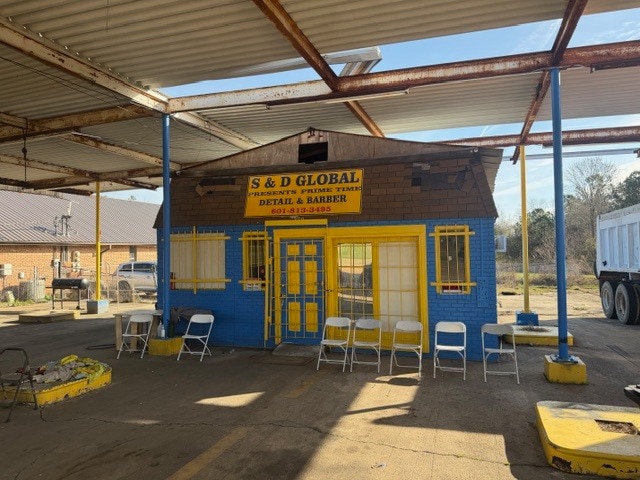
270 Maddox Rd
0835-0090-008
BEG 302.85 FT S INT E/L HWY 18 & N/L MADDOX RD ELY 288.75 FT S 80 FT W 288.75 FT N 80 FT TO POB IN SW 1/4 SE 1/4 SEC 15 T5 R1W
Commercialnec
HINDS
B and X Area of moderate flood hazard, usually the area between the limits of the 100-year and 500-year floods.
Mississippi
2024
0.52 AC
2025
South Jackson
011001
Jackson
601 SF
Jackson, MS
NEARBY LISTINGS FOR SALE OR LEASE
DEMOGRAPHICS near 270 Maddox Rd
1 mile
3 mile
5 mile
2025 Total Population
1,605
26,038
78,445
2030 Population
1,470
24,669
75,662
Pop Growth 2025-2030
(8.41%)
(5.26%)
(3.55%)
Average Age
40
38
38
2025 Total Households
667
10,191
30,751
HH Growth 2025-2030
(8.55%)
(5.57%)
(3.74%)
Median Household Inc
$64,978
$51,795
$48,195
Avg Household Size
2.30
2.50
2.40
2025 Avg HH Vehicles
2.00
2.00
2.00
Median Home Value
$139,382
$105,080
$120,124
Median Year Built
1977
1973
1972
Nearby Places
Map Layers
Map Styles
 Street
 Aerial
Transit
 Traffic
 Biking
Places
Listings with unknown addresses are not visible on the map
- Restaurants
- Banks
- Shops
- Fitness
- Groceries
PUBLIC TRANSPORTATION
COMMUTER RAIL
Jackson (City of New Orleans - Amtrak)
Drive
Walk
Distance
Jackson (City of New Orleans - Amtrak)
12 min
6.8 mi
AIRPORT
Jackson-Medgar Wiley Evers International
Drive
Walk
Distance
Jackson-Medgar Wiley Evers International
26 min
16.9 mi
Freight Ports
Port of Greater Baton Rouge
Drive
Walk
Distance
Port of Greater Baton Rouge
201 min
174.6 mi
Nearby Properties
Address
Land Use
TOTAL SIZE
Lot Size
Zoning
Address
Land Use
TOTAL SIZE
Lot Size
Zoning
113,434 SF
82.60 AC
Address
Land Use
TOTAL SIZE
Lot Size
Zoning
191,128 SF
29.57 AC
Address
Land Use
TOTAL SIZE
Lot Size
Zoning
192,048 SF
23.70 AC
Address
Land Use
TOTAL SIZE
Lot Size
Zoning
545,127 SF
36 AC
Address
Land Use
TOTAL SIZE
Lot Size
Zoning
41,110 SF
4.48 AC
Address
Land Use
TOTAL SIZE
Lot Size
Zoning
199,954 SF
23 AC
Address
Land Use
TOTAL SIZE
Lot Size
Zoning
171,950 SF
9 AC
Address
Land Use
TOTAL SIZE
Lot Size
Zoning
138,086 SF
14 AC
Address
Land Use
TOTAL SIZE
Lot Size
Zoning
223,892 SF
15 AC
Address
Land Use
TOTAL SIZE
Lot Size
Zoning
16,070 SF
6 AC
Address
Land Use
TOTAL SIZE
Lot Size
Zoning
11,950 SF
2 AC
Address
Land Use
TOTAL SIZE
Lot Size
Zoning
11,256 SF
3.60 AC
Address
Land Use
TOTAL SIZE
Lot Size
Zoning
7.28 AC
Address
Land Use
TOTAL SIZE
Lot Size
Zoning
13,721 SF
1.80 AC
Address
Land Use
TOTAL SIZE
Lot Size
Zoning
15.40 AC
Address
Land Use
TOTAL SIZE
Lot Size
Zoning
35,884 SF
0.02 AC
Address
Land Use
TOTAL SIZE
Lot Size
Zoning
13.86 AC
Address
Land Use
TOTAL SIZE
Lot Size
Zoning
21.12 AC
Address
Land Use
TOTAL SIZE
Lot Size
Zoning
185,868 SF
12 AC
Address
Land Use
TOTAL SIZE
Lot Size
Zoning
11,354 SF
50.54 AC
Address
Land Use
TOTAL SIZE
Lot Size
Zoning
174,366 SF
11.04 AC
Address
Land Use
TOTAL SIZE
Lot Size
Zoning
15,273 SF
1 AC
Address
Land Use
TOTAL SIZE
Lot Size
Zoning
14,075 SF
3.86 AC
Address
Land Use
TOTAL SIZE
Lot Size
Zoning
148,345 SF
9 AC
Address
Land Use
TOTAL SIZE
Lot Size
Zoning
8,152 SF
0.43 AC
Address
Land Use
TOTAL SIZE
Lot Size
Zoning
6,790 SF
0.75 AC
Address
Land Use
TOTAL SIZE
Lot Size
Zoning
22.50 AC
Address
Land Use
TOTAL SIZE
Lot Size
Zoning
101,010 SF
5.85 AC
Address
Land Use
TOTAL SIZE
Lot Size
Zoning
36.60 AC
Address
Land Use
TOTAL SIZE
Lot Size
Zoning
8.40 AC
The World's #1 Commercial Real Estate Marketplace
Connect with us
© 2026 CoStar Group
The information above has been obtained from sources believed reliable. While we do not doubt its accuracy we have not verified it and make no guarantee, warranty or representation about it. It is your responsibility to independently confirm its accuracy and completeness. Any projections, opinions, assumptions, or estimates used are for example only and do not represent the current or future performance of the property. The value of this transaction to you depends on tax and other factors which should be evaluated by your tax, financial, and legal advisors. You and your advisors should conduct a careful, independent investigation of the property to determine to your satisfaction the suitability of the property for your needs.