No Photo
Property Record
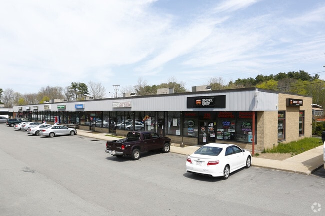
270 Main St, Hanson, MA 02341

Property Detail
270 Main St
HANS-000040-000000-000044C
Plymouth
Commercialnec
Massachusetts
100
3.35 AC
A Areas with a 1% annual chance of flooding and a 26% chance of flooding over the life of a 30-year mortgage.
Route 3 South
2025
Boston
2025
Boston-Cambridge-Newton, MA-NH
522101
NEARBY LISTINGS FOR SALE OR LEASE
DEMOGRAPHICS near 270 Main St
1 mile
3 mile
5 mile
2025 Total Population
2,486
20,841
58,448
2030 Population
2,549
21,149
59,147
Pop Growth 2025-2030
+ 2.53%
+ 1.48%
+ 1.20%
Average Age
42
42
43
2025 Total Households
925
7,599
21,191
HH Growth 2025-2030
+ 2.38%
+ 1.38%
+ 1.09%
Median Household Inc
$105,242
$119,155
$123,576
Avg Household Size
2.70
2.70
2.70
2025 Avg HH Vehicles
2.00
2.00
2.00
Median Home Value
$483,802
$561,412
$597,923
Median Year Built
1964
1971
1975
Nearby Places
Map Layers
Map Styles
 Street
 Aerial
Layers
 Traffic
 Biking
Places
Listings with unknown addresses are not visible on the map
- Restaurants
- Banks
- Shops
- Fitness
- Groceries
PUBLIC TRANSPORTATION
COMMUTER RAIL
Hanson (Kingston/Plymouth Line - Massachusetts Bay Transportation Authority Commuter Rail (Purple Line))
Drive
Walk
Distance
Hanson (Kingston/Plymouth Line - Massachusetts Bay Transportation Authority Commuter Rail (Purple Line))
4 min
1.7 mi
Halifax (Kingston/Plymouth Line - Massachusetts Bay Transportation Authority Commuter Rail (Purple Line))
Drive
Walk
Distance
Halifax (Kingston/Plymouth Line - Massachusetts Bay Transportation Authority Commuter Rail (Purple Line))
8 min
3.8 mi
AIRPORT
General Edward Lawrence Logan International
Drive
Walk
Distance
General Edward Lawrence Logan International
51 min
31.1 mi
Freight Ports
Port of Boston
Drive
Walk
Distance
Port of Boston
48 min
28.9 mi
Nearby Properties
Address
Land Use
TOTAL SIZE
Lot Size
Zoning
Address
Land Use
TOTAL SIZE
Lot Size
Zoning
198,173 SF
46.14 AC
Address
Land Use
TOTAL SIZE
Lot Size
Zoning
99,138 SF
83.32 AC
100
Address
Land Use
TOTAL SIZE
Lot Size
Zoning
81,433 SF
100.02 AC
Address
Land Use
TOTAL SIZE
Lot Size
Zoning
103,880 SF
30.51 AC
Address
Land Use
TOTAL SIZE
Lot Size
Zoning
25,262 SF
244 AC
Address
Land Use
TOTAL SIZE
Lot Size
Zoning
71,948 SF
38.96 AC
Address
Land Use
TOTAL SIZE
Lot Size
Zoning
8.32 AC
Address
Land Use
TOTAL SIZE
Lot Size
Zoning
57,730 SF
34.19 AC
Address
Land Use
TOTAL SIZE
Lot Size
Zoning
64,168 SF
10 AC
100
Address
Land Use
TOTAL SIZE
Lot Size
Zoning
77,930 SF
74.05 AC
Address
Land Use
TOTAL SIZE
Lot Size
Zoning
16.12 AC
100
Address
Land Use
TOTAL SIZE
Lot Size
Zoning
Address
Land Use
TOTAL SIZE
Lot Size
Zoning
78,601 SF
6.83 AC
100
Address
Land Use
TOTAL SIZE
Lot Size
Zoning
36,129 SF
36.70 AC
Address
Land Use
TOTAL SIZE
Lot Size
Zoning
51,280 SF
3.90 AC
100
Address
Land Use
TOTAL SIZE
Lot Size
Zoning
8.20 AC
100
Address
Land Use
TOTAL SIZE
Lot Size
Zoning
38,790 SF
7.82 AC
Address
Land Use
TOTAL SIZE
Lot Size
Zoning
42,152 SF
8.30 AC
Address
Land Use
TOTAL SIZE
Lot Size
Zoning
1,640 SF
854.31 AC
100
Address
Land Use
TOTAL SIZE
Lot Size
Zoning
14,464 SF
3.94 AC
100
Address
Land Use
TOTAL SIZE
Lot Size
Zoning
44,020 SF
7.38 AC
Address
Land Use
TOTAL SIZE
Lot Size
Zoning
15.80 AC
Address
Land Use
TOTAL SIZE
Lot Size
Zoning
54,705 SF
14.77 AC
100
Address
Land Use
TOTAL SIZE
Lot Size
Zoning
56,750 SF
2.85 AC
COMMER
Address
Land Use
TOTAL SIZE
Lot Size
Zoning
32,568 SF
1.89 AC
FLEX O
Address
Land Use
TOTAL SIZE
Lot Size
Zoning
9,000 SF
105.77 AC
Address
Land Use
TOTAL SIZE
Lot Size
Zoning
34,136 SF
3.45 AC
100
Address
Land Use
TOTAL SIZE
Lot Size
Zoning
75.76 AC
Address
Land Use
TOTAL SIZE
Lot Size
Zoning
22.97 AC
100
Address
Land Use
TOTAL SIZE
Lot Size
Zoning
63.40 AC
100
The World's #1 Commercial Real Estate Marketplace
Connect with us
© 2026 CoStar Group
The information above has been obtained from sources believed reliable. While we do not doubt its accuracy we have not verified it and make no guarantee, warranty or representation about it. It is your responsibility to independently confirm its accuracy and completeness. Any projections, opinions, assumptions, or estimates used are for example only and do not represent the current or future performance of the property. The value of this transaction to you depends on tax and other factors which should be evaluated by your tax, financial, and legal advisors. You and your advisors should conduct a careful, independent investigation of the property to determine to your satisfaction the suitability of the property for your needs.