Property Record
270 Main St, Harleysville, PA 19438


NEARBY LISTINGS FOR SALE OR LEASE
Property Detail
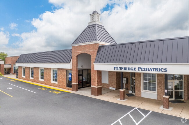
270 Main St
50-00-02017-003
ASSESSOR BLOCK-UNIT NUMBER 17-16
Regionalshoppingcenterormallwithanchorstore
Montgomery
AE
Pennsylvania
42091C0119G
16
2024
18.82 AC
2025
West Montgomery County
207001
Philadelphia
156,694 SF
Philadelphia-Camden-Wilmington, PA-NJ-DE-MD
DEMOGRAPHICS near 270 Main St
1 Mile
3 Mile
5 Mile
2024 Total Population
6,349
32,182
107,478
2029 Population
6,528
32,628
108,737
Pop Growth 2024-2029
+ 2.82%
+ 1.39%
+ 1.17%
Average Age
42
43
43
2024 Total Households
2,405
12,073
40,138
HH Growth 2024-2029
+ 2.91%
+ 1.35%
+ 1.15%
Median Household Inc
$124,501
$122,871
$103,549
Avg Household Size
2.60
2.60
2.50
2024 Avg HH Vehicles
2.00
2.00
2.00
Median Home Value
$432,769
$415,577
$372,183
Median Year Built
1989
1988
1981
Nearby Places
Map Layers
Map Styles
 Street
 Aerial
- Restaurants
- Banks
- Shops
- Fitness
- Groceries
PUBLIC TRANSPORTATION
COMMUTER RAIL
Lansdale (R5 - Southeastern Pennsylvania Transportation Authority Regional Rail (SEPTA Regional Rail))
DRIVE
WALK
Distance
Lansdale (R5 - Southeastern Pennsylvania Transportation Authority Regional Rail (SEPTA Regional Rail))
14 min
6.4 mi
North Wales (R5 - Southeastern Pennsylvania Transportation Authority Regional Rail (SEPTA Regional Rail))
DRIVE
WALK
Distance
North Wales (R5 - Southeastern Pennsylvania Transportation Authority Regional Rail (SEPTA Regional Rail))
16 min
7.0 mi
AIRPORT
Philadelphia International
DRIVE
WALK
Distance
Philadelphia International
54 min
38.6 mi
Lehigh Valley International
DRIVE
WALK
Distance
Lehigh Valley International
54 min
40.4 mi
Trenton Mercer
DRIVE
WALK
Distance
Trenton Mercer
61 min
47.0 mi
Freight Ports
Port of Philadelphia
DRIVE
WALK
Distance
Port of Philadelphia
46 min
28.4 mi
SALE & LEASE HISTORY
LISTING DATE
SALE/LEASE

Sep 25, 2016
For Lease
Nearby Properties
Address
Land Use
TOTAL SIZE
Lot Size
Zoning
Address
Land Use
TOTAL SIZE
Lot Size
Zoning
437,908 SF
104.29 AC
INST
Address
Land Use
TOTAL SIZE
Lot Size
Zoning
677,546 SF
92.50 AC
INST
Address
Land Use
TOTAL SIZE
Lot Size
Zoning
454,126 SF
37.18 AC
MRC
Address
Land Use
TOTAL SIZE
Lot Size
Zoning
253,741 SF
9.09 AC
VO
Address
Land Use
TOTAL SIZE
Lot Size
Zoning
832,830 SF
53.72 AC
LI
Address
Land Use
TOTAL SIZE
Lot Size
Zoning
211,561 SF
38.80 AC
LI
Address
Land Use
TOTAL SIZE
Lot Size
Zoning
373,104 SF
31.94 AC
LI
Address
Land Use
TOTAL SIZE
Lot Size
Zoning
170,351 SF
71.70 AC
IN
Address
Land Use
TOTAL SIZE
Lot Size
Zoning
179,930 SF
16 AC
IN
Address
Land Use
TOTAL SIZE
Lot Size
Zoning
149,259 SF
4.30 AC
R3
Address
Land Use
TOTAL SIZE
Lot Size
Zoning
156,186 SF
31.41 AC
R1
Address
Land Use
TOTAL SIZE
Lot Size
Zoning
136,281 SF
4.05 AC
R3
Address
Land Use
TOTAL SIZE
Lot Size
Zoning
52,348 SF
21.30 AC
R5
Address
Land Use
TOTAL SIZE
Lot Size
Zoning
98,782 SF
5.09 AC
BC
Address
Land Use
TOTAL SIZE
Lot Size
Zoning
17,364 SF
31.92 AC
LI
Address
Land Use
TOTAL SIZE
Lot Size
Zoning
197,233 SF
15.66 AC
LI
Address
Land Use
TOTAL SIZE
Lot Size
Zoning
90,217 SF
19 AC
R1
Address
Land Use
TOTAL SIZE
Lot Size
Zoning
246,631 SF
48.78 AC
AO
Address
Land Use
TOTAL SIZE
Lot Size
Zoning
115,644 SF
1.90 AC
LI
Address
Land Use
TOTAL SIZE
Lot Size
Zoning
112,282 SF
11.23 AC
R5
Address
Land Use
TOTAL SIZE
Lot Size
Zoning
90,053 SF
24.28 AC
LI
Address
Land Use
TOTAL SIZE
Lot Size
Zoning
93,049 SF
20.88 AC
CB
Address
Land Use
TOTAL SIZE
Lot Size
Zoning
76,871 SF
32.35 AC
R175
Address
Land Use
TOTAL SIZE
Lot Size
Zoning
77,700 SF
1.78 AC
BC
Address
Land Use
TOTAL SIZE
Lot Size
Zoning
60,519 SF
20.68 AC
R1
Address
Land Use
TOTAL SIZE
Lot Size
Zoning
98,526 SF
5.12 AC
LI
Address
Land Use
TOTAL SIZE
Lot Size
Zoning
24,850 SF
15.21 AC
IN
Address
Land Use
TOTAL SIZE
Lot Size
Zoning
29,014 SF
13.41 AC
R5
Address
Land Use
TOTAL SIZE
Lot Size
Zoning
89,433 SF
6.83 AC
IN
The World's #1 Commercial Real Estate Marketplace
Connect with us
© 2025 CoStar Group
The information above has been obtained from sources believed reliable. While we do not doubt its accuracy we have not verified it and make no guarantee, warranty or representation about it. It is your responsibility to independently confirm its accuracy and completeness. Any projections, opinions, assumptions, or estimates used are for example only and do not represent the current or future performance of the property. The value of this transaction to you depends on tax and other factors which should be evaluated by your tax, financial, and legal advisors. You and your advisors should conduct a careful, independent investigation of the property to determine to your satisfaction the suitability of the property for your needs.