Property Record
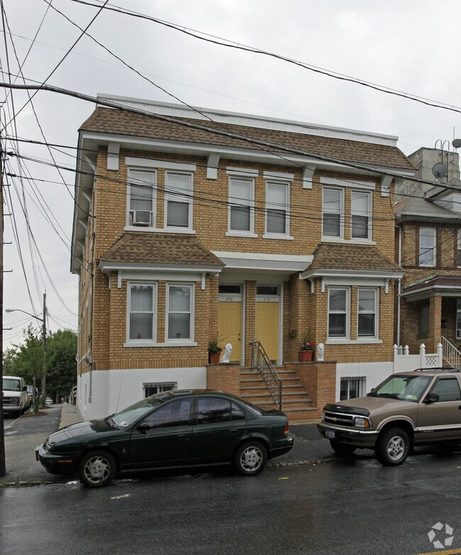
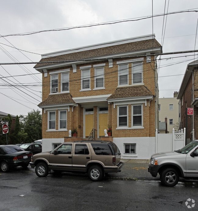
270 Mcclean Ave, Staten Island, NY 10305

NEARBY LISTINGS FOR SALE OR LEASE
Property Detail
270 Mcclean Ave
03108-0030
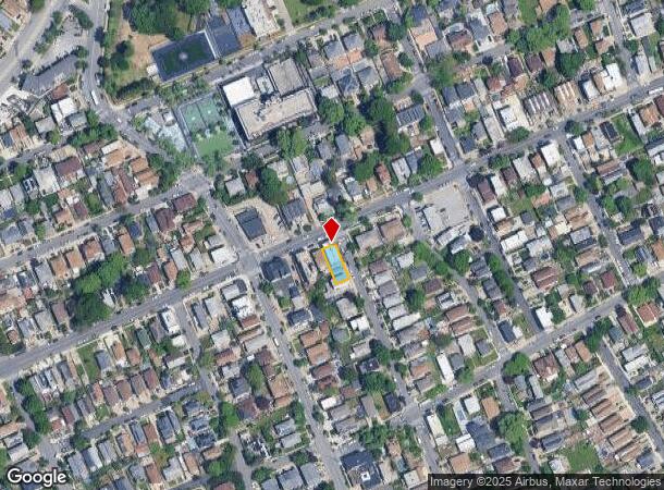
Map Of South Beach 4Th Ward Borough Of R
Multifamilydwelling
Staten Island
X
New York
3604970327F
30
2024
0.09 AC
2025
Arrochar
007400
Long Island (New York)
3,286 SF
New York-Jersey City-White Plains, NY-NJ
DEMOGRAPHICS near 270 Mcclean Ave
1 Mile
3 Mile
5 Mile
2024 Total Population
30,617
193,176
801,905
2029 Population
30,473
189,505
758,127
Pop Growth 2024-2029
(0.47%)
(1.90%)
(5.46%)
Average Age
41
41
40
2024 Total Households
10,520
71,324
273,065
HH Growth 2024-2029
(0.45%)
(2.23%)
(5.57%)
Median Household Inc
$73,875
$78,843
$67,896
Avg Household Size
2.80
2.60
2.80
2024 Avg HH Vehicles
1.00
1.00
1.00
Median Home Value
$654,765
$681,129
$718,802
Median Year Built
1974
1961
1951
Nearby Places
- Restaurants
- Banks
- Shops
- Fitness
- Groceries
PUBLIC TRANSPORTATION
TRANSIT/SUBWAY
Grasmere (Staten Island Railway - New York MTA Subway (The Subway))
DRIVE
WALK
Distance
Grasmere (Staten Island Railway - New York MTA Subway (The Subway))
3 min
20 min
1.0 mi
COMMUTER RAIL
Grasmere (Staten Island Railway - New York MTA Subway (The Subway))
DRIVE
WALK
Distance
Grasmere (Staten Island Railway - New York MTA Subway (The Subway))
3 min
20 min
1.0 mi
Old Town (Staten Island Railway - New York MTA Subway (The Subway))
DRIVE
WALK
Distance
Old Town (Staten Island Railway - New York MTA Subway (The Subway))
4 min
1.1 mi
AIRPORT
Newark Liberty International
DRIVE
WALK
Distance
Newark Liberty International
28 min
16.9 mi
LaGuardia
DRIVE
WALK
Distance
LaGuardia
34 min
19.7 mi
John F Kennedy International
DRIVE
WALK
Distance
John F Kennedy International
37 min
22.2 mi
Freight Ports
New York Container Terminal
DRIVE
WALK
Distance
New York Container Terminal
14 min
7.7 mi
Nearby Properties
Address
Land Use
TOTAL SIZE
Lot Size
Zoning
Address
Land Use
TOTAL SIZE
Lot Size
Zoning
1,524,659 SF
170.96 AC
R4
Address
Land Use
TOTAL SIZE
Lot Size
Zoning
686,130 SF
189.62 AC
R3-2
Address
Land Use
TOTAL SIZE
Lot Size
Zoning
640,077 SF
19.34 AC
R3-1
Address
Land Use
TOTAL SIZE
Lot Size
Zoning
135,000 SF
117.71 AC
PARK
Address
Land Use
TOTAL SIZE
Lot Size
Zoning
236,591 SF
207.66 AC
R3-2
Address
Land Use
TOTAL SIZE
Lot Size
Zoning
286,000 SF
12.63 AC
PARK
Address
Land Use
TOTAL SIZE
Lot Size
Zoning
521,405 SF
52.79 AC
R3-1
Address
Land Use
TOTAL SIZE
Lot Size
Zoning
421,275 SF
18.95 AC
R3-2
Address
Land Use
TOTAL SIZE
Lot Size
Zoning
111,000 SF
186.03 AC
PARK
Address
Land Use
TOTAL SIZE
Lot Size
Zoning
152,440 SF
23.07 AC
R4B
Address
Land Use
TOTAL SIZE
Lot Size
Zoning
240 SF
47.41 AC
R3-2
Address
Land Use
TOTAL SIZE
Lot Size
Zoning
476,145 SF
50.97 AC
R3-1
Address
Land Use
TOTAL SIZE
Lot Size
Zoning
43,068 SF
216.83 AC
PARK
Address
Land Use
TOTAL SIZE
Lot Size
Zoning
146,855 SF
16.50 AC
R3-1
Address
Land Use
TOTAL SIZE
Lot Size
Zoning
16,570 SF
240.82 AC
PARK
Address
Land Use
TOTAL SIZE
Lot Size
Zoning
414,400 SF
2.70 AC
R7A
Address
Land Use
TOTAL SIZE
Lot Size
Zoning
77,502 SF
1.29 AC
R3-1
Address
Land Use
TOTAL SIZE
Lot Size
Zoning
900 SF
50 AC
R1-1
Address
Land Use
TOTAL SIZE
Lot Size
Zoning
654,030 SF
13.94 AC
R5
Address
Land Use
TOTAL SIZE
Lot Size
Zoning
330,780 SF
676.51 AC
C4-2A
Address
Land Use
TOTAL SIZE
Lot Size
Zoning
45,570 SF
206.38 AC
PARKUS
Address
Land Use
TOTAL SIZE
Lot Size
Zoning
7,410 SF
44.60 AC
R1-1
Address
Land Use
TOTAL SIZE
Lot Size
Zoning
151,080 SF
17.59 AC
R1-2
Address
Land Use
TOTAL SIZE
Lot Size
Zoning
37.30 AC
PARK
Address
Land Use
TOTAL SIZE
Lot Size
Zoning
19,102 SF
67.84 AC
PARK
Address
Land Use
TOTAL SIZE
Lot Size
Zoning
146,568 SF
26.40 AC
R3-1
Address
Land Use
TOTAL SIZE
Lot Size
Zoning
3,000 SF
40 AC
R3-2
Address
Land Use
TOTAL SIZE
Lot Size
Zoning
15,110 SF
245.56 AC
PARK
Address
Land Use
TOTAL SIZE
Lot Size
Zoning
177,455 SF
1.01 AC
R4B
Address
Land Use
TOTAL SIZE
Lot Size
Zoning
326,646 SF
3.38 AC
R6
The World's #1 Commercial Real Estate Marketplace
Connect with us
© 2025 CoStar Group
The information above has been obtained from sources believed reliable. While we do not doubt its accuracy we have not verified it and make no guarantee, warranty or representation about it. It is your responsibility to independently confirm its accuracy and completeness. Any projections, opinions, assumptions, or estimates used are for example only and do not represent the current or future performance of the property. The value of this transaction to you depends on tax and other factors which should be evaluated by your tax, financial, and legal advisors. You and your advisors should conduct a careful, independent investigation of the property to determine to your satisfaction the suitability of the property for your needs.