Property Record
270 Parsons St, Brighton, MA 02135
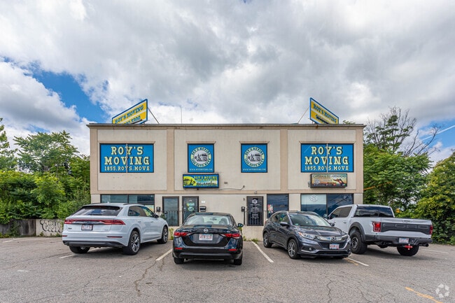
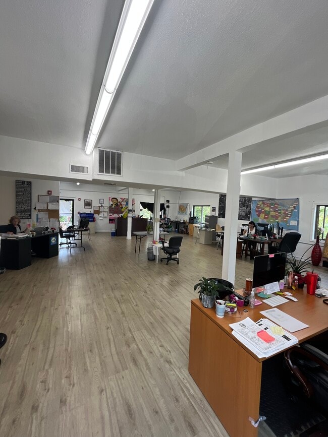
This Property Is For Sale
NEARBY LISTINGS FOR SALE OR LEASE
Property Detail
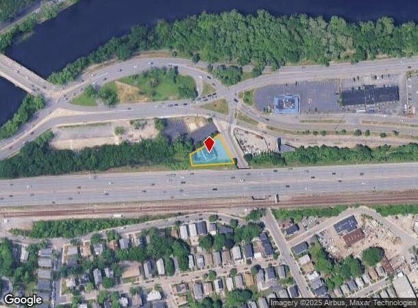
270 Parsons St
Commercialnec
Suffolk
X
Massachusetts
25017C0556F
0.32 AC
2025
Allston/Brighton
2025
Boston
000201
Boston-Cambridge-Newton, MA-NH
5,952 SF
BRIG-000000-000022-002765
DEMOGRAPHICS near 270 Parsons St
1 Mile
3 Mile
5 Mile
2024 Total Population
29,287
312,608
829,442
2029 Population
28,045
305,998
808,454
Pop Growth 2024-2029
(4.24%)
(2.11%)
(2.53%)
Average Age
38
37
38
2024 Total Households
12,319
129,581
345,716
HH Growth 2024-2029
(4.29%)
(2.28%)
(2.76%)
Median Household Inc
$101,940
$109,143
$105,203
Avg Household Size
2.30
2.20
2.20
2024 Avg HH Vehicles
1.00
1.00
1.00
Median Home Value
$725,676
$936,417
$880,678
Median Year Built
1950
1949
1949
Nearby Places
- Restaurants
- Banks
- Shops
- Fitness
- Groceries
PUBLIC TRANSPORTATION
COMMUTER RAIL
Boston Landing (Framingham/Worcester Line - MBTA)
DRIVE
WALK
Distance
Boston Landing (Framingham/Worcester Line - MBTA)
7 min
20 min
1.1 mi
Newtonville (Framingham/Worcester Line - Massachusetts Bay Transportation Authority Commuter Rail (Purple Line))
DRIVE
WALK
Distance
Newtonville (Framingham/Worcester Line - Massachusetts Bay Transportation Authority Commuter Rail (Purple Line))
5 min
2.7 mi
AIRPORT
General Edward Lawrence Logan International
DRIVE
WALK
Distance
General Edward Lawrence Logan International
17 min
9.3 mi
Freight Ports
Port of Boston
DRIVE
WALK
Distance
Port of Boston
15 min
7.7 mi
Nearby Properties
Address
Land Use
TOTAL SIZE
Lot Size
Zoning
Address
Land Use
TOTAL SIZE
Lot Size
Zoning
439,500 SF
9.21 AC
E
Address
Land Use
TOTAL SIZE
Lot Size
Zoning
125,571 SF
3.25 AC
C-3
Address
Land Use
TOTAL SIZE
Lot Size
Zoning
150,192 SF
10.27 AC
E
Address
Land Use
TOTAL SIZE
Lot Size
Zoning
530,200 SF
62.08 AC
E
Address
Land Use
TOTAL SIZE
Lot Size
Zoning
142,458 SF
1.67 AC
C-3
Address
Land Use
TOTAL SIZE
Lot Size
Zoning
304,349 SF
1.72 AC
Address
Land Use
TOTAL SIZE
Lot Size
Zoning
3.52 AC
C-3
Address
Land Use
TOTAL SIZE
Lot Size
Zoning
419,722 SF
2.03 AC
RC
Address
Land Use
TOTAL SIZE
Lot Size
Zoning
283,554 SF
2.76 AC
O-2A
Address
Land Use
TOTAL SIZE
Lot Size
Zoning
54,500 SF
4.01 AC
O-2A
Address
Land Use
TOTAL SIZE
Lot Size
Zoning
2.81 AC
O-2
Address
Land Use
TOTAL SIZE
Lot Size
Zoning
4,355 SF
13.12 AC
E
Address
Land Use
TOTAL SIZE
Lot Size
Zoning
336,518 SF
6.15 AC
I-3
Address
Land Use
TOTAL SIZE
Lot Size
Zoning
2.87 AC
O-2A
Address
Land Use
TOTAL SIZE
Lot Size
Zoning
155,818 SF
5.33 AC
OS
Address
Land Use
TOTAL SIZE
Lot Size
Zoning
220,671 SF
2.52 AC
I-2
Address
Land Use
TOTAL SIZE
Lot Size
Zoning
506,534 SF
2.75 AC
C
Address
Land Use
TOTAL SIZE
Lot Size
Zoning
213,834 SF
1.48 AC
SD-4
Address
Land Use
TOTAL SIZE
Lot Size
Zoning
136,025 SF
6.91 AC
C3
Address
Land Use
TOTAL SIZE
Lot Size
Zoning
2.25 AC
SD-12
Address
Land Use
TOTAL SIZE
Lot Size
Zoning
224,115 SF
2.35 AC
O-2A
Address
Land Use
TOTAL SIZE
Lot Size
Zoning
244,008 SF
4 AC
SD-4A
Address
Land Use
TOTAL SIZE
Lot Size
Zoning
174,764 SF
1.83 AC
C-3
Address
Land Use
TOTAL SIZE
Lot Size
Zoning
176,625 SF
5.76 AC
I-3
Address
Land Use
TOTAL SIZE
Lot Size
Zoning
110,299 SF
0.82 AC
C-3
Address
Land Use
TOTAL SIZE
Lot Size
Zoning
91,500 SF
1.03 AC
SD-5
Address
Land Use
TOTAL SIZE
Lot Size
Zoning
241,130 SF
0.84 AC
CRDD
Address
Land Use
TOTAL SIZE
Lot Size
Zoning
208,468 SF
1.44 AC
RC
Address
Land Use
TOTAL SIZE
Lot Size
Zoning
268,675 SF
1.72 AC
I
Address
Land Use
TOTAL SIZE
Lot Size
Zoning
1.28 AC
C-3
The World's #1 Commercial Real Estate Marketplace
Connect with us
© 2025 CoStar Group
The information above has been obtained from sources believed reliable. While we do not doubt its accuracy we have not verified it and make no guarantee, warranty or representation about it. It is your responsibility to independently confirm its accuracy and completeness. Any projections, opinions, assumptions, or estimates used are for example only and do not represent the current or future performance of the property. The value of this transaction to you depends on tax and other factors which should be evaluated by your tax, financial, and legal advisors. You and your advisors should conduct a careful, independent investigation of the property to determine to your satisfaction the suitability of the property for your needs.