Property Record
2700 Airport Rd, Kinston, NC 28504
NEARBY LISTINGS FOR SALE OR LEASE
-
-
View all Kinston listings for sale on LoopNet.com
Property Detail
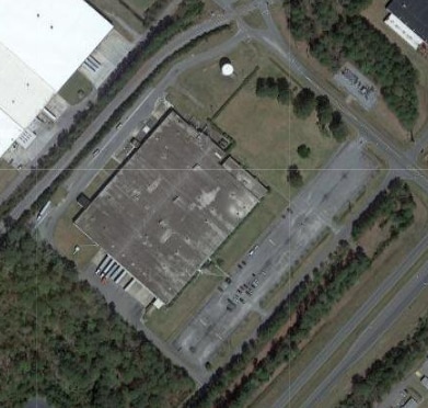
2700 Airport Rd
451703436648
SR 1610 TRACT 1B AIRPORT RD
Officebuilding
Lenoir
X
North Carolina
3720451700K
32.52 AC
2025
North Carolina Southeast Area
2025
Other Market Areas
011001
Kinston, NC
197,870 SF
DEMOGRAPHICS near 2700 Airport Rd
1 Mile
3 Mile
5 Mile
2024 Total Population
357
10,034
28,000
2029 Population
350
9,795
27,814
Pop Growth 2024-2029
(1.96%)
(2.38%)
(0.66%)
Average Age
48
44
43
2024 Total Households
131
4,118
11,943
HH Growth 2024-2029
(2.29%)
(2.53%)
(0.65%)
Median Household Inc
$44,199
$47,436
$38,063
Avg Household Size
2.20
2.20
2.20
2024 Avg HH Vehicles
2.00
2.00
2.00
Median Home Value
$123,333
$124,223
$105,079
Median Year Built
1976
1974
1972
Nearby Places
Map Layers
Map Styles
 Street
 Aerial
- Restaurants
- Banks
- Shops
- Fitness
- Groceries
PUBLIC TRANSPORTATION
AIRPORT
Pitt-Greenville
DRIVE
WALK
Distance
Pitt-Greenville
43 min
34.8 mi
Freight Ports
Port of Morehead City
DRIVE
WALK
Distance
Port of Morehead City
120 min
81.1 mi
Nearby Properties
Address
Land Use
TOTAL SIZE
Lot Size
Zoning
Address
Land Use
TOTAL SIZE
Lot Size
Zoning
274,824 SF
54.92 AC
OI
Address
Land Use
TOTAL SIZE
Lot Size
Zoning
22,420 SF
762.37 AC
RA6
Address
Land Use
TOTAL SIZE
Lot Size
Zoning
25,376 SF
953.68 AC
RA12
Address
Land Use
TOTAL SIZE
Lot Size
Zoning
159,064 SF
Address
Land Use
TOTAL SIZE
Lot Size
Zoning
65,704 SF
278.06 AC
RA20
Address
Land Use
TOTAL SIZE
Lot Size
Zoning
114,876 SF
64.24 AC
RA6
Address
Land Use
TOTAL SIZE
Lot Size
Zoning
150,941 SF
20 AC
I1
Address
Land Use
TOTAL SIZE
Lot Size
Zoning
191,518 SF
20.71 AC
SC
Address
Land Use
TOTAL SIZE
Lot Size
Zoning
15,858 SF
54.75 AC
I1
Address
Land Use
TOTAL SIZE
Lot Size
Zoning
214,740 SF
Address
Land Use
TOTAL SIZE
Lot Size
Zoning
156,784 SF
63.12 AC
I1
Address
Land Use
TOTAL SIZE
Lot Size
Zoning
278,576 SF
30.06 AC
I1
Address
Land Use
TOTAL SIZE
Lot Size
Zoning
254,440 SF
51.94 AC
I1
Address
Land Use
TOTAL SIZE
Lot Size
Zoning
145,364 SF
76.38 AC
I1
Address
Land Use
TOTAL SIZE
Lot Size
Zoning
5,664 SF
407.13 AC
RA6
Address
Land Use
TOTAL SIZE
Lot Size
Zoning
28,034 SF
278.73 AC
RA12
Address
Land Use
TOTAL SIZE
Lot Size
Zoning
101,200 SF
30.89 AC
Address
Land Use
TOTAL SIZE
Lot Size
Zoning
117,120 SF
8.12 AC
I1
Address
Land Use
TOTAL SIZE
Lot Size
Zoning
123,220 SF
8.99 AC
I1
Address
Land Use
TOTAL SIZE
Lot Size
Zoning
18,213 SF
159.12 AC
OI
Address
Land Use
TOTAL SIZE
Lot Size
Zoning
44,800 SF
9.75 AC
O&I
Address
Land Use
TOTAL SIZE
Lot Size
Zoning
11,270 SF
112 AC
RA6
Address
Land Use
TOTAL SIZE
Lot Size
Zoning
50,263 SF
11.34 AC
SC
Address
Land Use
TOTAL SIZE
Lot Size
Zoning
17,610 SF
28.68 AC
OI
Address
Land Use
TOTAL SIZE
Lot Size
Zoning
7,140 SF
5.04 AC
Address
Land Use
TOTAL SIZE
Lot Size
Zoning
14,651 SF
2.85 AC
B1
Address
Land Use
TOTAL SIZE
Lot Size
Zoning
31,335 SF
9.96 AC
SC
Address
Land Use
TOTAL SIZE
Lot Size
Zoning
36,044 SF
28.95 AC
I1
Address
Land Use
TOTAL SIZE
Lot Size
Zoning
74,734 SF
8.81 AC
RA8
The World's #1 Commercial Real Estate Marketplace
Connect with us
© 2026 CoStar Group
The information above has been obtained from sources believed reliable. While we do not doubt its accuracy we have not verified it and make no guarantee, warranty or representation about it. It is your responsibility to independently confirm its accuracy and completeness. Any projections, opinions, assumptions, or estimates used are for example only and do not represent the current or future performance of the property. The value of this transaction to you depends on tax and other factors which should be evaluated by your tax, financial, and legal advisors. You and your advisors should conduct a careful, independent investigation of the property to determine to your satisfaction the suitability of the property for your needs.