Property Record
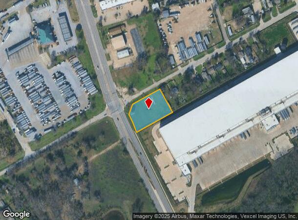
2700 Cedardale Rd, Lancaster, TX 75134


NEARBY LISTINGS FOR SALE OR LEASE
Property Detail
2700 Cedardale Rd
Dallas-Fort Worth-Arlington, TX
Smith Elkins
65043032510130000
SMITH ELKINS ABST 430 PG 325 TR 13 ACS 1.075 INT202200077058 DD03182022 CO-DC 0430325101300 4CN04303251
Commercialacreage
Dallas
X
Texas
48113C0495K
1.08 AC
2024
Southwest Dallas
2025
Dallas/Ft Worth
016704
DEMOGRAPHICS near 2700 Cedardale Rd
1 Mile
3 Mile
5 Mile
2024 Total Population
2,877
53,944
145,950
2029 Population
2,851
53,749
144,790
Pop Growth 2024-2029
(0.90%)
(0.36%)
(0.79%)
Average Age
35
36
37
2024 Total Households
865
17,589
47,790
HH Growth 2024-2029
(1.04%)
(0.59%)
(1.09%)
Median Household Inc
$48,499
$45,494
$43,317
Avg Household Size
3.20
3.00
2.90
2024 Avg HH Vehicles
2.00
2.00
2.00
Median Home Value
$201,824
$155,587
$160,921
Median Year Built
1975
1985
1977
Nearby Places
Map Layers
Map Styles
 Street
 Aerial
- Restaurants
- Banks
- Shops
- Fitness
- Groceries
PUBLIC TRANSPORTATION
AIRPORT
Dallas Love Field
DRIVE
WALK
Distance
Dallas Love Field
30 min
19.2 mi
Dallas-Fort Worth International
DRIVE
WALK
Distance
Dallas-Fort Worth International
42 min
32.9 mi
Freight Ports
Port of Shreveport
DRIVE
WALK
Distance
Port of Shreveport
210 min
195.4 mi
SALE & LEASE HISTORY
LISTING DATE
SALE/LEASE

Sep 25, 2016
For Lease
Nearby Properties
Address
Land Use
TOTAL SIZE
Lot Size
Zoning
Address
Land Use
TOTAL SIZE
Lot Size
Zoning
967,886 SF
80.90 AC
Z239
Address
Land Use
TOTAL SIZE
Lot Size
Zoning
1,283,264 SF
78.52 AC
Z04
Address
Land Use
TOTAL SIZE
Lot Size
Zoning
1,217,840 SF
58.27 AC
Z239
Address
Land Use
TOTAL SIZE
Lot Size
Zoning
241,034 SF
301.97 AC
Z298
Address
Land Use
TOTAL SIZE
Lot Size
Zoning
1,200,000 SF
60.01 AC
Z125
Address
Land Use
TOTAL SIZE
Lot Size
Zoning
1,015,340 SF
55.63 AC
Z239
Address
Land Use
TOTAL SIZE
Lot Size
Zoning
1,044,647 SF
65.80 AC
Z239
Address
Land Use
TOTAL SIZE
Lot Size
Zoning
1,025,640 SF
82.26 AC
Z125
Address
Land Use
TOTAL SIZE
Lot Size
Zoning
948,392 SF
50.80 AC
Z109
Address
Land Use
TOTAL SIZE
Lot Size
Zoning
799,529 SF
56.34 AC
Address
Land Use
TOTAL SIZE
Lot Size
Zoning
917,700 SF
44.27 AC
Z125
Address
Land Use
TOTAL SIZE
Lot Size
Zoning
900,000 SF
50.76 AC
Z04
Address
Land Use
TOTAL SIZE
Lot Size
Zoning
1,108,100 SF
65.25 AC
Z125
Address
Land Use
TOTAL SIZE
Lot Size
Zoning
872,640 SF
46.97 AC
Z125
Address
Land Use
TOTAL SIZE
Lot Size
Zoning
527,731 SF
56.12 AC
Z298
Address
Land Use
TOTAL SIZE
Lot Size
Zoning
753,200 SF
52.61 AC
Z239
Address
Land Use
TOTAL SIZE
Lot Size
Zoning
776,630 SF
58.40 AC
Z239
Address
Land Use
TOTAL SIZE
Lot Size
Zoning
713,000 SF
52.25 AC
Z125
Address
Land Use
TOTAL SIZE
Lot Size
Zoning
554,600 SF
50.31 AC
Z298
Address
Land Use
TOTAL SIZE
Lot Size
Zoning
550,800 SF
26.52 AC
Z239
Address
Land Use
TOTAL SIZE
Lot Size
Zoning
362,767 SF
101.01 AC
Z115
Address
Land Use
TOTAL SIZE
Lot Size
Zoning
660,400 SF
35.93 AC
Z125
Address
Land Use
TOTAL SIZE
Lot Size
Zoning
659,523 SF
35.33 AC
Z04
Address
Land Use
TOTAL SIZE
Lot Size
Zoning
648,960 SF
52.23 AC
Z06
Address
Land Use
TOTAL SIZE
Lot Size
Zoning
245,554 SF
12 AC
Z59
Address
Land Use
TOTAL SIZE
Lot Size
Zoning
595,148 SF
34.96 AC
Z39
Address
Land Use
TOTAL SIZE
Lot Size
Zoning
627,000 SF
37.09 AC
Z125
Address
Land Use
TOTAL SIZE
Lot Size
Zoning
610,806 SF
33.66 AC
Z125
Address
Land Use
TOTAL SIZE
Lot Size
Zoning
610,806 SF
34.20 AC
Z125
Address
Land Use
TOTAL SIZE
Lot Size
Zoning
590,200 SF
31.83 AC
Z04
The World's #1 Commercial Real Estate Marketplace
Connect with us
© 2025 CoStar Group
The information above has been obtained from sources believed reliable. While we do not doubt its accuracy we have not verified it and make no guarantee, warranty or representation about it. It is your responsibility to independently confirm its accuracy and completeness. Any projections, opinions, assumptions, or estimates used are for example only and do not represent the current or future performance of the property. The value of this transaction to you depends on tax and other factors which should be evaluated by your tax, financial, and legal advisors. You and your advisors should conduct a careful, independent investigation of the property to determine to your satisfaction the suitability of the property for your needs.