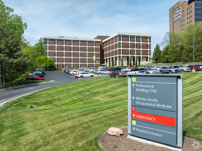
Property Record
2700 Clay Edwards Dr, Kansas City, MO 64116


Current Lease Availabilities
NEARBY LISTINGS FOR SALE OR LEASE
Property Detail
2700 Clay Edwards Dr
Kansas City, MO-KS
River Forest Subd
17-608-00-09-021.00
BEG SE COR LT 21 BLK 6 RIVER FOREST SUBD N712.49 E353.29 S646.71 SW62.15 S23.02 SW31.56WLY308.02 TO POB
Taxexempt
Clay
ARE
Missouri
29095C0143H
21
0
5.92 AC
2025
I-35 Corridor
022100
Kansas City
DEMOGRAPHICS near 2700 Clay Edwards Dr
1 Mile
3 Mile
5 Mile
2024 Total Population
5,108
54,991
182,970
2029 Population
5,346
57,042
189,127
Pop Growth 2024-2029
+ 4.66%
+ 3.73%
+ 3.37%
Average Age
39
38
37
2024 Total Households
2,422
23,843
77,349
HH Growth 2024-2029
+ 4.79%
+ 3.98%
+ 3.51%
Median Household Inc
$44,886
$49,225
$52,649
Avg Household Size
2.10
2.20
2.20
2024 Avg HH Vehicles
2.00
2.00
2.00
Median Home Value
$171,742
$162,113
$162,954
Median Year Built
1964
1963
1964
Nearby Places
Map Layers
Map Styles
 Street
 Aerial
- Restaurants
- Banks
- Shops
- Fitness
- Groceries
PUBLIC TRANSPORTATION
COMMUTER RAIL
DRIVE
WALK
Distance
12 min
6.4 mi
AIRPORT
Kansas City International
DRIVE
WALK
Distance
Kansas City International
25 min
17.6 mi
Nearby Properties
Address
Land Use
TOTAL SIZE
Lot Size
Zoning
Address
Land Use
TOTAL SIZE
Lot Size
Zoning
Address
Land Use
TOTAL SIZE
Lot Size
Zoning
8.29 AC
Address
Land Use
TOTAL SIZE
Lot Size
Zoning
63,748 SF
3.92 AC
Address
Land Use
TOTAL SIZE
Lot Size
Zoning
Address
Land Use
TOTAL SIZE
Lot Size
Zoning
4,012,734 SF
574.30 AC
KM3
Address
Land Use
TOTAL SIZE
Lot Size
Zoning
384,543 SF
5.40 AC
Address
Land Use
TOTAL SIZE
Lot Size
Zoning
276,233 SF
Address
Land Use
TOTAL SIZE
Lot Size
Zoning
10.97 AC
Address
Land Use
TOTAL SIZE
Lot Size
Zoning
5,044 SF
100.08 AC
Address
Land Use
TOTAL SIZE
Lot Size
Zoning
243,839 SF
47.82 AC
Address
Land Use
TOTAL SIZE
Lot Size
Zoning
Address
Land Use
TOTAL SIZE
Lot Size
Zoning
Address
Land Use
TOTAL SIZE
Lot Size
Zoning
Address
Land Use
TOTAL SIZE
Lot Size
Zoning
46.94 AC
Address
Land Use
TOTAL SIZE
Lot Size
Zoning
15.16 AC
Address
Land Use
TOTAL SIZE
Lot Size
Zoning
Address
Land Use
TOTAL SIZE
Lot Size
Zoning
311,213 SF
52.08 AC
Address
Land Use
TOTAL SIZE
Lot Size
Zoning
31.13 AC
Address
Land Use
TOTAL SIZE
Lot Size
Zoning
Address
Land Use
TOTAL SIZE
Lot Size
Zoning
236,589 SF
9.26 AC
Address
Land Use
TOTAL SIZE
Lot Size
Zoning
172,432 SF
3.34 AC
Address
Land Use
TOTAL SIZE
Lot Size
Zoning
50,661 SF
2.44 AC
Address
Land Use
TOTAL SIZE
Lot Size
Zoning
Address
Land Use
TOTAL SIZE
Lot Size
Zoning
30.43 AC
Address
Land Use
TOTAL SIZE
Lot Size
Zoning
67,344 SF
Address
Land Use
TOTAL SIZE
Lot Size
Zoning
7.10 AC
Address
Land Use
TOTAL SIZE
Lot Size
Zoning
Address
Land Use
TOTAL SIZE
Lot Size
Zoning
179.15 AC
Address
Land Use
TOTAL SIZE
Lot Size
Zoning
6.11 AC
The World's #1 Commercial Real Estate Marketplace
Connect with us
© 2026 CoStar Group
The information above has been obtained from sources believed reliable. While we do not doubt its accuracy we have not verified it and make no guarantee, warranty or representation about it. It is your responsibility to independently confirm its accuracy and completeness. Any projections, opinions, assumptions, or estimates used are for example only and do not represent the current or future performance of the property. The value of this transaction to you depends on tax and other factors which should be evaluated by your tax, financial, and legal advisors. You and your advisors should conduct a careful, independent investigation of the property to determine to your satisfaction the suitability of the property for your needs.