Property Record
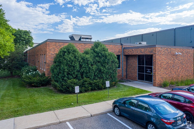
2700 E 28Th St, Minneapolis, MN 55406


Property Detail
2700 E 28Th St
36-029-24-42-0028
LOT 002 BLOCK 011 A SOUTH SIDE ADDN TO MPLS LOTS 2 THRU 23 INCL BLK 11 AND LOTS 3 THRU 22 INCL BLK 12 INCL ADJ 1/2 OF VAC STREET AND ALLEYS 741 X 528
Industrialgeneral
HENNEPIN
I2
Minnesota
B and X Area of moderate flood hazard, usually the area between the limits of the 100-year and 500-year floods.
2
2024
8.57 AC
2024
Minneapolis
107400
Minneapolis/St Paul
164,739 SF
Minneapolis-St. Paul-Bloomington, MN-WI
NEARBY LISTINGS FOR SALE OR LEASE
DEMOGRAPHICS near 2700 E 28Th St
1 mile
3 mile
5 mile
2025 Total Population
23,770
255,519
501,506
2030 Population
23,874
257,115
502,496
Pop Growth 2025-2030
+ 0.44%
+ 0.62%
+ 0.20%
Average Age
38
36
37
2025 Total Households
9,820
115,682
222,871
HH Growth 2025-2030
+ 0.50%
+ 0.76%
+ 0.28%
Median Household Inc
$62,346
$67,725
$80,231
Avg Household Size
2.20
2.00
2.10
2025 Avg HH Vehicles
1.00
1.00
1.00
Median Home Value
$329,883
$359,524
$377,780
Median Year Built
1949
1961
1954
Nearby Places
Map Layers
Map Styles
 Street
 Aerial
Layers
 Traffic
 Biking
Places
Listings with unknown addresses are not visible on the map
- Restaurants
- Banks
- Shops
- Fitness
- Groceries
PUBLIC TRANSPORTATION
TRANSIT/SUBWAY
Lake Street/Midtown Station (Hiawatha Line - Minneapolis-Saint Paul Metro Transit Light Rail)
Drive
Walk
Distance
Lake Street/Midtown Station (Hiawatha Line - Minneapolis-Saint Paul Metro Transit Light Rail)
3 min
13 min
0.7 mi
COMMUTER RAIL
Target Field Station (Northstar Corridor - Northstar Commuter Rail)
Drive
Walk
Distance
Target Field Station (Northstar Corridor - Northstar Commuter Rail)
10 min
3.6 mi
St. Paul-Minneapolis (Empire Builder - Amtrak)
Drive
Walk
Distance
St. Paul-Minneapolis (Empire Builder - Amtrak)
16 min
9.3 mi
AIRPORT
Minneapolis-St Paul International/Wold-Chamberlain
Drive
Walk
Distance
Minneapolis-St Paul International/Wold-Chamberlain
18 min
8.4 mi
Freight Ports
Port Milwaukee
Drive
Walk
Distance
Port Milwaukee
376 min
337.6 mi
SALE & LEASE HISTORY
LISTING DATE
SALE/LEASE

Sep 25, 2016
For Lease
May 14, 2020
For Lease
Jun 04, 2019
For Lease
Jan 03, 2018
For Lease
Nearby Properties
Address
Land Use
TOTAL SIZE
Lot Size
Zoning
Address
Land Use
TOTAL SIZE
Lot Size
Zoning
141,277 SF
44.78 AC
Address
Land Use
TOTAL SIZE
Lot Size
Zoning
1,462,182 SF
1 AC
B4-2
Address
Land Use
TOTAL SIZE
Lot Size
Zoning
2,094,377 SF
2.10 AC
B4-2
Address
Land Use
TOTAL SIZE
Lot Size
Zoning
1,821,999 SF
2.51 AC
B4-2
Address
Land Use
TOTAL SIZE
Lot Size
Zoning
Address
Land Use
TOTAL SIZE
Lot Size
Zoning
1,934,403 SF
1.67 AC
B4-2
Address
Land Use
TOTAL SIZE
Lot Size
Zoning
2,282,334 SF
3.25 AC
B4-2
Address
Land Use
TOTAL SIZE
Lot Size
Zoning
1,054,492 SF
1.70 AC
B4-1
Address
Land Use
TOTAL SIZE
Lot Size
Zoning
495,632 SF
1.72 AC
C1
Address
Land Use
TOTAL SIZE
Lot Size
Zoning
1,208,190 SF
1.20 AC
B4-2
Address
Land Use
TOTAL SIZE
Lot Size
Zoning
176,108 SF
27.45 AC
Address
Land Use
TOTAL SIZE
Lot Size
Zoning
621,608 SF
1.03 AC
B4-2
Address
Land Use
TOTAL SIZE
Lot Size
Zoning
458,470 SF
1.18 AC
OR3
Address
Land Use
TOTAL SIZE
Lot Size
Zoning
907,129 SF
1.65 AC
B4-1
Address
Land Use
TOTAL SIZE
Lot Size
Zoning
442,731 SF
0.97 AC
B4S-2
Address
Land Use
TOTAL SIZE
Lot Size
Zoning
1,044,454 SF
1.08 AC
B4-2
Address
Land Use
TOTAL SIZE
Lot Size
Zoning
1,261,574 SF
2.52 AC
B4-2
Address
Land Use
TOTAL SIZE
Lot Size
Zoning
695,624 SF
3.67 AC
C2
Address
Land Use
TOTAL SIZE
Lot Size
Zoning
2.67 AC
C3A
Address
Land Use
TOTAL SIZE
Lot Size
Zoning
615,172 SF
1.98 AC
I1
Address
Land Use
TOTAL SIZE
Lot Size
Zoning
722,423 SF
1.33 AC
B4-2
Address
Land Use
TOTAL SIZE
Lot Size
Zoning
1,424,796 SF
1.13 AC
B4-1
Address
Land Use
TOTAL SIZE
Lot Size
Zoning
577,656 SF
2.92 AC
C3A
Address
Land Use
TOTAL SIZE
Lot Size
Zoning
557,654 SF
3.15 AC
C2
Address
Land Use
TOTAL SIZE
Lot Size
Zoning
478,616 SF
2.28 AC
C2
Address
Land Use
TOTAL SIZE
Lot Size
Zoning
513,403 SF
0.73 AC
C2
Address
Land Use
TOTAL SIZE
Lot Size
Zoning
1,235,416 SF
1.12 AC
B4-2
Address
Land Use
TOTAL SIZE
Lot Size
Zoning
323,404 SF
2.54 AC
B4S-2
Address
Land Use
TOTAL SIZE
Lot Size
Zoning
561,603 SF
1 AC
B4N
Address
Land Use
TOTAL SIZE
Lot Size
Zoning
403,792 SF
2.51 AC
B4N
The World's #1 Commercial Real Estate Marketplace
Connect with us
© 2026 CoStar Group
The information above has been obtained from sources believed reliable. While we do not doubt its accuracy we have not verified it and make no guarantee, warranty or representation about it. It is your responsibility to independently confirm its accuracy and completeness. Any projections, opinions, assumptions, or estimates used are for example only and do not represent the current or future performance of the property. The value of this transaction to you depends on tax and other factors which should be evaluated by your tax, financial, and legal advisors. You and your advisors should conduct a careful, independent investigation of the property to determine to your satisfaction the suitability of the property for your needs.