Property Record
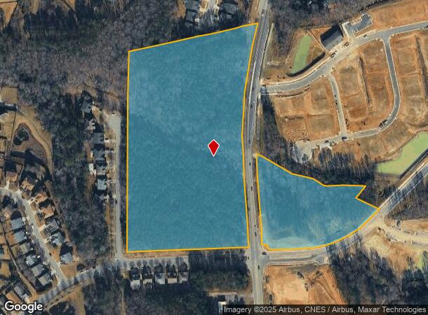
2700 Forestville Rd, Raleigh, NC 27616

This Property Is For Sale
NEARBY LISTINGS FOR SALE OR LEASE
Property Detail
2700 Forestville Rd
Raleigh/Durham
Comet Raleigh
Raleigh, NC
LO4 COMET RALEIGH APART RCMB BM2024-0123
1748.04-52-8864-000
Wake
Apartment
North Carolina
2025
4
2025
15.76 AC
054022
Route 1
DEMOGRAPHICS near 2700 Forestville Rd
1 Mile
3 Mile
5 Mile
2024 Total Population
9,177
46,732
134,370
2029 Population
9,992
50,753
146,392
Pop Growth 2024-2029
+ 8.88%
+ 8.60%
+ 8.95%
Average Age
37
37
38
2024 Total Households
3,138
16,090
49,439
HH Growth 2024-2029
+ 8.67%
+ 8.61%
+ 8.97%
Median Household Inc
$99,835
$97,115
$95,472
Avg Household Size
2.90
2.90
2.70
2024 Avg HH Vehicles
2.00
2.00
2.00
Median Home Value
$307,557
$315,221
$338,670
Median Year Built
2010
2006
2005
Nearby Places
Map Layers
Map Styles
 Street
 Aerial
- Restaurants
- Banks
- Shops
- Fitness
- Groceries
PUBLIC TRANSPORTATION
AIRPORT
Raleigh-Durham International
DRIVE
WALK
Distance
Raleigh-Durham International
28 min
20.9 mi
Freight Ports
Port of Wilmington
DRIVE
WALK
Distance
Port of Wilmington
167 min
141.1 mi
Nearby Properties
Address
Land Use
TOTAL SIZE
Lot Size
Zoning
Address
Land Use
TOTAL SIZE
Lot Size
Zoning
817,723 SF
64.40 AC
OX-5
Address
Land Use
TOTAL SIZE
Lot Size
Zoning
342,900 SF
19.15 AC
RX-3
Address
Land Use
TOTAL SIZE
Lot Size
Zoning
283,870 SF
11.39 AC
RMX
Address
Land Use
TOTAL SIZE
Lot Size
Zoning
263,777 SF
93.84 AC
GR3
Address
Land Use
TOTAL SIZE
Lot Size
Zoning
196,198 SF
29.21 AC
PD
Address
Land Use
TOTAL SIZE
Lot Size
Zoning
211,372 SF
38.26 AC
R-4
Address
Land Use
TOTAL SIZE
Lot Size
Zoning
196,091 SF
37.21 AC
RL
Address
Land Use
TOTAL SIZE
Lot Size
Zoning
145,944 SF
45.22 AC
OX-5
Address
Land Use
TOTAL SIZE
Lot Size
Zoning
93,494 SF
10.40 AC
R-10
Address
Land Use
TOTAL SIZE
Lot Size
Zoning
11,577 SF
114.41 AC
R-6
Address
Land Use
TOTAL SIZE
Lot Size
Zoning
139,600 SF
23.64 AC
LI
Address
Land Use
TOTAL SIZE
Lot Size
Zoning
104,919 SF
29.07 AC
GR3
Address
Land Use
TOTAL SIZE
Lot Size
Zoning
105,035 SF
20.68 AC
PD
Address
Land Use
TOTAL SIZE
Lot Size
Zoning
85,312 SF
21.37 AC
HB
Address
Land Use
TOTAL SIZE
Lot Size
Zoning
101,316 SF
25.68 AC
R-4
Address
Land Use
TOTAL SIZE
Lot Size
Zoning
270,754 SF
168 AC
IH
Address
Land Use
TOTAL SIZE
Lot Size
Zoning
129,612 SF
42.06 AC
ICD
Address
Land Use
TOTAL SIZE
Lot Size
Zoning
81,988 SF
26 AC
R-6
Address
Land Use
TOTAL SIZE
Lot Size
Zoning
341,726 SF
35.16 AC
HB
Address
Land Use
TOTAL SIZE
Lot Size
Zoning
115,872 SF
17.25 AC
CX-3
Address
Land Use
TOTAL SIZE
Lot Size
Zoning
57,692 SF
14.08 AC
HB
Address
Land Use
TOTAL SIZE
Lot Size
Zoning
115,800 SF
19.15 AC
LI
Address
Land Use
TOTAL SIZE
Lot Size
Zoning
50,676 SF
17.62 AC
CX-3
Address
Land Use
TOTAL SIZE
Lot Size
Zoning
177,306 SF
23.02 AC
IX-3
Address
Land Use
TOTAL SIZE
Lot Size
Zoning
88,201 SF
7.32 AC
CX-3
Address
Land Use
TOTAL SIZE
Lot Size
Zoning
101,445 SF
10.51 AC
RX-3
Address
Land Use
TOTAL SIZE
Lot Size
Zoning
77,559 SF
8.78 AC
RX-3
Address
Land Use
TOTAL SIZE
Lot Size
Zoning
108,206 SF
5.73 AC
CX-3
Address
Land Use
TOTAL SIZE
Lot Size
Zoning
49,690 SF
11.47 AC
HB
Address
Land Use
TOTAL SIZE
Lot Size
Zoning
63,386 SF
14.10 AC
R-4
The World's #1 Commercial Real Estate Marketplace
Connect with us
© 2025 CoStar Group
The information above has been obtained from sources believed reliable. While we do not doubt its accuracy we have not verified it and make no guarantee, warranty or representation about it. It is your responsibility to independently confirm its accuracy and completeness. Any projections, opinions, assumptions, or estimates used are for example only and do not represent the current or future performance of the property. The value of this transaction to you depends on tax and other factors which should be evaluated by your tax, financial, and legal advisors. You and your advisors should conduct a careful, independent investigation of the property to determine to your satisfaction the suitability of the property for your needs.