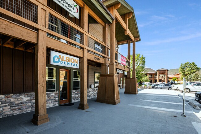
Property Record
2700 Homestead Rd, Park City, UT 84098

NEARBY LISTINGS FOR SALE OR LEASE
Property Detail
2700 Homestead Rd
TCVC-50-2AM
Toll Creek Village Condominium Second Am
Commercialbuilding
UNIT 50 TOLL CREEK VILLAGE CONDOMINIUM SECOND AMENDED; ACCORDING TO THE OFFICIAL PLAT ON FILE IN THE SUMMIT COUNTY RECORDERS OFFICE CONT 1475 SQ FT TOGETHER WITH AN UND 5.7% INT IN THE COMMON AREA 2320-630 2759-151
X
Summit
49043C0917D
Utah
2023
0.03 AC
2024
Summit County
964303
Salt Lake City
1,475 SF
Summit Park, UT
DEMOGRAPHICS near 2700 Homestead Rd
1 Mile
3 Mile
5 Mile
2024 Total Population
4,555
11,321
21,082
2029 Population
4,682
11,818
22,393
Pop Growth 2024-2029
+ 2.79%
+ 4.39%
+ 6.22%
Average Age
39
39
39
2024 Total Households
1,613
4,220
7,840
HH Growth 2024-2029
+ 1.74%
+ 3.63%
+ 5.60%
Median Household Inc
$194,633
$158,157
$156,576
Avg Household Size
2.80
2.60
2.60
2024 Avg HH Vehicles
2.00
2.00
2.00
Median Home Value
$848,204
$837,248
$872,831
Median Year Built
1994
1996
1997
Nearby Places
Map Layers
Map Styles
 Street
 Aerial
- Restaurants
- Banks
- Shops
- Fitness
- Groceries
PUBLIC TRANSPORTATION
AIRPORT
Salt Lake City International
DRIVE
WALK
Distance
Salt Lake City International
33 min
27.8 mi
Freight Ports
Port of Stockton
DRIVE
WALK
Distance
Port of Stockton
734 min
718.2 mi
SALE & LEASE HISTORY
LISTING DATE
SALE/LEASE

Sep 17, 2019
For Lease
Sep 14, 2020
For Sale
Sep 12, 2024
For Lease
Oct 23, 2023
For Lease
Mar 26, 2018
For Lease
Jun 24, 2020
For Lease
Jun 15, 2022
For Sale
Jun 15, 2021
For Sale
Jun 08, 2022
For Sale
Jul 12, 2019
For Lease
Nearby Properties
Address
Land Use
TOTAL SIZE
Lot Size
Zoning
Address
Land Use
TOTAL SIZE
Lot Size
Zoning
322,804 SF
37.32 AC
Address
Land Use
TOTAL SIZE
Lot Size
Zoning
74,233 SF
6.89 AC
Address
Land Use
TOTAL SIZE
Lot Size
Zoning
90,911 SF
1.88 AC
Address
Land Use
TOTAL SIZE
Lot Size
Zoning
68,248 SF
7.42 AC
Address
Land Use
TOTAL SIZE
Lot Size
Zoning
74,543 SF
3.45 AC
Address
Land Use
TOTAL SIZE
Lot Size
Zoning
55,447 SF
1.88 AC
Address
Land Use
TOTAL SIZE
Lot Size
Zoning
203.47 AC
Address
Land Use
TOTAL SIZE
Lot Size
Zoning
54,133 SF
1.97 AC
Address
Land Use
TOTAL SIZE
Lot Size
Zoning
0.55 AC
Address
Land Use
TOTAL SIZE
Lot Size
Zoning
49,257 SF
1.67 AC
Address
Land Use
TOTAL SIZE
Lot Size
Zoning
110,109 SF
7.05 AC
Address
Land Use
TOTAL SIZE
Lot Size
Zoning
50,913 SF
5.03 AC
Address
Land Use
TOTAL SIZE
Lot Size
Zoning
49,530 SF
2.43 AC
Address
Land Use
TOTAL SIZE
Lot Size
Zoning
115,767 SF
9.82 AC
Address
Land Use
TOTAL SIZE
Lot Size
Zoning
48,092 SF
2.28 AC
Address
Land Use
TOTAL SIZE
Lot Size
Zoning
53,948 SF
126.39 AC
Address
Land Use
TOTAL SIZE
Lot Size
Zoning
54,657 SF
5.20 AC
Address
Land Use
TOTAL SIZE
Lot Size
Zoning
39,080 SF
3.28 AC
Address
Land Use
TOTAL SIZE
Lot Size
Zoning
34,119 SF
1.39 AC
Address
Land Use
TOTAL SIZE
Lot Size
Zoning
39,601 SF
2.20 AC
Address
Land Use
TOTAL SIZE
Lot Size
Zoning
27,508 SF
0.96 AC
Address
Land Use
TOTAL SIZE
Lot Size
Zoning
12,347 SF
20.07 AC
Address
Land Use
TOTAL SIZE
Lot Size
Zoning
56,000 SF
11.49 AC
Address
Land Use
TOTAL SIZE
Lot Size
Zoning
53,020 SF
6.25 AC
Address
Land Use
TOTAL SIZE
Lot Size
Zoning
2,669 SF
344.78 AC
Address
Land Use
TOTAL SIZE
Lot Size
Zoning
66,150 SF
5.88 AC
Address
Land Use
TOTAL SIZE
Lot Size
Zoning
9,103 SF
60 AC
Address
Land Use
TOTAL SIZE
Lot Size
Zoning
21,665 SF
0.68 AC
The World's #1 Commercial Real Estate Marketplace
Connect with us
© 2025 CoStar Group
The information above has been obtained from sources believed reliable. While we do not doubt its accuracy we have not verified it and make no guarantee, warranty or representation about it. It is your responsibility to independently confirm its accuracy and completeness. Any projections, opinions, assumptions, or estimates used are for example only and do not represent the current or future performance of the property. The value of this transaction to you depends on tax and other factors which should be evaluated by your tax, financial, and legal advisors. You and your advisors should conduct a careful, independent investigation of the property to determine to your satisfaction the suitability of the property for your needs.