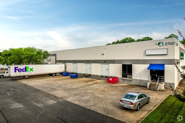
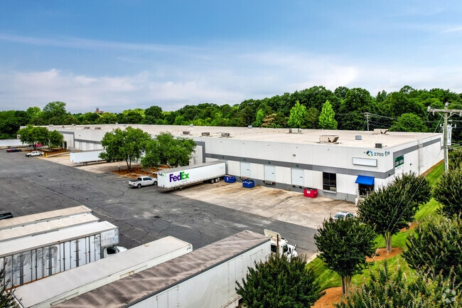
Property Record
2700 Hutchison Mcdonald Rd, Charlotte, NC 28269
Current Lease Availabilities
NEARBY LISTINGS FOR SALE OR LEASE
Property Detail
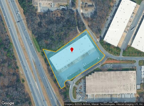
2700 Hutchison Mcdonald Rd
Charlotte-Concord-Gastonia, NC-SC
Crosspoint Center 01-8
041-061-02
U/M
Industrialgeneral
Mecklenburg
X
North Carolina
3710454600K
2
2024
7.30 AC
2025
North
005405
Charlotte
119,500 SF
DEMOGRAPHICS near 2700 Hutchison Mcdonald Rd
1 Mile
3 Mile
5 Mile
2024 Total Population
6,045
64,863
237,234
2029 Population
6,446
69,077
253,414
Pop Growth 2024-2029
+ 6.63%
+ 6.50%
+ 6.82%
Average Age
38
37
36
2024 Total Households
2,279
23,718
101,045
HH Growth 2024-2029
+ 6.58%
+ 6.57%
+ 7.04%
Median Household Inc
$55,337
$44,972
$60,787
Avg Household Size
2.60
2.60
2.20
2024 Avg HH Vehicles
2.00
2.00
2.00
Median Home Value
$162,985
$191,775
$250,719
Median Year Built
1992
1987
1997
Nearby Places
Map Layers
Map Styles
 Street
 Aerial
- Restaurants
- Banks
- Shops
- Fitness
- Groceries
PUBLIC TRANSPORTATION
COMMUTER RAIL
DRIVE
WALK
Distance
11 min
4.4 mi
AIRPORT
Charlotte/Douglas International
DRIVE
WALK
Distance
Charlotte/Douglas International
22 min
11.4 mi
Concord-Padgett Regional
DRIVE
WALK
Distance
Concord-Padgett Regional
23 min
14.1 mi
Nearby Properties
Address
Land Use
TOTAL SIZE
Lot Size
Zoning
Address
Land Use
TOTAL SIZE
Lot Size
Zoning
500,761 SF
3.18 AC
TOD-CC
Address
Land Use
TOTAL SIZE
Lot Size
Zoning
641,285 SF
43.18 AC
I-1
Address
Land Use
TOTAL SIZE
Lot Size
Zoning
17,192 SF
3.50 AC
I-2
Address
Land Use
TOTAL SIZE
Lot Size
Zoning
308,793 SF
47.41 AC
R5
Address
Land Use
TOTAL SIZE
Lot Size
Zoning
322,507 SF
25.95 AC
I1
Address
Land Use
TOTAL SIZE
Lot Size
Zoning
393,282 SF
3.80 AC
I2CD
Address
Land Use
TOTAL SIZE
Lot Size
Zoning
490,844 SF
40.50 AC
I-2(CD)
Address
Land Use
TOTAL SIZE
Lot Size
Zoning
43,387 SF
43.43 AC
Address
Land Use
TOTAL SIZE
Lot Size
Zoning
236,101 SF
7.35 AC
Address
Land Use
TOTAL SIZE
Lot Size
Zoning
58,666 SF
7.47 AC
Address
Land Use
TOTAL SIZE
Lot Size
Zoning
407,683 SF
37.23 AC
R22MF
Address
Land Use
TOTAL SIZE
Lot Size
Zoning
187,636 SF
16.56 AC
R17MFCD
Address
Land Use
TOTAL SIZE
Lot Size
Zoning
634,939 SF
42.26 AC
I1CD
Address
Land Use
TOTAL SIZE
Lot Size
Zoning
192,939 SF
7.40 AC
MUDDO
Address
Land Use
TOTAL SIZE
Lot Size
Zoning
348,081 SF
17.20 AC
I-2(CD)
Address
Land Use
TOTAL SIZE
Lot Size
Zoning
627,355 SF
45.41 AC
I2
Address
Land Use
TOTAL SIZE
Lot Size
Zoning
0.65 AC
Address
Land Use
TOTAL SIZE
Lot Size
Zoning
185,350 SF
11.49 AC
R22MF
Address
Land Use
TOTAL SIZE
Lot Size
Zoning
174,768 SF
9.28 AC
INST(CD)
Address
Land Use
TOTAL SIZE
Lot Size
Zoning
382,375 SF
25.11 AC
I1
Address
Land Use
TOTAL SIZE
Lot Size
Zoning
117,219 SF
3.22 AC
UR-2(CD)
Address
Land Use
TOTAL SIZE
Lot Size
Zoning
205,067 SF
9.94 AC
R5
Address
Land Use
TOTAL SIZE
Lot Size
Zoning
104,232 SF
3.30 AC
UR-2(CD)
Address
Land Use
TOTAL SIZE
Lot Size
Zoning
154,388 SF
23.25 AC
Address
Land Use
TOTAL SIZE
Lot Size
Zoning
215,728 SF
13.32 AC
INST(CD)
Address
Land Use
TOTAL SIZE
Lot Size
Zoning
15,869 SF
517.12 AC
R4
Address
Land Use
TOTAL SIZE
Lot Size
Zoning
101,156 SF
3.17 AC
R22MF
Address
Land Use
TOTAL SIZE
Lot Size
Zoning
111,280 SF
36.80 AC
R-4
Address
Land Use
TOTAL SIZE
Lot Size
Zoning
59,310 SF
6.01 AC
MUDD(CD)
Address
Land Use
TOTAL SIZE
Lot Size
Zoning
37,136 SF
10.08 AC
I-2
The World's #1 Commercial Real Estate Marketplace
Connect with us
© 2026 CoStar Group
The information above has been obtained from sources believed reliable. While we do not doubt its accuracy we have not verified it and make no guarantee, warranty or representation about it. It is your responsibility to independently confirm its accuracy and completeness. Any projections, opinions, assumptions, or estimates used are for example only and do not represent the current or future performance of the property. The value of this transaction to you depends on tax and other factors which should be evaluated by your tax, financial, and legal advisors. You and your advisors should conduct a careful, independent investigation of the property to determine to your satisfaction the suitability of the property for your needs.