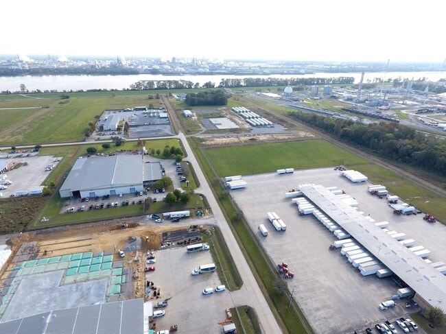
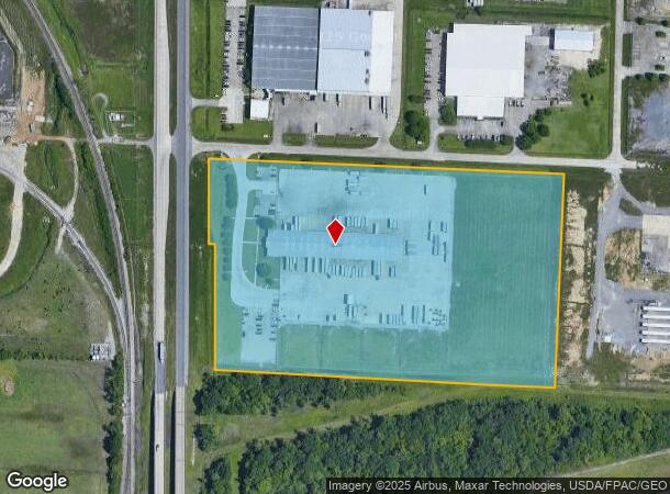
Property Record
2700 Hwy 1 N, Port Allen, LA 70767
NEARBY LISTINGS FOR SALE OR LEASE
Property Detail
2700 Hwy 1 N
Baton Rouge, LA
Poplar Grove Ind Prk
045100003000
LOT 6 POPLAR GROVE INDUSTRIAL PARK CONT 15.98 AC 51-30 CB408 E15 (MB4 E277)
Industrialgeneral
W Baton Rouge
X
Louisiana
22121C0155D
6
2024
15.98 AC
2024
West Baton Rouge
020200
Baton Rouge
14,340 SF
DEMOGRAPHICS near 2700 Hwy 1 N
1 Mile
3 Mile
5 Mile
2024 Total Population
22
20,539
98,863
2029 Population
24
21,089
99,238
Pop Growth 2024-2029
+ 9.09%
+ 2.68%
+ 0.38%
Average Age
40
38
37
2024 Total Households
6
8,259
37,769
HH Growth 2024-2029
+ 16.67%
+ 2.54%
+ 0.46%
Median Household Inc
$74,999
$36,443
$32,497
Avg Household Size
2.20
2.30
2.30
2024 Avg HH Vehicles
2.00
1.00
1.00
Median Home Value
$74,999
$102,391
$114,332
Median Year Built
1992
1966
1966
Nearby Places
- Restaurants
- Banks
- Shops
- Fitness
- Groceries
PUBLIC TRANSPORTATION
AIRPORT
Baton Rouge Metro Ryan Field
DRIVE
WALK
Distance
Baton Rouge Metro Ryan Field
13 min
7.3 mi
Freight Ports
Port of Greater Baton Rouge
DRIVE
WALK
Distance
Port of Greater Baton Rouge
11 min
4.4 mi
SALE & LEASE HISTORY
LISTING DATE
SALE/LEASE

Oct 20, 2020
For Lease
Nearby Properties
Address
Land Use
TOTAL SIZE
Lot Size
Zoning
Address
Land Use
TOTAL SIZE
Lot Size
Zoning
Address
Land Use
TOTAL SIZE
Lot Size
Zoning
Address
Land Use
TOTAL SIZE
Lot Size
Zoning
332,000 SF
1.42 AC
Address
Land Use
TOTAL SIZE
Lot Size
Zoning
Address
Land Use
TOTAL SIZE
Lot Size
Zoning
Address
Land Use
TOTAL SIZE
Lot Size
Zoning
385,397 SF
509.42 AC
Address
Land Use
TOTAL SIZE
Lot Size
Zoning
55,755 SF
9.29 AC
Address
Land Use
TOTAL SIZE
Lot Size
Zoning
244,833 SF
0.84 AC
Address
Land Use
TOTAL SIZE
Lot Size
Zoning
17.51 AC
Address
Land Use
TOTAL SIZE
Lot Size
Zoning
350,000 SF
1.20 AC
Address
Land Use
TOTAL SIZE
Lot Size
Zoning
100,000 SF
Address
Land Use
TOTAL SIZE
Lot Size
Zoning
207,577 SF
0.93 AC
Address
Land Use
TOTAL SIZE
Lot Size
Zoning
Address
Land Use
TOTAL SIZE
Lot Size
Zoning
2,074 SF
18.72 AC
Address
Land Use
TOTAL SIZE
Lot Size
Zoning
149,372 SF
0.19 AC
Address
Land Use
TOTAL SIZE
Lot Size
Zoning
15.49 AC
Address
Land Use
TOTAL SIZE
Lot Size
Zoning
336,660 SF
Address
Land Use
TOTAL SIZE
Lot Size
Zoning
13.70 AC
Address
Land Use
TOTAL SIZE
Lot Size
Zoning
15.85 AC
Address
Land Use
TOTAL SIZE
Lot Size
Zoning
247,104 SF
12 AC
Address
Land Use
TOTAL SIZE
Lot Size
Zoning
78,100 SF
0.26 AC
Address
Land Use
TOTAL SIZE
Lot Size
Zoning
Address
Land Use
TOTAL SIZE
Lot Size
Zoning
Address
Land Use
TOTAL SIZE
Lot Size
Zoning
237,538 SF
8.19 AC
Address
Land Use
TOTAL SIZE
Lot Size
Zoning
20.46 AC
Address
Land Use
TOTAL SIZE
Lot Size
Zoning
89,942 SF
0.19 AC
Address
Land Use
TOTAL SIZE
Lot Size
Zoning
Address
Land Use
TOTAL SIZE
Lot Size
Zoning
84.58 AC
Address
Land Use
TOTAL SIZE
Lot Size
Zoning
71,603 SF
0.32 AC
Address
Land Use
TOTAL SIZE
Lot Size
Zoning
54,975 SF
0.52 AC
The World's #1 Commercial Real Estate Marketplace
Connect with us
© 2025 CoStar Group
The information above has been obtained from sources believed reliable. While we do not doubt its accuracy we have not verified it and make no guarantee, warranty or representation about it. It is your responsibility to independently confirm its accuracy and completeness. Any projections, opinions, assumptions, or estimates used are for example only and do not represent the current or future performance of the property. The value of this transaction to you depends on tax and other factors which should be evaluated by your tax, financial, and legal advisors. You and your advisors should conduct a careful, independent investigation of the property to determine to your satisfaction the suitability of the property for your needs.