Property Record
1024 S Georgia St, Amarillo, TX 79102
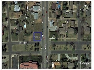

Property Detail
1024 S Georgia St
Amarillo, TX
Sunset Park Addition
R-078-1200-0280-0
SUNSET PARK ADDN # 5, LOT 11A, BLK 0001, 0.4400 ACRES
Medicalbuilding
Potter
X
Texas
48375C0530C
11a
2024
0.45 AC
2025
Amarillo
011600
Other Market Areas
4,583 SF
NEARBY LISTINGS FOR SALE OR LEASE
DEMOGRAPHICS near 1024 S Georgia St
1 mile
3 mile
5 mile
2024 Total Population
11,834
78,346
165,219
2029 Population
11,422
79,773
170,490
Pop Growth 2024-2029
(3.48%)
+ 1.82%
+ 3.19%
Average Age
36
38
38
2024 Total Households
5,106
32,821
65,941
HH Growth 2024-2029
(3.84%)
+ 1.80%
+ 3.37%
Median Household Inc
$41,493
$44,789
$52,352
Avg Household Size
2.30
2.30
2.40
2024 Avg HH Vehicles
2.00
2.00
2.00
Median Home Value
$119,285
$134,790
$148,171
Median Year Built
1951
1961
1969
Nearby Places
Map Layers
Map Styles
 Street
 Aerial
Transit
 Traffic
 Biking
Places
Listings with unknown addresses are not visible on the map
- Restaurants
- Banks
- Shops
- Fitness
- Groceries
PUBLIC TRANSPORTATION
AIRPORT
Rick Husband Amarillo International
Drive
Walk
Distance
Rick Husband Amarillo International
17 min
11.1 mi
Freight Ports
Tulsa Port Of Catoosa
Drive
Walk
Distance
Tulsa Port Of Catoosa
399 min
379.1 mi
SALE & LEASE HISTORY
LISTING DATE
SALE/LEASE

Aug 13, 2018
For Sale
Nearby Properties
Address
Land Use
TOTAL SIZE
Lot Size
Zoning
Address
Land Use
TOTAL SIZE
Lot Size
Zoning
480,593 SF
30.60 AC
O
Address
Land Use
TOTAL SIZE
Lot Size
Zoning
431,320 SF
14.82 AC
1F2 S
Address
Land Use
TOTAL SIZE
Lot Size
Zoning
247,218 SF
39.36 AC
O
Address
Land Use
TOTAL SIZE
Lot Size
Zoning
250,705 SF
2.07 AC
CB
Address
Land Use
TOTAL SIZE
Lot Size
Zoning
168,978 SF
4.23 AC
1F2 S
Address
Land Use
TOTAL SIZE
Lot Size
Zoning
350,459 SF
10.71 AC
Address
Land Use
TOTAL SIZE
Lot Size
Zoning
2,419 SF
8.93 AC
PD
Address
Land Use
TOTAL SIZE
Lot Size
Zoning
207,120 SF
16.54 AC
GR
Address
Land Use
TOTAL SIZE
Lot Size
Zoning
345,555 SF
23.69 AC
PD
Address
Land Use
TOTAL SIZE
Lot Size
Zoning
116,842 SF
4.17 AC
Address
Land Use
TOTAL SIZE
Lot Size
Zoning
45,380 SF
2.62 AC
Address
Land Use
TOTAL SIZE
Lot Size
Zoning
325,727 SF
26.09 AC
2F
Address
Land Use
TOTAL SIZE
Lot Size
Zoning
254,693 SF
5.24 AC
LC
Address
Land Use
TOTAL SIZE
Lot Size
Zoning
367,924 SF
39.99 AC
PD
Address
Land Use
TOTAL SIZE
Lot Size
Zoning
371,536 SF
2.07 AC
CB
Address
Land Use
TOTAL SIZE
Lot Size
Zoning
129,829 SF
14.50 AC
PD2
Address
Land Use
TOTAL SIZE
Lot Size
Zoning
145,652 SF
20.53 AC
Address
Land Use
TOTAL SIZE
Lot Size
Zoning
133,279 SF
2.07 AC
CB
Address
Land Use
TOTAL SIZE
Lot Size
Zoning
229,869 SF
10.85 AC
Address
Land Use
TOTAL SIZE
Lot Size
Zoning
168,130 SF
16.32 AC
Address
Land Use
TOTAL SIZE
Lot Size
Zoning
100,350 SF
1.24 AC
CB
Address
Land Use
TOTAL SIZE
Lot Size
Zoning
125,357 SF
4.34 AC
LC
Address
Land Use
TOTAL SIZE
Lot Size
Zoning
99,739 SF
3.88 AC
R2
Address
Land Use
TOTAL SIZE
Lot Size
Zoning
96,942 SF
14.98 AC
PD
Address
Land Use
TOTAL SIZE
Lot Size
Zoning
80,476 SF
7.51 AC
I1
Address
Land Use
TOTAL SIZE
Lot Size
Zoning
388,909 SF
2.07 AC
CB
Address
Land Use
TOTAL SIZE
Lot Size
Zoning
77,549 SF
0.19 AC
CB
Address
Land Use
TOTAL SIZE
Lot Size
Zoning
110,796 SF
0.55 AC
MF2
Address
Land Use
TOTAL SIZE
Lot Size
Zoning
327,117 SF
32.06 AC
PD
Address
Land Use
TOTAL SIZE
Lot Size
Zoning
193,004 SF
The World's #1 Commercial Real Estate Marketplace
Connect with us
© 2026 CoStar Group
The information above has been obtained from sources believed reliable. While we do not doubt its accuracy we have not verified it and make no guarantee, warranty or representation about it. It is your responsibility to independently confirm its accuracy and completeness. Any projections, opinions, assumptions, or estimates used are for example only and do not represent the current or future performance of the property. The value of this transaction to you depends on tax and other factors which should be evaluated by your tax, financial, and legal advisors. You and your advisors should conduct a careful, independent investigation of the property to determine to your satisfaction the suitability of the property for your needs.