Property Record
2700 N 7Th St, Broken Arrow, OK 74012
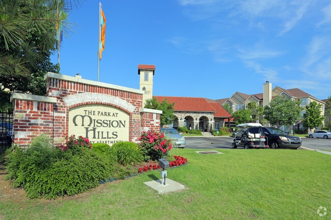
Property Detail
2700 N 7Th St
80792-94-35-67310
LOT 1 BLOCK 1
Nightclub
Tulsa
RM
Oklahoma
C and X Area of minimal flood hazard, usually depicted on FIRMs as above the 500-year flood level.
1
2025
14.50 AC
2025
South Tulsa
009020
Tulsa
279,184 SF
Tulsa, OK
NEARBY LISTINGS FOR SALE OR LEASE
-
-
View all Broken Arrow listings for sale on LoopNet.com
DEMOGRAPHICS near 2700 N 7Th St
1 mile
3 mile
5 mile
2025 Total Population
7,620
58,836
149,716
2030 Population
7,912
61,535
155,316
Pop Growth 2025-2030
+ 3.83%
+ 4.59%
+ 3.74%
Average Age
38
37
37
2025 Total Households
3,162
22,609
55,792
HH Growth 2025-2030
+ 4.11%
+ 4.48%
+ 3.73%
Median Household Inc
$81,190
$81,759
$73,807
Avg Household Size
2.30
2.50
2.60
2025 Avg HH Vehicles
2.00
2.00
2.00
Median Home Value
$263,262
$247,854
$232,531
Median Year Built
2003
2000
1989
Nearby Places
Map Layers
Map Styles
 Street
 Aerial
Layers
 Traffic
 Biking
Places
Listings with unknown addresses are not visible on the map
- Restaurants
- Banks
- Shops
- Fitness
- Groceries
PUBLIC TRANSPORTATION
AIRPORT
Tulsa International
Drive
Walk
Distance
Tulsa International
24 min
16.2 mi
Freight Ports
Tulsa Port Of Catoosa
Drive
Walk
Distance
Tulsa Port Of Catoosa
22 min
12.7 mi
Nearby Properties
Address
Land Use
TOTAL SIZE
Lot Size
Zoning
Address
Land Use
TOTAL SIZE
Lot Size
Zoning
197,676 SF
13.38 AC
CH
Address
Land Use
TOTAL SIZE
Lot Size
Zoning
435,822 SF
43.42 AC
R1
Address
Land Use
TOTAL SIZE
Lot Size
Zoning
115,003 SF
59.09 AC
CG
Address
Land Use
TOTAL SIZE
Lot Size
Zoning
125,902 SF
19.15 AC
CH
Address
Land Use
TOTAL SIZE
Lot Size
Zoning
59,108 SF
11.18 AC
R3
Address
Land Use
TOTAL SIZE
Lot Size
Zoning
53,139 SF
108.91 AC
A1
Address
Land Use
TOTAL SIZE
Lot Size
Zoning
55,283 SF
39.50 AC
SR
Address
Land Use
TOTAL SIZE
Lot Size
Zoning
84,927 SF
4.81 AC
RM2
Address
Land Use
TOTAL SIZE
Lot Size
Zoning
75,444 SF
23.92 AC
R1
Address
Land Use
TOTAL SIZE
Lot Size
Zoning
58,695 SF
5.34 AC
RM
Address
Land Use
TOTAL SIZE
Lot Size
Zoning
77,260 SF
0.58 AC
R3
Address
Land Use
TOTAL SIZE
Lot Size
Zoning
49,113 SF
5.42 AC
R3
Address
Land Use
TOTAL SIZE
Lot Size
Zoning
222,768 SF
20.24 AC
CS
Address
Land Use
TOTAL SIZE
Lot Size
Zoning
67,149 SF
28.56 AC
R2
Address
Land Use
TOTAL SIZE
Lot Size
Zoning
58,627 SF
6.07 AC
CG
Address
Land Use
TOTAL SIZE
Lot Size
Zoning
363,154 SF
23.09 AC
IL
Address
Land Use
TOTAL SIZE
Lot Size
Zoning
71,362 SF
14.08 AC
RD
Address
Land Use
TOTAL SIZE
Lot Size
Zoning
279,517 SF
25.43 AC
CO
Address
Land Use
TOTAL SIZE
Lot Size
Zoning
248,722 SF
15.01 AC
RM
Address
Land Use
TOTAL SIZE
Lot Size
Zoning
268,496 SF
19.31 AC
CN
Address
Land Use
TOTAL SIZE
Lot Size
Zoning
36,408 SF
10.46 AC
IL
Address
Land Use
TOTAL SIZE
Lot Size
Zoning
239,868 SF
14.84 AC
CG
Address
Land Use
TOTAL SIZE
Lot Size
Zoning
13,691 SF
2.04 AC
CH
Address
Land Use
TOTAL SIZE
Lot Size
Zoning
14,056 SF
60.03 AC
A1
Address
Land Use
TOTAL SIZE
Lot Size
Zoning
8.25 AC
CH
Address
Land Use
TOTAL SIZE
Lot Size
Zoning
367,352 SF
17.83 AC
CG
Address
Land Use
TOTAL SIZE
Lot Size
Zoning
252,887 SF
80.92 AC
OL
Address
Land Use
TOTAL SIZE
Lot Size
Zoning
59,222 SF
5.12 AC
IH
Address
Land Use
TOTAL SIZE
Lot Size
Zoning
28,071 SF
19 AC
Address
Land Use
TOTAL SIZE
Lot Size
Zoning
155,646 SF
14.53 AC
RM
The World's #1 Commercial Real Estate Marketplace
Connect with us
© 2026 CoStar Group
The information above has been obtained from sources believed reliable. While we do not doubt its accuracy we have not verified it and make no guarantee, warranty or representation about it. It is your responsibility to independently confirm its accuracy and completeness. Any projections, opinions, assumptions, or estimates used are for example only and do not represent the current or future performance of the property. The value of this transaction to you depends on tax and other factors which should be evaluated by your tax, financial, and legal advisors. You and your advisors should conduct a careful, independent investigation of the property to determine to your satisfaction the suitability of the property for your needs.