Property Record
2700 N Melrose Rd, Springfield, MO 65757
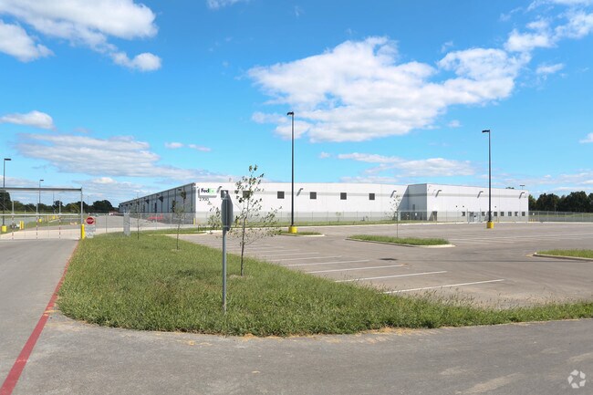


Property Detail
2700 N Melrose Rd
Springfield, MO
31.56A M/L BEG 1441.97 FT S 9.09 FT E NW COR E1/2 LOT 1 NW1/ 4 E 1339.92 FT S 700.65 FT SWLY 906.56 FT WLY 582.84 FT N 12 12.3 FT TO BEG (EX R/W)1/29/21
12-01-300-029
GREENE
Truckterminal
Missouri
INC
1
B and X Area of moderate flood hazard, usually the area between the limits of the 100-year and 500-year floods.
31.56 AC
2025
Outlying Greene County
2025
Springfield
003702
NEARBY LISTINGS FOR SALE OR LEASE
DEMOGRAPHICS near 2700 N Melrose Rd
1 mile
3 mile
5 mile
2025 Total Population
644
5,320
35,375
2030 Population
674
5,526
36,480
Pop Growth 2025-2030
+ 4.66%
+ 3.87%
+ 3.12%
Average Age
41
44
41
2025 Total Households
253
2,172
15,176
HH Growth 2025-2030
+ 4.74%
+ 3.96%
+ 3.27%
Median Household Inc
$107,500
$107,620
$65,170
Avg Household Size
2.50
2.40
2.30
2025 Avg HH Vehicles
2.00
2.00
2.00
Median Home Value
$360,714
$358,947
$256,939
Median Year Built
2009
2001
1982
Nearby Places
Map Layers
Map Styles
 Street
 Aerial
Layers
 Traffic
 Biking
Places
Listings with unknown addresses are not visible on the map
- Restaurants
- Banks
- Shops
- Fitness
- Groceries
PUBLIC TRANSPORTATION
AIRPORT
Springfield-Branson Ntl
Drive
Walk
Distance
Springfield-Branson Ntl
26 min
15.9 mi
Freight Ports
Tulsa Port of Inola
Drive
Walk
Distance
Tulsa Port of Inola
199 min
178.3 mi
Nearby Properties
Address
Land Use
TOTAL SIZE
Lot Size
Zoning
Address
Land Use
TOTAL SIZE
Lot Size
Zoning
68.92 AC
INC
Address
Land Use
TOTAL SIZE
Lot Size
Zoning
617,990 SF
49.88 AC
INC
Address
Land Use
TOTAL SIZE
Lot Size
Zoning
20.01 AC
Address
Land Use
TOTAL SIZE
Lot Size
Zoning
22.01 AC
INC.
Address
Land Use
TOTAL SIZE
Lot Size
Zoning
37.01 AC
INC
Address
Land Use
TOTAL SIZE
Lot Size
Zoning
349,216 SF
29.46 AC
INC
Address
Land Use
TOTAL SIZE
Lot Size
Zoning
805,370 SF
54.30 AC
INC
Address
Land Use
TOTAL SIZE
Lot Size
Zoning
24.54 AC
INC.
Address
Land Use
TOTAL SIZE
Lot Size
Zoning
127,740 SF
27.70 AC
INC
Address
Land Use
TOTAL SIZE
Lot Size
Zoning
92,702 SF
42.54 AC
INC
Address
Land Use
TOTAL SIZE
Lot Size
Zoning
110,347 SF
14.58 AC
INC
Address
Land Use
TOTAL SIZE
Lot Size
Zoning
256,172 SF
19.03 AC
INC
Address
Land Use
TOTAL SIZE
Lot Size
Zoning
8.66 AC
INC
Address
Land Use
TOTAL SIZE
Lot Size
Zoning
79.50 AC
INC
Address
Land Use
TOTAL SIZE
Lot Size
Zoning
328,252 SF
18.67 AC
INC
Address
Land Use
TOTAL SIZE
Lot Size
Zoning
32.40 AC
INC
Address
Land Use
TOTAL SIZE
Lot Size
Zoning
16.03 AC
INC
Address
Land Use
TOTAL SIZE
Lot Size
Zoning
11.68 AC
INC
Address
Land Use
TOTAL SIZE
Lot Size
Zoning
70,284 SF
22.88 AC
INC
Address
Land Use
TOTAL SIZE
Lot Size
Zoning
491,910 SF
49.03 AC
INC
Address
Land Use
TOTAL SIZE
Lot Size
Zoning
5.26 AC
INC
Address
Land Use
TOTAL SIZE
Lot Size
Zoning
54,952 SF
9.29 AC
INC
Address
Land Use
TOTAL SIZE
Lot Size
Zoning
115,860 SF
9.18 AC
INC
Address
Land Use
TOTAL SIZE
Lot Size
Zoning
16.03 AC
INC.
Address
Land Use
TOTAL SIZE
Lot Size
Zoning
8.82 AC
INC
Address
Land Use
TOTAL SIZE
Lot Size
Zoning
4.75 AC
INC
Address
Land Use
TOTAL SIZE
Lot Size
Zoning
129,666 SF
13.73 AC
INC
Address
Land Use
TOTAL SIZE
Lot Size
Zoning
67,502 SF
7.70 AC
INC
Address
Land Use
TOTAL SIZE
Lot Size
Zoning
102,824 SF
7.46 AC
M-1
The World's #1 Commercial Real Estate Marketplace
Connect with us
© 2026 CoStar Group
The information above has been obtained from sources believed reliable. While we do not doubt its accuracy we have not verified it and make no guarantee, warranty or representation about it. It is your responsibility to independently confirm its accuracy and completeness. Any projections, opinions, assumptions, or estimates used are for example only and do not represent the current or future performance of the property. The value of this transaction to you depends on tax and other factors which should be evaluated by your tax, financial, and legal advisors. You and your advisors should conduct a careful, independent investigation of the property to determine to your satisfaction the suitability of the property for your needs.