Property Record
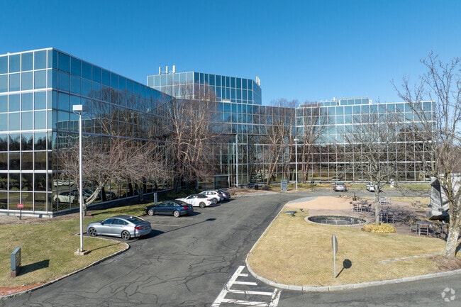
2500 Westchester Ave, Purchase, NY 10577


Current Lease Availabilities
NEARBY LISTINGS FOR SALE OR LEASE
Property Detail
2500 Westchester Ave
2801-000-611-00000-000-0003
Map Washington Park
Officebuilding
Westchester
AE
New York
36119C0289F
3
2025
24.62 AC
2024
East I-287 Corridor
008500
Westchester/So Connecticut
273,700 SF
New York-Jersey City-White Plains, NY-NJ
DEMOGRAPHICS near 2500 Westchester Ave
1 Mile
3 Mile
5 Mile
2024 Total Population
3,849
80,755
205,565
2029 Population
3,772
78,830
201,752
Pop Growth 2024-2029
(2.00%)
(2.38%)
(1.85%)
Average Age
44
41
41
2024 Total Households
1,337
27,929
75,806
HH Growth 2024-2029
(2.17%)
(2.46%)
(1.80%)
Median Household Inc
$239,688
$133,389
$132,854
Avg Household Size
2.80
2.80
2.60
2024 Avg HH Vehicles
2.00
2.00
2.00
Median Home Value
$925,268
$845,687
$826,033
Median Year Built
1962
1959
1959
Nearby Places
Map Layers
Map Styles
 Street
 Aerial
- Restaurants
- Banks
- Shops
- Fitness
- Groceries
PUBLIC TRANSPORTATION
COMMUTER RAIL
Port Chester Station (New Haven Line - Metro-North Commuter Railroad Company (Metro-North))
DRIVE
WALK
Distance
Port Chester Station (New Haven Line - Metro-North Commuter Railroad Company (Metro-North))
7 min
2.8 mi
Rye Station (New Haven Line - Metro-North Commuter Railroad Company (Metro-North))
DRIVE
WALK
Distance
Rye Station (New Haven Line - Metro-North Commuter Railroad Company (Metro-North))
7 min
2.9 mi
AIRPORT
Westchester County
DRIVE
WALK
Distance
Westchester County
13 min
7.6 mi
LaGuardia
DRIVE
WALK
Distance
LaGuardia
41 min
24.7 mi
John F Kennedy International
DRIVE
WALK
Distance
John F Kennedy International
47 min
32.2 mi
Freight Ports
NY - Red Hook Container Terminal
DRIVE
WALK
Distance
NY - Red Hook Container Terminal
56 min
35.2 mi
Nearby Properties
Address
Land Use
TOTAL SIZE
Lot Size
Zoning
Address
Land Use
TOTAL SIZE
Lot Size
Zoning
5COMMUND
Address
Land Use
TOTAL SIZE
Lot Size
Zoning
80,427 SF
18.06 AC
GBO
Address
Land Use
TOTAL SIZE
Lot Size
Zoning
277,172 SF
29.98 AC
CD COMM
Address
Land Use
TOTAL SIZE
Lot Size
Zoning
9,828 SF
22.01 AC
R-6
Address
Land Use
TOTAL SIZE
Lot Size
Zoning
0.01 AC
5COMMUND
Address
Land Use
TOTAL SIZE
Lot Size
Zoning
5COMMUND
Address
Land Use
TOTAL SIZE
Lot Size
Zoning
9,305 SF
35.53 AC
R-C7
Address
Land Use
TOTAL SIZE
Lot Size
Zoning
345,927 SF
4.32 AC
MUR WTRFR
Address
Land Use
TOTAL SIZE
Lot Size
Zoning
556,297 SF
25.31 AC
05 - COMME
Address
Land Use
TOTAL SIZE
Lot Size
Zoning
117,252 SF
4.15 AC
GBO
Address
Land Use
TOTAL SIZE
Lot Size
Zoning
5COMMUND
Address
Land Use
TOTAL SIZE
Lot Size
Zoning
91,202 SF
22.09 AC
R-6
Address
Land Use
TOTAL SIZE
Lot Size
Zoning
42,306 SF
20.35 AC
GB
Address
Land Use
TOTAL SIZE
Lot Size
Zoning
135,380 SF
7.32 AC
MUR WTRFR
Address
Land Use
TOTAL SIZE
Lot Size
Zoning
164,312 SF
4.92 AC
Z-4 AIRPRT
Address
Land Use
TOTAL SIZE
Lot Size
Zoning
143,372 SF
24.05 AC
OB-2 OFFC
Address
Land Use
TOTAL SIZE
Lot Size
Zoning
84,747 SF
8.64 AC
C1-P RTAIL
Address
Land Use
TOTAL SIZE
Lot Size
Zoning
51,982 SF
2.25 AC
GBO
Address
Land Use
TOTAL SIZE
Lot Size
Zoning
158,232 SF
4.47 AC
GBO
Address
Land Use
TOTAL SIZE
Lot Size
Zoning
126,404 SF
1.12 AC
GBO
Address
Land Use
TOTAL SIZE
Lot Size
Zoning
85,338 SF
25.19 AC
OB-1 OFFC
Address
Land Use
TOTAL SIZE
Lot Size
Zoning
9.30 AC
M2 INDUST
Address
Land Use
TOTAL SIZE
Lot Size
Zoning
69,114 SF
19.83 AC
R-7
Address
Land Use
TOTAL SIZE
Lot Size
Zoning
122,386 SF
1.39 AC
DW2 WTRFR
Address
Land Use
TOTAL SIZE
Lot Size
Zoning
477.23 AC
Address
Land Use
TOTAL SIZE
Lot Size
Zoning
56,795 SF
HO
Address
Land Use
TOTAL SIZE
Lot Size
Zoning
65,659 SF
7.72 AC
R-6
Address
Land Use
TOTAL SIZE
Lot Size
Zoning
101,657 SF
1.14 AC
C2 COMM
Address
Land Use
TOTAL SIZE
Lot Size
Zoning
5,400 SF
21.08 AC
R-20 SFR
Address
Land Use
TOTAL SIZE
Lot Size
Zoning
107,754 SF
3.22 AC
GBO
The World's #1 Commercial Real Estate Marketplace
Connect with us
© 2025 CoStar Group
The information above has been obtained from sources believed reliable. While we do not doubt its accuracy we have not verified it and make no guarantee, warranty or representation about it. It is your responsibility to independently confirm its accuracy and completeness. Any projections, opinions, assumptions, or estimates used are for example only and do not represent the current or future performance of the property. The value of this transaction to you depends on tax and other factors which should be evaluated by your tax, financial, and legal advisors. You and your advisors should conduct a careful, independent investigation of the property to determine to your satisfaction the suitability of the property for your needs.