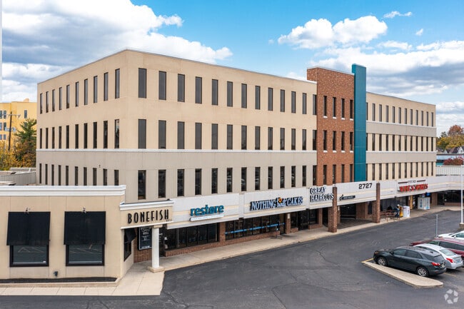
Property Record
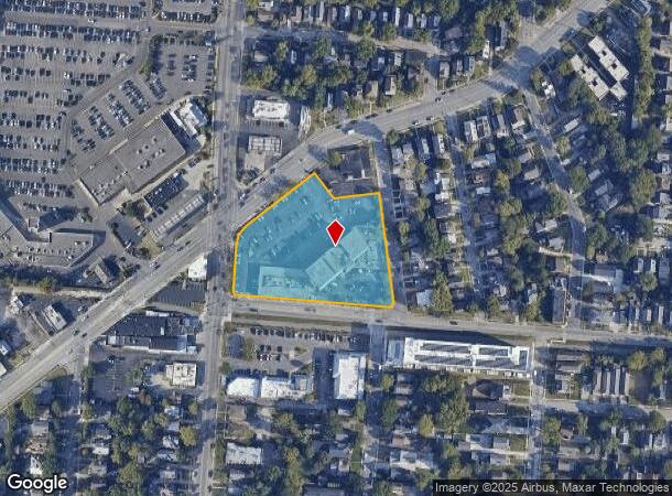
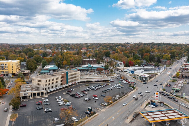
2727 Madison Rd, Cincinnati, OH 45209
Current Lease Availabilities
NEARBY LISTINGS FOR SALE OR LEASE
Property Detail
2727 Madison Rd
Cincinnati, OH-KY-IN
Ruzicka Remke Sub
040-0004-0037
SS MADISON 2.7016 ACS PT LTS 1TH3-7TH16 LTS 4TH6 E F WALTERS LT 13TH18&PT12-19 RUZICKA REMKE SUB
Commercialnec
Hamilton
X
Ohio
39061C0239E
1th3-
2024
2.70 AC
2024
Fairfax/Mt. Lookout
005200
Cincinnati/Dayton
58,422 SF
DEMOGRAPHICS near 2727 Madison Rd
1 Mile
3 Mile
5 Mile
2024 Total Population
18,054
114,414
285,459
2029 Population
17,653
113,929
285,780
Pop Growth 2024-2029
(2.22%)
(0.42%)
+ 0.11%
Average Age
38
38
38
2024 Total Households
9,181
53,622
129,016
HH Growth 2024-2029
(2.41%)
(0.63%)
+ 0.09%
Median Household Inc
$96,556
$63,691
$61,451
Avg Household Size
1.90
2.00
2.00
2024 Avg HH Vehicles
2.00
1.00
2.00
Median Home Value
$355,200
$261,017
$247,741
Median Year Built
1946
1948
1949
Nearby Places
- Restaurants
- Banks
- Shops
- Fitness
- Groceries
PUBLIC TRANSPORTATION
COMMUTER RAIL
Cincinnati Union Terminal (Cardinal - Amtrak)
DRIVE
WALK
Distance
Cincinnati Union Terminal (Cardinal - Amtrak)
14 min
8.3 mi
AIRPORT
Cincinnati/Northern Kentucky International
DRIVE
WALK
Distance
Cincinnati/Northern Kentucky International
35 min
20.3 mi
Freight Ports
Port of Toledo
DRIVE
WALK
Distance
Port of Toledo
239 min
202.6 mi
Nearby Properties
Address
Land Use
TOTAL SIZE
Lot Size
Zoning
Address
Land Use
TOTAL SIZE
Lot Size
Zoning
62.10 AC
Address
Land Use
TOTAL SIZE
Lot Size
Zoning
13.80 AC
Address
Land Use
TOTAL SIZE
Lot Size
Zoning
21.34 AC
Address
Land Use
TOTAL SIZE
Lot Size
Zoning
27.30 AC
M2
Address
Land Use
TOTAL SIZE
Lot Size
Zoning
11.68 AC
Address
Land Use
TOTAL SIZE
Lot Size
Zoning
26,453 SF
19.91 AC
M2
Address
Land Use
TOTAL SIZE
Lot Size
Zoning
148,748 SF
24.90 AC
CGA
Address
Land Use
TOTAL SIZE
Lot Size
Zoning
3.17 AC
R2PUD
Address
Land Use
TOTAL SIZE
Lot Size
Zoning
9.16 AC
Address
Land Use
TOTAL SIZE
Lot Size
Zoning
Address
Land Use
TOTAL SIZE
Lot Size
Zoning
10.76 AC
Address
Land Use
TOTAL SIZE
Lot Size
Zoning
Address
Land Use
TOTAL SIZE
Lot Size
Zoning
Address
Land Use
TOTAL SIZE
Lot Size
Zoning
5.07 AC
Address
Land Use
TOTAL SIZE
Lot Size
Zoning
Address
Land Use
TOTAL SIZE
Lot Size
Zoning
6.93 AC
MG
Address
Land Use
TOTAL SIZE
Lot Size
Zoning
8.05 AC
Address
Land Use
TOTAL SIZE
Lot Size
Zoning
Address
Land Use
TOTAL SIZE
Lot Size
Zoning
2,916 SF
27.68 AC
Address
Land Use
TOTAL SIZE
Lot Size
Zoning
Address
Land Use
TOTAL SIZE
Lot Size
Zoning
3.34 AC
Address
Land Use
TOTAL SIZE
Lot Size
Zoning
83,122 SF
1.99 AC
Address
Land Use
TOTAL SIZE
Lot Size
Zoning
1,187 SF
31.75 AC
ML
Address
Land Use
TOTAL SIZE
Lot Size
Zoning
6.91 AC
Address
Land Use
TOTAL SIZE
Lot Size
Zoning
3,864 SF
5.30 AC
PD
Address
Land Use
TOTAL SIZE
Lot Size
Zoning
19.17 AC
ML
Address
Land Use
TOTAL SIZE
Lot Size
Zoning
4,706 SF
18.29 AC
RM20
Address
Land Use
TOTAL SIZE
Lot Size
Zoning
Address
Land Use
TOTAL SIZE
Lot Size
Zoning
7.06 AC
Address
Land Use
TOTAL SIZE
Lot Size
Zoning
1,152 SF
24.78 AC
B
The World's #1 Commercial Real Estate Marketplace
Connect with us
© 2025 CoStar Group
The information above has been obtained from sources believed reliable. While we do not doubt its accuracy we have not verified it and make no guarantee, warranty or representation about it. It is your responsibility to independently confirm its accuracy and completeness. Any projections, opinions, assumptions, or estimates used are for example only and do not represent the current or future performance of the property. The value of this transaction to you depends on tax and other factors which should be evaluated by your tax, financial, and legal advisors. You and your advisors should conduct a careful, independent investigation of the property to determine to your satisfaction the suitability of the property for your needs.