Property Record
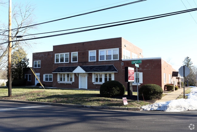
2701 Cowpath Rd, Hatfield, PA 19440


Property Detail
2701 Cowpath Rd
35-00-02596-006
L 8-9 U3 & U33
Commercialnec
Montgomery
RA1
Pennsylvania
B and X Area of moderate flood hazard, usually the area between the limits of the 100-year and 500-year floods.
8-9
2026
0.63 AC
2026
West Montgomery County
200707
Philadelphia
13,208 SF
Philadelphia-Camden-Wilmington, PA-NJ-DE-MD
NEARBY LISTINGS FOR SALE OR LEASE
DEMOGRAPHICS near 2701 Cowpath Rd
1 mile
3 mile
5 mile
2025 Total Population
16,788
63,947
152,946
2030 Population
18,156
66,345
156,353
Pop Growth 2025-2030
+ 8.15%
+ 3.75%
+ 2.23%
Average Age
41
42
43
2025 Total Households
6,241
24,561
58,737
HH Growth 2025-2030
+ 7.40%
+ 3.48%
+ 2.08%
Median Household Inc
$92,646
$95,959
$104,376
Avg Household Size
2.60
2.50
2.50
2025 Avg HH Vehicles
2.00
2.00
2.00
Median Home Value
$437,039
$411,312
$433,576
Median Year Built
1990
1976
1980
Nearby Places
Map Layers
Map Styles
 Street
 Aerial
Layers
 Traffic
 Biking
Places
Listings with unknown addresses are not visible on the map
- Restaurants
- Banks
- Shops
- Fitness
- Groceries
PUBLIC TRANSPORTATION
COMMUTER RAIL
Fortuna (R5 - Southeastern Pennsylvania Transportation Authority Regional Rail (SEPTA Regional Rail))
Drive
Walk
Distance
Fortuna (R5 - Southeastern Pennsylvania Transportation Authority Regional Rail (SEPTA Regional Rail))
6 min
2.6 mi
Drive
Walk
Distance
7 min
3.7 mi
AIRPORT
Lehigh Valley International
Drive
Walk
Distance
Lehigh Valley International
50 min
30.9 mi
Trenton Mercer
Drive
Walk
Distance
Trenton Mercer
60 min
38.8 mi
Philadelphia International
Drive
Walk
Distance
Philadelphia International
57 min
40.6 mi
SALE & LEASE HISTORY
LISTING DATE
SALE/LEASE

May 22, 2024
For Lease
Nearby Properties
Address
Land Use
TOTAL SIZE
Lot Size
Zoning
Address
Land Use
TOTAL SIZE
Lot Size
Zoning
437,908 SF
104.29 AC
INST
Address
Land Use
TOTAL SIZE
Lot Size
Zoning
258,179 SF
65.34 AC
IN
Address
Land Use
TOTAL SIZE
Lot Size
Zoning
977,439 SF
70.93 AC
GA
Address
Land Use
TOTAL SIZE
Lot Size
Zoning
457,221 SF
37.18 AC
MRC
Address
Land Use
TOTAL SIZE
Lot Size
Zoning
139,733 SF
46.65 AC
R130
Address
Land Use
TOTAL SIZE
Lot Size
Zoning
517,834 SF
31.33 AC
GA
Address
Land Use
TOTAL SIZE
Lot Size
Zoning
832,830 SF
53.72 AC
LI
Address
Land Use
TOTAL SIZE
Lot Size
Zoning
349,078 SF
18.46 AC
INST
Address
Land Use
TOTAL SIZE
Lot Size
Zoning
253,915 SF
17.78 AC
GA
Address
Land Use
TOTAL SIZE
Lot Size
Zoning
219,869 SF
41.98 AC
LI
Address
Land Use
TOTAL SIZE
Lot Size
Zoning
211,561 SF
38.80 AC
LI
Address
Land Use
TOTAL SIZE
Lot Size
Zoning
225,154 SF
6.38 AC
B
Address
Land Use
TOTAL SIZE
Lot Size
Zoning
985,663 SF
64.82 AC
RC
Address
Land Use
TOTAL SIZE
Lot Size
Zoning
373,104 SF
31.94 AC
LI
Address
Land Use
TOTAL SIZE
Lot Size
Zoning
171,807 SF
71.70 AC
IN
Address
Land Use
TOTAL SIZE
Lot Size
Zoning
334,450 SF
18.86 AC
GA
Address
Land Use
TOTAL SIZE
Lot Size
Zoning
179,930 SF
16 AC
IN
Address
Land Use
TOTAL SIZE
Lot Size
Zoning
131,631 SF
18.12 AC
SC
Address
Land Use
TOTAL SIZE
Lot Size
Zoning
289,681 SF
4.75 AC
BPO
Address
Land Use
TOTAL SIZE
Lot Size
Zoning
220,124 SF
33.16 AC
SC
Address
Land Use
TOTAL SIZE
Lot Size
Zoning
152,085 SF
38.16 AC
INST
Address
Land Use
TOTAL SIZE
Lot Size
Zoning
168,557 SF
44.77 AC
RA1
Address
Land Use
TOTAL SIZE
Lot Size
Zoning
444,718 SF
46.51 AC
LI
Address
Land Use
TOTAL SIZE
Lot Size
Zoning
324,796 SF
42.20 AC
LI
Address
Land Use
TOTAL SIZE
Lot Size
Zoning
207,306 SF
14.50 AC
GA
Address
Land Use
TOTAL SIZE
Lot Size
Zoning
87,170 SF
10.23 AC
RA
Address
Land Use
TOTAL SIZE
Lot Size
Zoning
98,782 SF
5.09 AC
BC
Address
Land Use
TOTAL SIZE
Lot Size
Zoning
502,169 SF
83.16 AC
LI
Address
Land Use
TOTAL SIZE
Lot Size
Zoning
333,888 SF
35.37 AC
LI
Address
Land Use
TOTAL SIZE
Lot Size
Zoning
132,154 SF
21.50 AC
IN
The World's #1 Commercial Real Estate Marketplace
Connect with us
© 2026 CoStar Group
The information above has been obtained from sources believed reliable. While we do not doubt its accuracy we have not verified it and make no guarantee, warranty or representation about it. It is your responsibility to independently confirm its accuracy and completeness. Any projections, opinions, assumptions, or estimates used are for example only and do not represent the current or future performance of the property. The value of this transaction to you depends on tax and other factors which should be evaluated by your tax, financial, and legal advisors. You and your advisors should conduct a careful, independent investigation of the property to determine to your satisfaction the suitability of the property for your needs.