Property Record
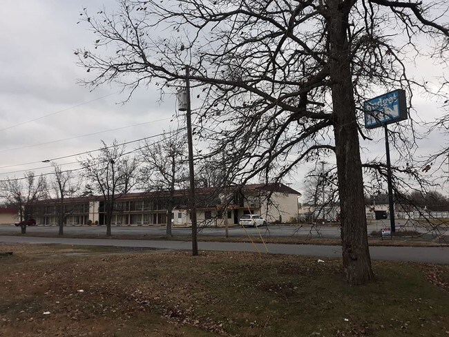
2701 Hc Mathis Dr, Paducah, KY 42001


Property Detail
2701 Hc Mathis Dr
Other Market Areas
MCCRACKEN
Paducah, KY-IL
Kentucky
104-12-05-002
1.66 AC
Commercialnec
Kentucky West Area
NEARBY LISTINGS FOR SALE OR LEASE
-
-
View all Paducah listings for sale on LoopNet.com
DEMOGRAPHICS near 2701 Hc Mathis Dr
1 mile
3 mile
5 mile
2025 Total Population
6,459
27,301
46,063
2030 Population
6,417
27,296
46,053
Pop Growth 2025-2030
(0.65%)
(0.02%)
(0.02%)
Average Age
40
41
41
2025 Total Households
2,996
11,745
20,106
HH Growth 2025-2030
(0.67%)
(0.06%)
(0.03%)
Median Household Inc
$38,230
$49,093
$53,290
Avg Household Size
2.10
2.10
2.10
2025 Avg HH Vehicles
1.00
2.00
2.00
Median Home Value
$119,459
$158,436
$164,440
Median Year Built
1957
1966
1975
Nearby Places
Map Layers
Map Styles
 Street
 Aerial
Layers
 Traffic
 Biking
Places
Listings with unknown addresses are not visible on the map
- Restaurants
- Banks
- Shops
- Fitness
- Groceries
SALE & LEASE HISTORY
LISTING DATE
SALE/LEASE

Nov 21, 2019
For Sale
Nearby Properties
Address
Land Use
TOTAL SIZE
Lot Size
Zoning
Address
Land Use
TOTAL SIZE
Lot Size
Zoning
Address
Land Use
TOTAL SIZE
Lot Size
Zoning
35.07 AC
Address
Land Use
TOTAL SIZE
Lot Size
Zoning
33.35 AC
Address
Land Use
TOTAL SIZE
Lot Size
Zoning
65.20 AC
Address
Land Use
TOTAL SIZE
Lot Size
Zoning
Address
Land Use
TOTAL SIZE
Lot Size
Zoning
4.27 AC
Address
Land Use
TOTAL SIZE
Lot Size
Zoning
Address
Land Use
TOTAL SIZE
Lot Size
Zoning
Address
Land Use
TOTAL SIZE
Lot Size
Zoning
10.39 AC
Address
Land Use
TOTAL SIZE
Lot Size
Zoning
Address
Land Use
TOTAL SIZE
Lot Size
Zoning
13.34 AC
Address
Land Use
TOTAL SIZE
Lot Size
Zoning
7.05 AC
Address
Land Use
TOTAL SIZE
Lot Size
Zoning
10.17 AC
Address
Land Use
TOTAL SIZE
Lot Size
Zoning
27.89 AC
Address
Land Use
TOTAL SIZE
Lot Size
Zoning
Address
Land Use
TOTAL SIZE
Lot Size
Zoning
1.37 AC
Address
Land Use
TOTAL SIZE
Lot Size
Zoning
8.54 AC
Address
Land Use
TOTAL SIZE
Lot Size
Zoning
13.03 AC
Address
Land Use
TOTAL SIZE
Lot Size
Zoning
5.17 AC
Address
Land Use
TOTAL SIZE
Lot Size
Zoning
5.08 AC
Address
Land Use
TOTAL SIZE
Lot Size
Zoning
24.38 AC
Address
Land Use
TOTAL SIZE
Lot Size
Zoning
13.90 AC
Address
Land Use
TOTAL SIZE
Lot Size
Zoning
Address
Land Use
TOTAL SIZE
Lot Size
Zoning
13.47 AC
Address
Land Use
TOTAL SIZE
Lot Size
Zoning
Address
Land Use
TOTAL SIZE
Lot Size
Zoning
37.34 AC
Address
Land Use
TOTAL SIZE
Lot Size
Zoning
Address
Land Use
TOTAL SIZE
Lot Size
Zoning
Address
Land Use
TOTAL SIZE
Lot Size
Zoning
4,000 SF
18 AC
Address
Land Use
TOTAL SIZE
Lot Size
Zoning
2.84 AC
The World's #1 Commercial Real Estate Marketplace
Connect with us
© 2026 CoStar Group
The information above has been obtained from sources believed reliable. While we do not doubt its accuracy we have not verified it and make no guarantee, warranty or representation about it. It is your responsibility to independently confirm its accuracy and completeness. Any projections, opinions, assumptions, or estimates used are for example only and do not represent the current or future performance of the property. The value of this transaction to you depends on tax and other factors which should be evaluated by your tax, financial, and legal advisors. You and your advisors should conduct a careful, independent investigation of the property to determine to your satisfaction the suitability of the property for your needs.