Property Record
2701 Memorial Hwy, Mandan, ND 58554


NEARBY LISTINGS FOR SALE OR LEASE
-
-
View all Mandan listings for lease on LoopNet.com
Property Detail
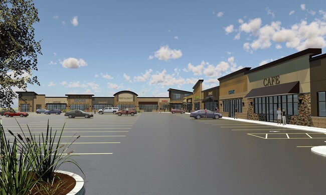
2701 Memorial Hwy
Bismarck, ND
Ramblewood 11Th
65-6100180
TWN: 0 SCT: 0 RNG: 0 SUB: 580 BLK: 1 LOT: 1 (LESS RAMBLEWOOD 14TH ADDN .38AC) 10286
Residentialacreage
Morton
X
North Dakota
38015C0780E
1
2024
4.25 AC
2024
Prairie West
020303
Other Market Areas
DEMOGRAPHICS near 2701 Memorial Hwy
1 Mile
3 Mile
5 Mile
2024 Total Population
1,751
36,214
89,700
2029 Population
1,823
37,518
92,613
Pop Growth 2024-2029
+ 4.11%
+ 3.60%
+ 3.25%
Average Age
38
40
40
2024 Total Households
708
15,256
38,793
HH Growth 2024-2029
+ 4.10%
+ 3.62%
+ 3.26%
Median Household Inc
$57,261
$73,322
$66,879
Avg Household Size
2.30
2.30
2.20
2024 Avg HH Vehicles
2.00
2.00
2.00
Median Home Value
$180,092
$262,906
$258,574
Median Year Built
1976
1982
1980
Nearby Places
Map Layers
Map Styles
 Street
 Aerial
- Restaurants
- Banks
- Shops
- Fitness
- Groceries
PUBLIC TRANSPORTATION
AIRPORT
Bismarck Municipal
DRIVE
WALK
Distance
Bismarck Municipal
20 min
7.9 mi
Freight Ports
Port Milwaukee
DRIVE
WALK
Distance
Port Milwaukee
828 min
769.3 mi
SALE & LEASE HISTORY
LISTING DATE
SALE/LEASE

Sep 26, 2016
For Lease
Nearby Properties
Address
Land Use
TOTAL SIZE
Lot Size
Zoning
Address
Land Use
TOTAL SIZE
Lot Size
Zoning
13.47 AC
PUD
Address
Land Use
TOTAL SIZE
Lot Size
Zoning
38,467 SF
13.89 AC
CG
Address
Land Use
TOTAL SIZE
Lot Size
Zoning
13.98 AC
CG
Address
Land Use
TOTAL SIZE
Lot Size
Zoning
57,580 SF
8.85 AC
CG
Address
Land Use
TOTAL SIZE
Lot Size
Zoning
8.64 AC
ETZ
Address
Land Use
TOTAL SIZE
Lot Size
Zoning
88,263 SF
8.58 AC
CG
Address
Land Use
TOTAL SIZE
Lot Size
Zoning
48,661 SF
4.91 AC
CG
Address
Land Use
TOTAL SIZE
Lot Size
Zoning
68,211 SF
10 AC
RT
Address
Land Use
TOTAL SIZE
Lot Size
Zoning
8,280 SF
9.76 AC
RM30
Address
Land Use
TOTAL SIZE
Lot Size
Zoning
35,354 SF
3.75 AC
RT
Address
Land Use
TOTAL SIZE
Lot Size
Zoning
77,477 SF
3.43 AC
RM30
Address
Land Use
TOTAL SIZE
Lot Size
Zoning
28,532 SF
4.43 AC
RM30
Address
Land Use
TOTAL SIZE
Lot Size
Zoning
28,802 SF
1.82 AC
CG
Address
Land Use
TOTAL SIZE
Lot Size
Zoning
60,141 SF
4.80 AC
RM15
Address
Land Use
TOTAL SIZE
Lot Size
Zoning
55,629 SF
6 AC
CG
Address
Land Use
TOTAL SIZE
Lot Size
Zoning
37,611 SF
3.57 AC
RM30
Address
Land Use
TOTAL SIZE
Lot Size
Zoning
27,375 SF
3.28 AC
RM30
Address
Land Use
TOTAL SIZE
Lot Size
Zoning
22,474 SF
2.04 AC
CG
Address
Land Use
TOTAL SIZE
Lot Size
Zoning
30,015 SF
1.83 AC
CG
Address
Land Use
TOTAL SIZE
Lot Size
Zoning
43,708 SF
3.87 AC
CG
Address
Land Use
TOTAL SIZE
Lot Size
Zoning
24,283 SF
2.02 AC
RT
Address
Land Use
TOTAL SIZE
Lot Size
Zoning
24,611 SF
3.10 AC
RM30
Address
Land Use
TOTAL SIZE
Lot Size
Zoning
53,834 SF
1.96 AC
CG
Address
Land Use
TOTAL SIZE
Lot Size
Zoning
46,106 SF
2.18 AC
RT
Address
Land Use
TOTAL SIZE
Lot Size
Zoning
60,582 SF
2.21 AC
CG
Address
Land Use
TOTAL SIZE
Lot Size
Zoning
45,519 SF
2.33 AC
RT
Address
Land Use
TOTAL SIZE
Lot Size
Zoning
13,910 SF
1.52 AC
CG
Address
Land Use
TOTAL SIZE
Lot Size
Zoning
0.72 AC
ETZ
Address
Land Use
TOTAL SIZE
Lot Size
Zoning
55,480 SF
2.27 AC
RM30
Address
Land Use
TOTAL SIZE
Lot Size
Zoning
The World's #1 Commercial Real Estate Marketplace
Connect with us
© 2025 CoStar Group
The information above has been obtained from sources believed reliable. While we do not doubt its accuracy we have not verified it and make no guarantee, warranty or representation about it. It is your responsibility to independently confirm its accuracy and completeness. Any projections, opinions, assumptions, or estimates used are for example only and do not represent the current or future performance of the property. The value of this transaction to you depends on tax and other factors which should be evaluated by your tax, financial, and legal advisors. You and your advisors should conduct a careful, independent investigation of the property to determine to your satisfaction the suitability of the property for your needs.