Property Record
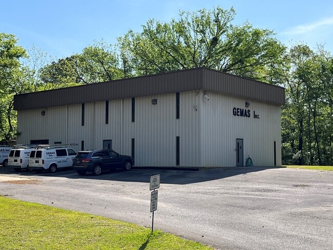
2701 Pine St, Irondale, AL 35210

Property Detail
2701 Pine St
24-00-03-3-002-005.000
POB BEG INTER OF NE R/W JOHNSON ST & E R/W PINE ST TH N ON E R/W PINE ST 183 FT TH NE 63.3 FT TH SE 198.6 FT TH SW 205 FT TH SWLY 50 FT TH NWLY 90 FT TO POB SECT 03 TWSP 17S RANGE 1W
Officebuilding
JEFFERSON
C1
Alabama
B and X Area of moderate flood hazard, usually the area between the limits of the 100-year and 500-year floods.
1 AC
2024
Trussville
2025
Birmingham
011115
Birmingham, AL
6,000 SF
NEARBY LISTINGS FOR SALE OR LEASE
DEMOGRAPHICS near 2701 Pine St
1 mile
3 mile
5 mile
2025 Total Population
362
19,021
74,020
2030 Population
356
18,455
72,600
Pop Growth 2025-2030
(1.66%)
(2.98%)
(1.92%)
Average Age
41
41
39
2025 Total Households
136
7,299
28,428
HH Growth 2025-2030
(1.47%)
(3.16%)
(1.97%)
Median Household Inc
$105,555
$77,161
$65,532
Avg Household Size
2.50
2.40
2.50
2025 Avg HH Vehicles
2.00
2.00
2.00
Median Home Value
$330,434
$268,069
$217,110
Median Year Built
1985
1978
1975
Nearby Places
Map Layers
Map Styles
 Street
 Aerial
Layers
 Traffic
 Biking
Places
Listings with unknown addresses are not visible on the map
- Restaurants
- Banks
- Shops
- Fitness
- Groceries
PUBLIC TRANSPORTATION
AIRPORT
Birmingham-Shuttlesworth International
Drive
Walk
Distance
Birmingham-Shuttlesworth International
18 min
11.4 mi
SALE & LEASE HISTORY
LISTING DATE
SALE/LEASE

May 12, 2022
For Sale
Nearby Properties
Address
Land Use
TOTAL SIZE
Lot Size
Zoning
Address
Land Use
TOTAL SIZE
Lot Size
Zoning
152,664 SF
12 AC
CO&I
Address
Land Use
TOTAL SIZE
Lot Size
Zoning
326,294 SF
26 AC
R4&U
Address
Land Use
TOTAL SIZE
Lot Size
Zoning
174,247 SF
47 AC
INST
Address
Land Use
TOTAL SIZE
Lot Size
Zoning
346,184 SF
22 AC
I2
Address
Land Use
TOTAL SIZE
Lot Size
Zoning
128,233 SF
CO&I
Address
Land Use
TOTAL SIZE
Lot Size
Zoning
137,168 SF
63 AC
A1
Address
Land Use
TOTAL SIZE
Lot Size
Zoning
155,845 SF
17 AC
C2
Address
Land Use
TOTAL SIZE
Lot Size
Zoning
87,863 SF
13.20 AC
PUD
Address
Land Use
TOTAL SIZE
Lot Size
Zoning
168,744 SF
8 AC
I1
Address
Land Use
TOTAL SIZE
Lot Size
Zoning
58,509 SF
CO&I
Address
Land Use
TOTAL SIZE
Lot Size
Zoning
57,296 SF
CO&I
Address
Land Use
TOTAL SIZE
Lot Size
Zoning
39,890 SF
7 AC
R8
Address
Land Use
TOTAL SIZE
Lot Size
Zoning
194,730 SF
25 AC
I-1
Address
Land Use
TOTAL SIZE
Lot Size
Zoning
114,134 SF
8 AC
I1
Address
Land Use
TOTAL SIZE
Lot Size
Zoning
178,988 SF
8 AC
CR5
Address
Land Use
TOTAL SIZE
Lot Size
Zoning
176,232 SF
5 AC
C2
Address
Land Use
TOTAL SIZE
Lot Size
Zoning
94,262 SF
17 AC
C-2
Address
Land Use
TOTAL SIZE
Lot Size
Zoning
110,776 SF
11 AC
C2
Address
Land Use
TOTAL SIZE
Lot Size
Zoning
170,992 SF
10 AC
C1
Address
Land Use
TOTAL SIZE
Lot Size
Zoning
49,858 SF
7 AC
C4
Address
Land Use
TOTAL SIZE
Lot Size
Zoning
122,397 SF
13.13 AC
C1
Address
Land Use
TOTAL SIZE
Lot Size
Zoning
40,011 SF
2 AC
C1
Address
Land Use
TOTAL SIZE
Lot Size
Zoning
53,864 SF
7 AC
C2
Address
Land Use
TOTAL SIZE
Lot Size
Zoning
76,037 SF
32.40 AC
A1
Address
Land Use
TOTAL SIZE
Lot Size
Zoning
14,432 SF
38.50 AC
I1
Address
Land Use
TOTAL SIZE
Lot Size
Zoning
170,783 SF
105 AC
PR1
Address
Land Use
TOTAL SIZE
Lot Size
Zoning
34,169 SF
3 AC
QC2
Address
Land Use
TOTAL SIZE
Lot Size
Zoning
29,422 SF
5 AC
C2
Address
Land Use
TOTAL SIZE
Lot Size
Zoning
67,270 SF
10 AC
C2
Address
Land Use
TOTAL SIZE
Lot Size
Zoning
149,773 SF
7 AC
CR5
The World's #1 Commercial Real Estate Marketplace
Connect with us
© 2026 CoStar Group
The information above has been obtained from sources believed reliable. While we do not doubt its accuracy we have not verified it and make no guarantee, warranty or representation about it. It is your responsibility to independently confirm its accuracy and completeness. Any projections, opinions, assumptions, or estimates used are for example only and do not represent the current or future performance of the property. The value of this transaction to you depends on tax and other factors which should be evaluated by your tax, financial, and legal advisors. You and your advisors should conduct a careful, independent investigation of the property to determine to your satisfaction the suitability of the property for your needs.