Property Record
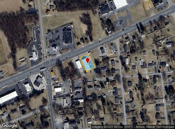
2701 Stuarts Draft Hwy, Stuarts Draft, VA 24477


This Property Is For Sale
NEARBY LISTINGS FOR SALE OR LEASE
Property Detail
2701 Stuarts Draft Hwy
084A-5-57A
Stuarts Draft
Warehouse
84A-(5)-57A NEAR STUARTS DRAFT 0.40 ACRES
X
Augusta
51015C0520D
Virginia
2025
0.40 AC
2025
Staunton & Harrisonburg
071101
Other Market Areas
12,376 SF
Staunton-Waynesboro, VA
DEMOGRAPHICS near 2701 Stuarts Draft Hwy
1 Mile
3 Mile
5 Mile
2024 Total Population
1,821
11,119
18,466
2029 Population
1,859
11,278
18,862
Pop Growth 2024-2029
+ 2.09%
+ 1.43%
+ 2.14%
Average Age
44
43
44
2024 Total Households
771
4,484
7,475
HH Growth 2024-2029
+ 2.08%
+ 1.45%
+ 2.21%
Median Household Inc
$64,590
$70,517
$67,003
Avg Household Size
2.30
2.40
2.40
2024 Avg HH Vehicles
2.00
2.00
2.00
Median Home Value
$223,714
$237,717
$247,454
Median Year Built
1980
1988
1990
Nearby Places
Map Layers
Map Styles
 Street
 Aerial
- Restaurants
- Banks
- Shops
- Fitness
- Groceries
Nearby Properties
Address
Land Use
TOTAL SIZE
Lot Size
Zoning
Address
Land Use
TOTAL SIZE
Lot Size
Zoning
1,555,974 SF
119.40 AC
GENERAL IN
Address
Land Use
TOTAL SIZE
Lot Size
Zoning
847,235 SF
301.72 AC
GENERAL IN
Address
Land Use
TOTAL SIZE
Lot Size
Zoning
847,235 SF
301.72 AC
GENERAL IN
Address
Land Use
TOTAL SIZE
Lot Size
Zoning
111,337 SF
48.49 AC
GENERAL AG
Address
Land Use
TOTAL SIZE
Lot Size
Zoning
592,952 SF
171.54 AC
GENERAL IN
Address
Land Use
TOTAL SIZE
Lot Size
Zoning
162,201 SF
31.27 AC
GENERAL AG
Address
Land Use
TOTAL SIZE
Lot Size
Zoning
270,213 SF
104.69 AC
GENERAL AG
Address
Land Use
TOTAL SIZE
Lot Size
Zoning
3,152 SF
17.16 AC
GENERAL AG
Address
Land Use
TOTAL SIZE
Lot Size
Zoning
285,650 SF
39.18 AC
GENERAL IN
Address
Land Use
TOTAL SIZE
Lot Size
Zoning
7,986 SF
132.59 AC
GENERAL AG
Address
Land Use
TOTAL SIZE
Lot Size
Zoning
260,908 SF
25.88 AC
GENERAL IN
Address
Land Use
TOTAL SIZE
Lot Size
Zoning
58,504 SF
10.15 AC
SINGLE FAM
Address
Land Use
TOTAL SIZE
Lot Size
Zoning
62,377 SF
5.83 AC
GENERAL BU
Address
Land Use
TOTAL SIZE
Lot Size
Zoning
191.92 AC
GENERAL AG
Address
Land Use
TOTAL SIZE
Lot Size
Zoning
10,704 SF
11 AC
MULTI-FAMI
Address
Land Use
TOTAL SIZE
Lot Size
Zoning
10,500 SF
9.30 AC
GENERAL BU
Address
Land Use
TOTAL SIZE
Lot Size
Zoning
37,167 SF
4.93 AC
MULTI-FAMI
Address
Land Use
TOTAL SIZE
Lot Size
Zoning
47.54 AC
MANUFACTUR
Address
Land Use
TOTAL SIZE
Lot Size
Zoning
13,994 SF
4.63 AC
MULTI-FAMI
Address
Land Use
TOTAL SIZE
Lot Size
Zoning
123,849 SF
5.37 AC
GENERAL BU
Address
Land Use
TOTAL SIZE
Lot Size
Zoning
50,355 SF
9.32 AC
GENERAL AG
Address
Land Use
TOTAL SIZE
Lot Size
Zoning
93,200 SF
18.11 AC
GENERAL IN
Address
Land Use
TOTAL SIZE
Lot Size
Zoning
4,244 SF
4.38 AC
MULTI-FAMI
Address
Land Use
TOTAL SIZE
Lot Size
Zoning
120,803 SF
11.95 AC
GENERAL BU
Address
Land Use
TOTAL SIZE
Lot Size
Zoning
33,159 SF
3.12 AC
MULTI-FAMI
Address
Land Use
TOTAL SIZE
Lot Size
Zoning
54,980 SF
9.56 AC
GENERAL AG
Address
Land Use
TOTAL SIZE
Lot Size
Zoning
8,004 SF
19.31 AC
MULTI-FAMI
Address
Land Use
TOTAL SIZE
Lot Size
Zoning
11,192 SF
2.75 AC
MULTI-FAMI
Address
Land Use
TOTAL SIZE
Lot Size
Zoning
3,082 SF
0.96 AC
GENERAL AG
The World's #1 Commercial Real Estate Marketplace
Connect with us
© 2025 CoStar Group
The information above has been obtained from sources believed reliable. While we do not doubt its accuracy we have not verified it and make no guarantee, warranty or representation about it. It is your responsibility to independently confirm its accuracy and completeness. Any projections, opinions, assumptions, or estimates used are for example only and do not represent the current or future performance of the property. The value of this transaction to you depends on tax and other factors which should be evaluated by your tax, financial, and legal advisors. You and your advisors should conduct a careful, independent investigation of the property to determine to your satisfaction the suitability of the property for your needs.