Property Record
2701 W Superior St, Duluth, MN 55806


NEARBY LISTINGS FOR SALE OR LEASE
Property Detail
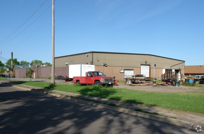
2701 W Superior St
Duluth, MN-WI
Duluth Proper
010112003370
LOTS 433 & 434 LOT 435 EX WLY 21 FT OF SLY 78FT LOT 436 LOT 437 EX SLY 78 FT LOTS 438 440442 444 446 & 448 LOT 439 EX SLY 78
Commercialnec
St Louis
X
Minnesota
27137C3769E
435
2024
1.88 AC
2024
Lincoln Park/Garfield
015600
Duluth
21,600 SF
DEMOGRAPHICS near 2701 W Superior St
1 mile
3 mile
5 mile
2024 Total Population
6,141
31,519
83,927
2029 Population
6,020
31,124
82,785
Pop Growth 2024-2029
(1.97%)
(1.25%)
(1.36%)
Average Age
36
40
39
2024 Total Households
2,762
14,862
36,249
HH Growth 2024-2029
(2.06%)
(1.26%)
(1.44%)
Median Household Inc
$40,989
$45,197
$51,671
Avg Household Size
2.10
2.00
2.10
2024 Avg HH Vehicles
1.00
1.00
2.00
Median Home Value
$143,660
$173,017
$183,023
Median Year Built
1946
1949
1954
Nearby Places
Map Layers
Map Styles
 Street
 Aerial
Transit
 Traffic
 Biking
Places
Listings with unknown addresses are not visible on the map
- Restaurants
- Banks
- Shops
- Fitness
- Groceries
PUBLIC TRANSPORTATION
AIRPORT
Duluth International
Drive
Walk
Distance
Duluth International
21 min
9.1 mi
Freight Ports
Port Milwaukee
Drive
Walk
Distance
Port Milwaukee
451 min
397.8 mi
SALE & LEASE HISTORY
LISTING DATE
SALE/LEASE

Feb 14, 2019
For Lease
Nearby Properties
Address
Land Use
TOTAL SIZE
Lot Size
Zoning
Address
Land Use
TOTAL SIZE
Lot Size
Zoning
539,170 SF
0.49 AC
Address
Land Use
TOTAL SIZE
Lot Size
Zoning
338,800 SF
0.17 AC
Address
Land Use
TOTAL SIZE
Lot Size
Zoning
547,975 SF
18.72 AC
Address
Land Use
TOTAL SIZE
Lot Size
Zoning
328,704 SF
3.81 AC
Address
Land Use
TOTAL SIZE
Lot Size
Zoning
391,335 SF
53.53 AC
Address
Land Use
TOTAL SIZE
Lot Size
Zoning
175 AC
W1
Address
Land Use
TOTAL SIZE
Lot Size
Zoning
134,100 SF
0.17 AC
Address
Land Use
TOTAL SIZE
Lot Size
Zoning
195,455 SF
54.06 AC
Address
Land Use
TOTAL SIZE
Lot Size
Zoning
248,716 SF
1.02 AC
Address
Land Use
TOTAL SIZE
Lot Size
Zoning
40,835 SF
0.33 AC
Address
Land Use
TOTAL SIZE
Lot Size
Zoning
203,540 SF
0.24 AC
Address
Land Use
TOTAL SIZE
Lot Size
Zoning
93,584 SF
0.66 AC
Address
Land Use
TOTAL SIZE
Lot Size
Zoning
97,552 SF
1.29 AC
Address
Land Use
TOTAL SIZE
Lot Size
Zoning
232,586 SF
0.16 AC
Address
Land Use
TOTAL SIZE
Lot Size
Zoning
178,104 SF
0.95 AC
Address
Land Use
TOTAL SIZE
Lot Size
Zoning
113,615 SF
0.32 AC
R4
Address
Land Use
TOTAL SIZE
Lot Size
Zoning
107,796 SF
9.19 AC
Address
Land Use
TOTAL SIZE
Lot Size
Zoning
175,168 SF
0.16 AC
Address
Land Use
TOTAL SIZE
Lot Size
Zoning
62,634 SF
4.32 AC
Address
Land Use
TOTAL SIZE
Lot Size
Zoning
144,760 SF
0.56 AC
C4
Address
Land Use
TOTAL SIZE
Lot Size
Zoning
68,296 SF
0.38 AC
Address
Land Use
TOTAL SIZE
Lot Size
Zoning
144,408 SF
1.29 AC
Address
Land Use
TOTAL SIZE
Lot Size
Zoning
72,980 SF
2.85 AC
R1B
Address
Land Use
TOTAL SIZE
Lot Size
Zoning
141,049 SF
0.50 AC
Address
Land Use
TOTAL SIZE
Lot Size
Zoning
100,800 SF
1.14 AC
C4
Address
Land Use
TOTAL SIZE
Lot Size
Zoning
93,480 SF
0.13 AC
Address
Land Use
TOTAL SIZE
Lot Size
Zoning
145,801 SF
1.30 AC
Address
Land Use
TOTAL SIZE
Lot Size
Zoning
123,055 SF
0.67 AC
Address
Land Use
TOTAL SIZE
Lot Size
Zoning
125,495 SF
1.03 AC
C4
The World's #1 Commercial Real Estate Marketplace
Connect with us
© 2026 CoStar Group
The information above has been obtained from sources believed reliable. While we do not doubt its accuracy we have not verified it and make no guarantee, warranty or representation about it. It is your responsibility to independently confirm its accuracy and completeness. Any projections, opinions, assumptions, or estimates used are for example only and do not represent the current or future performance of the property. The value of this transaction to you depends on tax and other factors which should be evaluated by your tax, financial, and legal advisors. You and your advisors should conduct a careful, independent investigation of the property to determine to your satisfaction the suitability of the property for your needs.