Property Record
27025 Girard St, Hemet, CA 92544


NEARBY LISTINGS FOR SALE OR LEASE
-
-
View all Hemet listings for sale on LoopNet.com
Property Detail
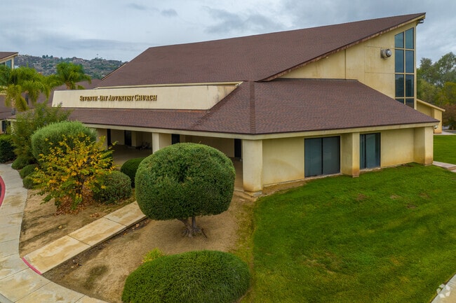
27025 Girard St
Riverside-San Bernardino-Ontario, CA
Hemet Land Co
451-180-019
5.93 ACRES M/L IN POR LOT 1 BLK 219 MB 001/014 HEMET LAND CO
Religious
Riverside
X
California
06065C2105G
1
2024
5.93 AC
2025
Beaumont/Hemet
043312
Inland Empire (California)
DEMOGRAPHICS near 27025 Girard St
1 Mile
3 Mile
5 Mile
2024 Total Population
14,646
90,739
169,950
2029 Population
15,364
95,896
179,592
Pop Growth 2024-2029
+ 4.90%
+ 5.68%
+ 5.67%
Average Age
35
38
38
2024 Total Households
4,254
30,884
55,644
HH Growth 2024-2029
+ 4.44%
+ 5.37%
+ 5.37%
Median Household Inc
$58,569
$50,299
$53,782
Avg Household Size
3.30
2.80
2.90
2024 Avg HH Vehicles
2.00
2.00
2.00
Median Home Value
$260,877
$247,969
$273,576
Median Year Built
1969
1977
1983
Nearby Places
Map Layers
Map Styles
 Street
 Aerial
- Restaurants
- Banks
- Shops
- Fitness
- Groceries
PUBLIC TRANSPORTATION
AIRPORT
Palm Springs International
DRIVE
WALK
Distance
Palm Springs International
61 min
49.4 mi
Freight Ports
Port of Long Beach
DRIVE
WALK
Distance
Port of Long Beach
116 min
88.9 mi
Nearby Properties
Address
Land Use
TOTAL SIZE
Lot Size
Zoning
Address
Land Use
TOTAL SIZE
Lot Size
Zoning
850,640 SF
42.40 AC
Address
Land Use
TOTAL SIZE
Lot Size
Zoning
4,550 SF
127.73 AC
Address
Land Use
TOTAL SIZE
Lot Size
Zoning
306,540 SF
7.69 AC
Address
Land Use
TOTAL SIZE
Lot Size
Zoning
5.96 AC
Address
Land Use
TOTAL SIZE
Lot Size
Zoning
63,960 SF
8.57 AC
R3
Address
Land Use
TOTAL SIZE
Lot Size
Zoning
193,123 SF
19.92 AC
Address
Land Use
TOTAL SIZE
Lot Size
Zoning
165,401 SF
13.45 AC
C1
Address
Land Use
TOTAL SIZE
Lot Size
Zoning
9,184 SF
4.75 AC
R3
Address
Land Use
TOTAL SIZE
Lot Size
Zoning
27,964 SF
5.47 AC
Address
Land Use
TOTAL SIZE
Lot Size
Zoning
53,140 SF
6.74 AC
C2
Address
Land Use
TOTAL SIZE
Lot Size
Zoning
40,880 SF
6 AC
R3
Address
Land Use
TOTAL SIZE
Lot Size
Zoning
66,482 SF
9.11 AC
A1
Address
Land Use
TOTAL SIZE
Lot Size
Zoning
122,037 SF
5.52 AC
Address
Land Use
TOTAL SIZE
Lot Size
Zoning
28,145 SF
4.67 AC
R3
Address
Land Use
TOTAL SIZE
Lot Size
Zoning
59,680 SF
5.80 AC
C2
Address
Land Use
TOTAL SIZE
Lot Size
Zoning
69,306 SF
6.02 AC
Address
Land Use
TOTAL SIZE
Lot Size
Zoning
79,683 SF
7.97 AC
C1
Address
Land Use
TOTAL SIZE
Lot Size
Zoning
24,656 SF
4.32 AC
R3
Address
Land Use
TOTAL SIZE
Lot Size
Zoning
88,530 SF
18.41 AC
Address
Land Use
TOTAL SIZE
Lot Size
Zoning
202,852 SF
11.37 AC
Address
Land Use
TOTAL SIZE
Lot Size
Zoning
66,913 SF
6.41 AC
Address
Land Use
TOTAL SIZE
Lot Size
Zoning
107,874 SF
7.36 AC
Address
Land Use
TOTAL SIZE
Lot Size
Zoning
28,882 SF
4.35 AC
IP
Address
Land Use
TOTAL SIZE
Lot Size
Zoning
29.30 AC
Address
Land Use
TOTAL SIZE
Lot Size
Zoning
47,046 SF
4.48 AC
Address
Land Use
TOTAL SIZE
Lot Size
Zoning
53,284 SF
4.28 AC
Address
Land Use
TOTAL SIZE
Lot Size
Zoning
11,940 SF
1.12 AC
C1
Address
Land Use
TOTAL SIZE
Lot Size
Zoning
12,389 SF
7.31 AC
R3
Address
Land Use
TOTAL SIZE
Lot Size
Zoning
67,146 SF
13.97 AC
Address
Land Use
TOTAL SIZE
Lot Size
Zoning
29,688 SF
1.46 AC
C2
The World's #1 Commercial Real Estate Marketplace
Connect with us
© 2025 CoStar Group
The information above has been obtained from sources believed reliable. While we do not doubt its accuracy we have not verified it and make no guarantee, warranty or representation about it. It is your responsibility to independently confirm its accuracy and completeness. Any projections, opinions, assumptions, or estimates used are for example only and do not represent the current or future performance of the property. The value of this transaction to you depends on tax and other factors which should be evaluated by your tax, financial, and legal advisors. You and your advisors should conduct a careful, independent investigation of the property to determine to your satisfaction the suitability of the property for your needs.