Property Record
2705 Plainfield Rd, Joliet, IL 60435

Save to a Folder
{{folder.Name}}
{{folder.ListingIds.length}} Properties
{{folder.ListingIds.length}} Property
Create a New Folder
Property Detail
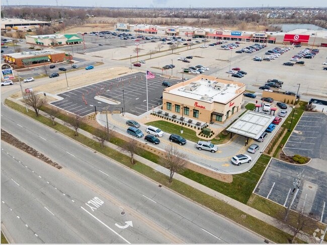
2705 Plainfield Rd
Chicago-Naperville-Elgin, IL-IN
LOT 1 IN US ROUTE 30 / KELLOGG STREET SUB UNIT 3, A RESUB OF LOT 5 IN THE RESUB OF US ROUTE 30 / KELLOGG STREET SUB UNIT 2, B
06-03-25-107-021
WILL
Commercialnec
Illinois
AE The base floodplain where base flood elevations are provided. AE Zones are now used on new format FIRMs instead of A1-A30 Zones.
1
2025
0.47 AC
2024
Joliet/Central Will
880427
Chicago
NEARBY LISTINGS FOR SALE OR LEASE
DEMOGRAPHICS near 2705 Plainfield Rd
1 mile
3 mile
5 mile
2025 Total Population
7,923
68,256
198,874
2030 Population
7,949
68,725
201,624
Pop Growth 2025-2030
+ 0.33%
+ 0.69%
+ 1.38%
Average Age
39
41
40
2025 Total Households
2,657
25,348
69,741
HH Growth 2025-2030
+ 0.38%
+ 0.82%
+ 1.41%
Median Household Inc
$101,923
$92,825
$92,582
Avg Household Size
2.90
2.60
2.70
2025 Avg HH Vehicles
2.00
2.00
2.00
Median Home Value
$262,479
$275,270
$276,687
Median Year Built
1993
1994
1992
Nearby Places
Map Layers
Map Styles
 Street
 Aerial
Layers
 Traffic
 Biking
Places
Listings with unknown addresses are not visible on the map
- Restaurants
- Banks
- Shops
- Fitness
- Groceries
PUBLIC TRANSPORTATION
COMMUTER RAIL
Joliet Station (Heritage Corridor Line - Northeast Illinois Regional Commuter Railroad (Metra), Rock Island District Line - Northeast Illinois Regional Commuter Railroad (Metra))
Drive
Walk
Distance
Joliet Station (Heritage Corridor Line - Northeast Illinois Regional Commuter Railroad (Metra), Rock Island District Line - Northeast Illinois Regional Commuter Railroad (Metra))
13 min
5.8 mi
Lockport Station (Heritage Corridor Line - Northeast Illinois Regional Commuter Railroad (Metra))
Drive
Walk
Distance
Lockport Station (Heritage Corridor Line - Northeast Illinois Regional Commuter Railroad (Metra))
15 min
6.4 mi
AIRPORT
Chicago Midway International
Drive
Walk
Distance
Chicago Midway International
40 min
29.3 mi
Freight Ports
Port Milwaukee
Drive
Walk
Distance
Port Milwaukee
138 min
112.4 mi
Nearby Properties
Address
Land Use
TOTAL SIZE
Lot Size
Zoning
Address
Land Use
TOTAL SIZE
Lot Size
Zoning
21.76 AC
Address
Land Use
TOTAL SIZE
Lot Size
Zoning
32.49 AC
Address
Land Use
TOTAL SIZE
Lot Size
Zoning
46.85 AC
Address
Land Use
TOTAL SIZE
Lot Size
Zoning
54.90 AC
Address
Land Use
TOTAL SIZE
Lot Size
Zoning
10.47 AC
Address
Land Use
TOTAL SIZE
Lot Size
Zoning
7.72 AC
Address
Land Use
TOTAL SIZE
Lot Size
Zoning
23.12 AC
Address
Land Use
TOTAL SIZE
Lot Size
Zoning
Address
Land Use
TOTAL SIZE
Lot Size
Zoning
26.02 AC
Address
Land Use
TOTAL SIZE
Lot Size
Zoning
26.31 AC
Address
Land Use
TOTAL SIZE
Lot Size
Zoning
18.76 AC
Address
Land Use
TOTAL SIZE
Lot Size
Zoning
20.22 AC
Address
Land Use
TOTAL SIZE
Lot Size
Zoning
Address
Land Use
TOTAL SIZE
Lot Size
Zoning
15.59 AC
Address
Land Use
TOTAL SIZE
Lot Size
Zoning
15.72 AC
Address
Land Use
TOTAL SIZE
Lot Size
Zoning
1.66 AC
Address
Land Use
TOTAL SIZE
Lot Size
Zoning
Address
Land Use
TOTAL SIZE
Lot Size
Zoning
15.45 AC
Address
Land Use
TOTAL SIZE
Lot Size
Zoning
16,359 SF
1.26 AC
Address
Land Use
TOTAL SIZE
Lot Size
Zoning
8.46 AC
Address
Land Use
TOTAL SIZE
Lot Size
Zoning
5.75 AC
Address
Land Use
TOTAL SIZE
Lot Size
Zoning
Address
Land Use
TOTAL SIZE
Lot Size
Zoning
4.73 AC
Address
Land Use
TOTAL SIZE
Lot Size
Zoning
17.62 AC
Address
Land Use
TOTAL SIZE
Lot Size
Zoning
105,825 SF
2.62 AC
Address
Land Use
TOTAL SIZE
Lot Size
Zoning
68,154 SF
6.94 AC
Address
Land Use
TOTAL SIZE
Lot Size
Zoning
8.91 AC
Address
Land Use
TOTAL SIZE
Lot Size
Zoning
8.99 AC
Address
Land Use
TOTAL SIZE
Lot Size
Zoning
6.58 AC
Address
Land Use
TOTAL SIZE
Lot Size
Zoning
The World's #1 Commercial Real Estate Marketplace
Connect with us
© 2026 CoStar Group
The information above has been obtained from sources believed reliable. While we do not doubt its accuracy we have not verified it and make no guarantee, warranty or representation about it. It is your responsibility to independently confirm its accuracy and completeness. Any projections, opinions, assumptions, or estimates used are for example only and do not represent the current or future performance of the property. The value of this transaction to you depends on tax and other factors which should be evaluated by your tax, financial, and legal advisors. You and your advisors should conduct a careful, independent investigation of the property to determine to your satisfaction the suitability of the property for your needs.