Property Record
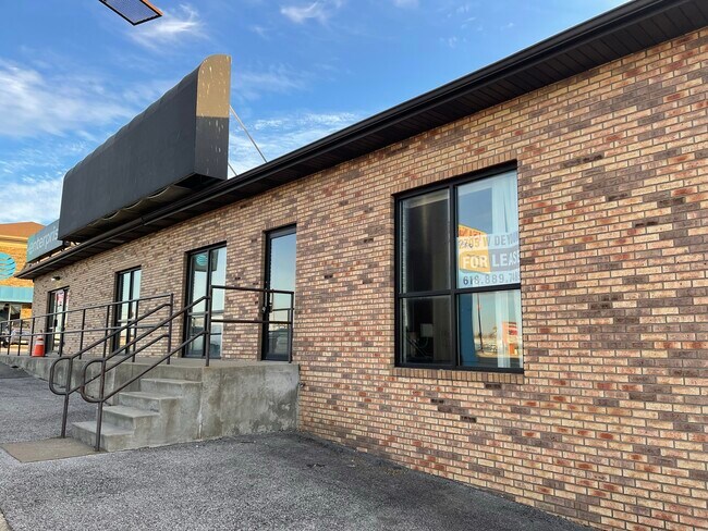
Pub Rd, Marion, IL 62959

NEARBY LISTINGS FOR SALE OR LEASE
Property Detail
Pub Rd
Carbondale-Marion, IL
Wal-Marts 2Nd Add
06-15-201-017
WAL-MART'S 2ND ADD A RESUB OF LOTS 1-6 WAL-MART'S 1ST PT OF LOT 1 BEING AN IR TR ON E SIDE OF LOT 1 EX N 100
Commercialacreage
Williamson
X
Illinois
17199C0177D
1
2024
0.09 AC
2025
Marion/I-64 & South
021300
Other Market Areas
DEMOGRAPHICS near Pub Rd
1 Mile
3 Mile
5 Mile
2024 Total Population
1,386
15,749
27,321
2029 Population
1,388
15,773
27,190
Pop Growth 2024-2029
+ 0.14%
+ 0.15%
(0.48%)
Average Age
45
42
43
2024 Total Households
657
7,093
11,985
HH Growth 2024-2029
+ 0.15%
+ 0.17%
(0.45%)
Median Household Inc
$65,595
$46,351
$49,658
Avg Household Size
2.00
2.10
2.20
2024 Avg HH Vehicles
2.00
2.00
2.00
Median Home Value
$189,255
$133,584
$149,433
Median Year Built
1993
1978
1982
Nearby Places
Map Layers
Map Styles
 Street
 Aerial
- Restaurants
- Banks
- Shops
- Fitness
- Groceries
SALE & LEASE HISTORY
LISTING DATE
SALE/LEASE

Sep 20, 2017
For Lease
Feb 09, 2022
For Lease
Nearby Properties
Address
Land Use
TOTAL SIZE
Lot Size
Zoning
Address
Land Use
TOTAL SIZE
Lot Size
Zoning
26.32 AC
Address
Land Use
TOTAL SIZE
Lot Size
Zoning
38.14 AC
Address
Land Use
TOTAL SIZE
Lot Size
Zoning
37.88 AC
Address
Land Use
TOTAL SIZE
Lot Size
Zoning
26.41 AC
Address
Land Use
TOTAL SIZE
Lot Size
Zoning
Address
Land Use
TOTAL SIZE
Lot Size
Zoning
50.79 AC
Address
Land Use
TOTAL SIZE
Lot Size
Zoning
21.42 AC
Address
Land Use
TOTAL SIZE
Lot Size
Zoning
16.06 AC
Address
Land Use
TOTAL SIZE
Lot Size
Zoning
2.47 AC
Address
Land Use
TOTAL SIZE
Lot Size
Zoning
9.14 AC
Address
Land Use
TOTAL SIZE
Lot Size
Zoning
10.15 AC
Address
Land Use
TOTAL SIZE
Lot Size
Zoning
Address
Land Use
TOTAL SIZE
Lot Size
Zoning
10.56 AC
Address
Land Use
TOTAL SIZE
Lot Size
Zoning
Address
Land Use
TOTAL SIZE
Lot Size
Zoning
6.22 AC
Address
Land Use
TOTAL SIZE
Lot Size
Zoning
4.82 AC
Address
Land Use
TOTAL SIZE
Lot Size
Zoning
12.22 AC
Address
Land Use
TOTAL SIZE
Lot Size
Zoning
1.18 AC
Address
Land Use
TOTAL SIZE
Lot Size
Zoning
Address
Land Use
TOTAL SIZE
Lot Size
Zoning
9.04 AC
Address
Land Use
TOTAL SIZE
Lot Size
Zoning
1.18 AC
Address
Land Use
TOTAL SIZE
Lot Size
Zoning
15.51 AC
Address
Land Use
TOTAL SIZE
Lot Size
Zoning
1.50 AC
Address
Land Use
TOTAL SIZE
Lot Size
Zoning
1.36 AC
Address
Land Use
TOTAL SIZE
Lot Size
Zoning
Address
Land Use
TOTAL SIZE
Lot Size
Zoning
17.55 AC
Address
Land Use
TOTAL SIZE
Lot Size
Zoning
1.90 AC
The World's #1 Commercial Real Estate Marketplace
Connect with us
© 2025 CoStar Group
The information above has been obtained from sources believed reliable. While we do not doubt its accuracy we have not verified it and make no guarantee, warranty or representation about it. It is your responsibility to independently confirm its accuracy and completeness. Any projections, opinions, assumptions, or estimates used are for example only and do not represent the current or future performance of the property. The value of this transaction to you depends on tax and other factors which should be evaluated by your tax, financial, and legal advisors. You and your advisors should conduct a careful, independent investigation of the property to determine to your satisfaction the suitability of the property for your needs.