Property Record
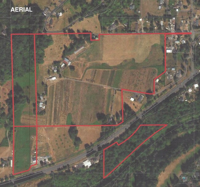
27055 Se Meier Ln, Boring, OR 97009

Property Detail
27055 Se Meier Ln
Portland-Vancouver-Hillsboro, OR-WA
SECTION 01 TOWNSHIP 2S RANGE 3E QUARTER B TAX LOT 01100W1
00600308
CLACKAMAS
Agriculturalland
Oregon
EFU
1100
B and X Area of moderate flood hazard, usually the area between the limits of the 100-year and 500-year floods.
47.95 AC
2025
SE Outlying
2025
Portland
0233003001
NEARBY LISTINGS FOR SALE OR LEASE
-
-
View all Boring listings for sale on LoopNet.com
DEMOGRAPHICS near 27055 Se Meier Ln
1 mile
3 mile
5 mile
2025 Total Population
1,287
9,485
57,848
2030 Population
1,265
9,409
57,579
Pop Growth 2025-2030
(1.71%)
(0.80%)
(0.47%)
Average Age
46
45
42
2025 Total Households
458
3,253
19,495
HH Growth 2025-2030
(1.75%)
(0.95%)
(0.76%)
Median Household Inc
$140,808
$119,797
$102,665
Avg Household Size
2.80
2.80
2.90
2025 Avg HH Vehicles
3.00
3.00
2.00
Median Home Value
$745,708
$728,714
$624,306
Median Year Built
1974
1975
1985
Nearby Places
Map Layers
Map Styles
 Street
 Aerial
Transit
 Traffic
 Biking
Places
Listings with unknown addresses are not visible on the map
- Restaurants
- Banks
- Shops
- Fitness
- Groceries
PUBLIC TRANSPORTATION
AIRPORT
Portland International
Drive
Walk
Distance
Portland International
37 min
20.8 mi
Freight Ports
Port of Portland
Drive
Walk
Distance
Port of Portland
41 min
23.7 mi
SALE & LEASE HISTORY
LISTING DATE
SALE/LEASE

May 24, 2022
For Sale
Aug 31, 2021
For Sale
Apr 11, 2022
For Sale
Nearby Properties
Address
Land Use
TOTAL SIZE
Lot Size
Zoning
Address
Land Use
TOTAL SIZE
Lot Size
Zoning
Address
Land Use
TOTAL SIZE
Lot Size
Zoning
5.62 AC
RI
Address
Land Use
TOTAL SIZE
Lot Size
Zoning
2,270 SF
28.32 AC
FF10
Address
Land Use
TOTAL SIZE
Lot Size
Zoning
5,376 SF
9.60 AC
RRFF5
Address
Land Use
TOTAL SIZE
Lot Size
Zoning
3,176 SF
4 AC
RA1
Address
Land Use
TOTAL SIZE
Lot Size
Zoning
Address
Land Use
TOTAL SIZE
Lot Size
Zoning
9.21 AC
RI
Address
Land Use
TOTAL SIZE
Lot Size
Zoning
4.23 AC
RI
Address
Land Use
TOTAL SIZE
Lot Size
Zoning
1,228 SF
2.75 AC
RI
Address
Land Use
TOTAL SIZE
Lot Size
Zoning
3.56 AC
RC
Address
Land Use
TOTAL SIZE
Lot Size
Zoning
8,000 SF
2 AC
RC
Address
Land Use
TOTAL SIZE
Lot Size
Zoning
2,300 SF
3.10 AC
RRFF5
Address
Land Use
TOTAL SIZE
Lot Size
Zoning
32,856 SF
26.72 AC
MDR12
Address
Land Use
TOTAL SIZE
Lot Size
Zoning
1,616 SF
1.81 AC
RC
Address
Land Use
TOTAL SIZE
Lot Size
Zoning
1 AC
RC
Address
Land Use
TOTAL SIZE
Lot Size
Zoning
1.79 AC
RI
Address
Land Use
TOTAL SIZE
Lot Size
Zoning
3,039 SF
13.68 AC
RI
Address
Land Use
TOTAL SIZE
Lot Size
Zoning
0.64 AC
RI
Address
Land Use
TOTAL SIZE
Lot Size
Zoning
5,760 SF
8.12 AC
RRFF5
Address
Land Use
TOTAL SIZE
Lot Size
Zoning
536 SF
1.47 AC
RC
Address
Land Use
TOTAL SIZE
Lot Size
Zoning
8.55 AC
RRFF5
Address
Land Use
TOTAL SIZE
Lot Size
Zoning
1.45 AC
RI
Address
Land Use
TOTAL SIZE
Lot Size
Zoning
3,162 SF
0.94 AC
RC
Address
Land Use
TOTAL SIZE
Lot Size
Zoning
37.99 AC
LDR-5
Address
Land Use
TOTAL SIZE
Lot Size
Zoning
2,216 SF
1.63 AC
RC
Address
Land Use
TOTAL SIZE
Lot Size
Zoning
3.45 AC
RI
Address
Land Use
TOTAL SIZE
Lot Size
Zoning
8,718 SF
34.33 AC
EFU
Address
Land Use
TOTAL SIZE
Lot Size
Zoning
0.79 AC
RC
Address
Land Use
TOTAL SIZE
Lot Size
Zoning
0.60 AC
RC
The World's #1 Commercial Real Estate Marketplace
Connect with us
© 2026 CoStar Group
The information above has been obtained from sources believed reliable. While we do not doubt its accuracy we have not verified it and make no guarantee, warranty or representation about it. It is your responsibility to independently confirm its accuracy and completeness. Any projections, opinions, assumptions, or estimates used are for example only and do not represent the current or future performance of the property. The value of this transaction to you depends on tax and other factors which should be evaluated by your tax, financial, and legal advisors. You and your advisors should conduct a careful, independent investigation of the property to determine to your satisfaction the suitability of the property for your needs.