Property Record
2705 Plymouth Rd, Ann Arbor, MI 48105
Current Lease Availabilities
NEARBY LISTINGS FOR SALE OR LEASE
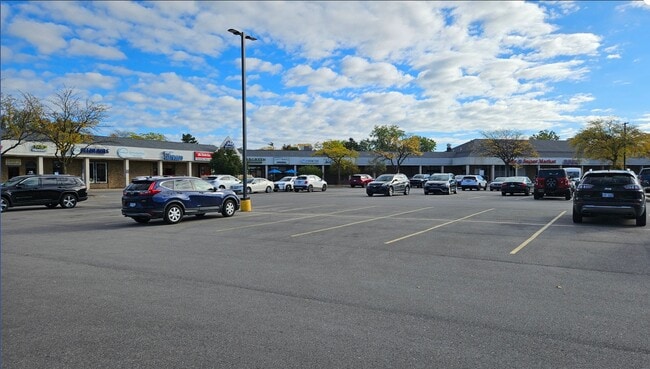
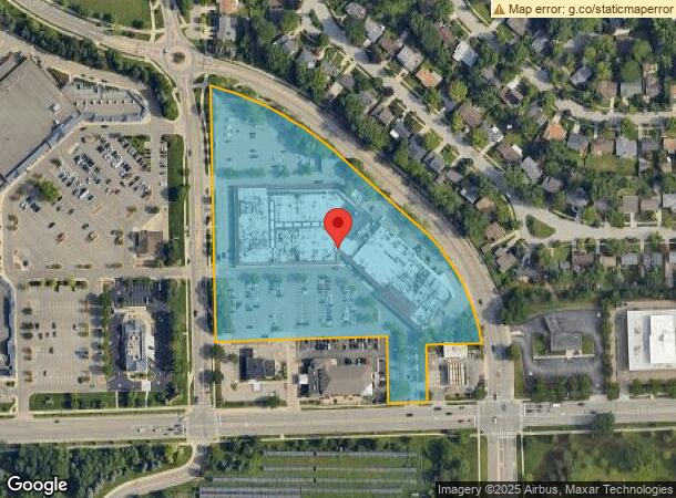
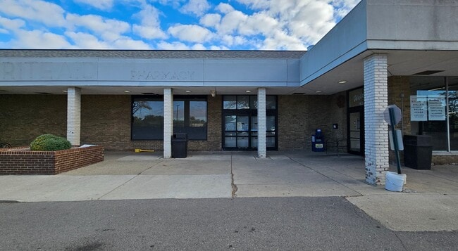
Property Detail
2705 Plymouth Rd
Ann Arbor, MI
North Campus Heightsno 2
09-15-400-011
OUTLOT F, NORTH CAMPUS HEIGHTS NO 2, EXCEPT THAT PRT OF OUTLOT F DESCRIBED AS; BEG AT NE COR OUTLOT E, NORTH CAMPUS HEIGHTS
Commercialnec
Washtenaw
X
Michigan
26161C0262E
f
2025
7.30 AC
2025
Washtenaw W of 23
403600
Detroit
94,830 SF
DEMOGRAPHICS near 2705 Plymouth Rd
1 Mile
3 Mile
5 Mile
2024 Total Population
15,186
69,449
146,374
2029 Population
15,057
68,771
144,794
Pop Growth 2024-2029
(0.85%)
(0.98%)
(1.08%)
Average Age
33
33
36
2024 Total Households
5,619
25,662
61,151
HH Growth 2024-2029
(0.57%)
(0.74%)
(1.04%)
Median Household Inc
$59,764
$67,033
$72,504
Avg Household Size
2.10
2.20
2.10
2024 Avg HH Vehicles
1.00
1.00
2.00
Median Home Value
$394,066
$479,648
$411,834
Median Year Built
1979
1974
1973
Nearby Places
- Restaurants
- Banks
- Shops
- Fitness
- Groceries
PUBLIC TRANSPORTATION
COMMUTER RAIL
DRIVE
WALK
Distance
7 min
2.7 mi
AIRPORT
Detroit Metro Wayne County
DRIVE
WALK
Distance
Detroit Metro Wayne County
39 min
29.0 mi
Nearby Properties
Address
Land Use
TOTAL SIZE
Lot Size
Zoning
Address
Land Use
TOTAL SIZE
Lot Size
Zoning
235,070 SF
0.80 AC
D1
Address
Land Use
TOTAL SIZE
Lot Size
Zoning
358,683 SF
5.42 AC
PUD
Address
Land Use
TOTAL SIZE
Lot Size
Zoning
212,047 SF
1.15 AC
D2
Address
Land Use
TOTAL SIZE
Lot Size
Zoning
268,612 SF
0.74 AC
D1
Address
Land Use
TOTAL SIZE
Lot Size
Zoning
211,670 SF
0.54 AC
D1
Address
Land Use
TOTAL SIZE
Lot Size
Zoning
222,126 SF
0.52 AC
D1
Address
Land Use
TOTAL SIZE
Lot Size
Zoning
401,491 SF
3.12 AC
C1A/R
Address
Land Use
TOTAL SIZE
Lot Size
Zoning
2,668 SF
31.60 AC
PUD
Address
Land Use
TOTAL SIZE
Lot Size
Zoning
189,221 SF
0.58 AC
D1
Address
Land Use
TOTAL SIZE
Lot Size
Zoning
524,946 SF
10.43 AC
PUD
Address
Land Use
TOTAL SIZE
Lot Size
Zoning
301,086 SF
21.41 AC
R4A
Address
Land Use
TOTAL SIZE
Lot Size
Zoning
173,885 SF
0.45 AC
D1
Address
Land Use
TOTAL SIZE
Lot Size
Zoning
323,630 SF
21.55 AC
UNKNOWN
Address
Land Use
TOTAL SIZE
Lot Size
Zoning
140,840 SF
0.50 AC
D1
Address
Land Use
TOTAL SIZE
Lot Size
Zoning
133,830 SF
0.59 AC
D1
Address
Land Use
TOTAL SIZE
Lot Size
Zoning
249,612 SF
1.87 AC
C1A/R
Address
Land Use
TOTAL SIZE
Lot Size
Zoning
99,982 SF
0.35 AC
D1
Address
Land Use
TOTAL SIZE
Lot Size
Zoning
324,832 SF
18.81 AC
R4A
Address
Land Use
TOTAL SIZE
Lot Size
Zoning
127,076 SF
0.39 AC
D1
Address
Land Use
TOTAL SIZE
Lot Size
Zoning
333,275 SF
0.65 AC
D1
Address
Land Use
TOTAL SIZE
Lot Size
Zoning
273,440 SF
73.06 AC
RRA
Address
Land Use
TOTAL SIZE
Lot Size
Zoning
208,890 SF
A-1
Address
Land Use
TOTAL SIZE
Lot Size
Zoning
125,073 SF
0.26 AC
D1
Address
Land Use
TOTAL SIZE
Lot Size
Zoning
137,874 SF
0.55 AC
PUD
Address
Land Use
TOTAL SIZE
Lot Size
Zoning
219,322 SF
19.82 AC
R4D
Address
Land Use
TOTAL SIZE
Lot Size
Zoning
114,208 SF
8.63 AC
PUD
Address
Land Use
TOTAL SIZE
Lot Size
Zoning
202,219 SF
22.84 AC
PUD
Address
Land Use
TOTAL SIZE
Lot Size
Zoning
1.19 AC
R4C
Address
Land Use
TOTAL SIZE
Lot Size
Zoning
116,650 SF
0.32 AC
D1
Address
Land Use
TOTAL SIZE
Lot Size
Zoning
5,416 SF
30.14 AC
R-9
The World's #1 Commercial Real Estate Marketplace
Connect with us
© 2025 CoStar Group
The information above has been obtained from sources believed reliable. While we do not doubt its accuracy we have not verified it and make no guarantee, warranty or representation about it. It is your responsibility to independently confirm its accuracy and completeness. Any projections, opinions, assumptions, or estimates used are for example only and do not represent the current or future performance of the property. The value of this transaction to you depends on tax and other factors which should be evaluated by your tax, financial, and legal advisors. You and your advisors should conduct a careful, independent investigation of the property to determine to your satisfaction the suitability of the property for your needs.