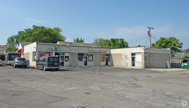
Property Record
2707 Wilmington Pike, Dayton, OH 45419
NEARBY LISTINGS FOR SALE OR LEASE
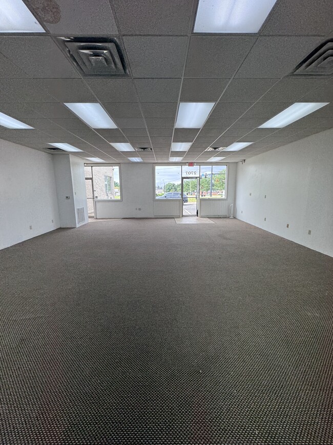
Property Detail
2707 Wilmington Pike
Dayton, OH
Oakwood Ext
N64-00803-0003
369 PT
Storebuilding
Montgomery
X
Ohio
39113C0259F
3
2023
0.22 AC
2024
South Central Dayton
021000
Cincinnati/Dayton
3,875 SF
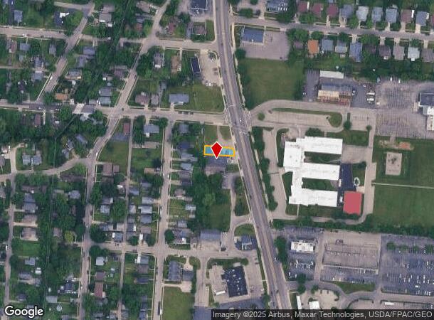
DEMOGRAPHICS near 2707 Wilmington Pike
1 Mile
3 Mile
5 Mile
2024 Total Population
11,996
99,830
210,020
2029 Population
11,862
98,855
209,644
Pop Growth 2024-2029
(1.12%)
(0.98%)
(0.18%)
Average Age
39
40
40
2024 Total Households
5,583
43,269
89,467
HH Growth 2024-2029
(1.06%)
(1.01%)
(0.22%)
Median Household Inc
$61,498
$64,759
$61,839
Avg Household Size
2.00
2.10
2.20
2024 Avg HH Vehicles
2.00
2.00
2.00
Median Home Value
$152,901
$164,394
$170,517
Median Year Built
1959
1956
1959
Nearby Places
Map Layers
Map Styles
 Street
 Aerial
- Restaurants
- Banks
- Shops
- Fitness
- Groceries
PUBLIC TRANSPORTATION
AIRPORT
James M Cox Dayton International
DRIVE
WALK
Distance
James M Cox Dayton International
28 min
17.2 mi
SALE & LEASE HISTORY
LISTING DATE
SALE/LEASE

Mar 20, 2017
For Sale
Jan 31, 2025
For Lease
Aug 18, 2024
For Sale
Nearby Properties
Address
Land Use
TOTAL SIZE
Lot Size
Zoning
Address
Land Use
TOTAL SIZE
Lot Size
Zoning
634,753 SF
54 AC
Address
Land Use
TOTAL SIZE
Lot Size
Zoning
428,925 SF
21.70 AC
Address
Land Use
TOTAL SIZE
Lot Size
Zoning
275,808 SF
19.97 AC
Address
Land Use
TOTAL SIZE
Lot Size
Zoning
55.88 AC
Address
Land Use
TOTAL SIZE
Lot Size
Zoning
752,874 SF
74.85 AC
Address
Land Use
TOTAL SIZE
Lot Size
Zoning
424,080 SF
63.14 AC
Address
Land Use
TOTAL SIZE
Lot Size
Zoning
23.35 AC
Address
Land Use
TOTAL SIZE
Lot Size
Zoning
175,938 SF
49.33 AC
Address
Land Use
TOTAL SIZE
Lot Size
Zoning
375,053 SF
7.27 AC
Address
Land Use
TOTAL SIZE
Lot Size
Zoning
1,951 SF
56.54 AC
Address
Land Use
TOTAL SIZE
Lot Size
Zoning
240,090 SF
1.93 AC
MXPUD02
Address
Land Use
TOTAL SIZE
Lot Size
Zoning
Address
Land Use
TOTAL SIZE
Lot Size
Zoning
3.27 AC
Address
Land Use
TOTAL SIZE
Lot Size
Zoning
4.86 AC
Address
Land Use
TOTAL SIZE
Lot Size
Zoning
41.38 AC
Address
Land Use
TOTAL SIZE
Lot Size
Zoning
18.33 AC
Address
Land Use
TOTAL SIZE
Lot Size
Zoning
38,832 SF
30.51 AC
R-PUD 03-7
Address
Land Use
TOTAL SIZE
Lot Size
Zoning
69,939 SF
90.27 AC
Address
Land Use
TOTAL SIZE
Lot Size
Zoning
4.38 AC
Address
Land Use
TOTAL SIZE
Lot Size
Zoning
1,008 SF
7 AC
R1A
Address
Land Use
TOTAL SIZE
Lot Size
Zoning
4.98 AC
Address
Land Use
TOTAL SIZE
Lot Size
Zoning
109,680 SF
32.24 AC
R4
Address
Land Use
TOTAL SIZE
Lot Size
Zoning
5.95 AC
Address
Land Use
TOTAL SIZE
Lot Size
Zoning
130,766 SF
1.68 AC
Address
Land Use
TOTAL SIZE
Lot Size
Zoning
152,844 SF
14.80 AC
Address
Land Use
TOTAL SIZE
Lot Size
Zoning
301,146 SF
19.40 AC
Address
Land Use
TOTAL SIZE
Lot Size
Zoning
406,186 SF
36.48 AC
Address
Land Use
TOTAL SIZE
Lot Size
Zoning
100,450 SF
1.66 AC
MXPUD02
Address
Land Use
TOTAL SIZE
Lot Size
Zoning
148,309 SF
1.50 AC
MXPUD02
Address
Land Use
TOTAL SIZE
Lot Size
Zoning
236,103 SF
7.28 AC
The World's #1 Commercial Real Estate Marketplace
Connect with us
© 2025 CoStar Group
The information above has been obtained from sources believed reliable. While we do not doubt its accuracy we have not verified it and make no guarantee, warranty or representation about it. It is your responsibility to independently confirm its accuracy and completeness. Any projections, opinions, assumptions, or estimates used are for example only and do not represent the current or future performance of the property. The value of this transaction to you depends on tax and other factors which should be evaluated by your tax, financial, and legal advisors. You and your advisors should conduct a careful, independent investigation of the property to determine to your satisfaction the suitability of the property for your needs.