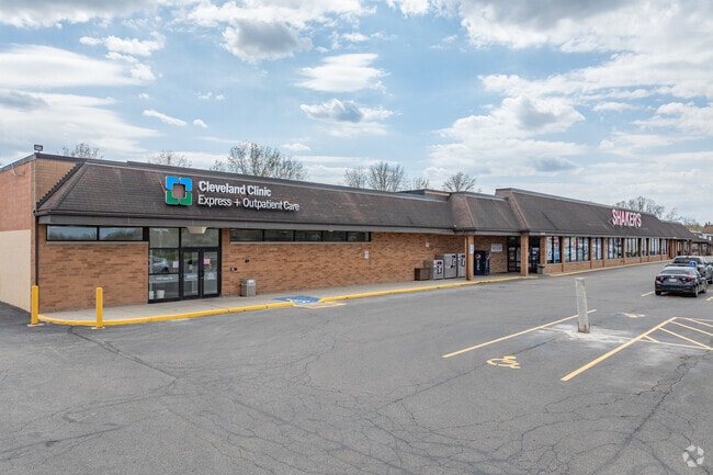
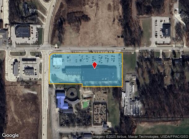
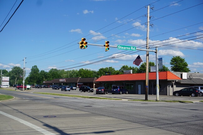
Property Record
27091 Bagley Rd, Olmsted Twp, OH 44138
NEARBY LISTINGS FOR SALE OR LEASE
Property Detail
27091 Bagley Rd
Cleveland-Elyria, OH
Pt Add
263-01-005
FF 673.31 D 352.09 5.6069AC OL TR 2 9 PT ADD TO ROAD ADDITIONAL PARCEL 26301006 2010S/R
Storebuilding
Cuyahoga
X
Ohio
39035C0252E
2
2024
4.90 AC
2024
Southwest
190506
Cleveland
54,204 SF
DEMOGRAPHICS near 27091 Bagley Rd
1 Mile
3 Mile
5 Mile
2024 Total Population
3,726
39,748
111,846
2029 Population
3,596
39,298
111,099
Pop Growth 2024-2029
(3.49%)
(1.13%)
(0.67%)
Average Age
37
44
44
2024 Total Households
1,331
16,258
45,945
HH Growth 2024-2029
(3.53%)
(1.19%)
(0.84%)
Median Household Inc
$128,812
$86,606
$80,949
Avg Household Size
2.80
2.40
2.40
2024 Avg HH Vehicles
2.00
2.00
2.00
Median Home Value
$265,419
$218,048
$207,788
Median Year Built
2001
1983
1975
Nearby Places
Map Layers
Map Styles
 Street
 Aerial
- Restaurants
- Banks
- Shops
- Fitness
- Groceries
PUBLIC TRANSPORTATION
AIRPORT
Cleveland-Hopkins International
DRIVE
WALK
Distance
Cleveland-Hopkins International
16 min
8.5 mi
Freight Ports
Port of Toledo
DRIVE
WALK
Distance
Port of Toledo
117 min
97.1 mi
SALE & LEASE HISTORY
LISTING DATE
SALE/LEASE

Sep 25, 2016
For Lease
Sep 25, 2016
For Lease
Nov 22, 2016
For Lease
May 14, 2024
For Sale
Nearby Properties
Address
Land Use
TOTAL SIZE
Lot Size
Zoning
Address
Land Use
TOTAL SIZE
Lot Size
Zoning
327,732 SF
57.22 AC
1F
Address
Land Use
TOTAL SIZE
Lot Size
Zoning
278,056 SF
42.71 AC
R-40
Address
Land Use
TOTAL SIZE
Lot Size
Zoning
195,990 SF
46.88 AC
RMF-A
Address
Land Use
TOTAL SIZE
Lot Size
Zoning
176,857 SF
8.62 AC
B-2
Address
Land Use
TOTAL SIZE
Lot Size
Zoning
46,133 SF
35.03 AC
RMF-A
Address
Land Use
TOTAL SIZE
Lot Size
Zoning
209,822 SF
26.92 AC
R-40
Address
Land Use
TOTAL SIZE
Lot Size
Zoning
50,668 SF
9.04 AC
Address
Land Use
TOTAL SIZE
Lot Size
Zoning
130,030 SF
5.69 AC
RMF-A
Address
Land Use
TOTAL SIZE
Lot Size
Zoning
128,416 SF
13.42 AC
R-40
Address
Land Use
TOTAL SIZE
Lot Size
Zoning
141,245 SF
8.90 AC
1F1
Address
Land Use
TOTAL SIZE
Lot Size
Zoning
179,879 SF
5.34 AC
RMF-A
Address
Land Use
TOTAL SIZE
Lot Size
Zoning
43,950 SF
9.40 AC
Address
Land Use
TOTAL SIZE
Lot Size
Zoning
188,031 SF
16.59 AC
R-40
Address
Land Use
TOTAL SIZE
Lot Size
Zoning
54,718 SF
149.12 AC
R-40
Address
Land Use
TOTAL SIZE
Lot Size
Zoning
57,126 SF
11.74 AC
Address
Land Use
TOTAL SIZE
Lot Size
Zoning
73,673 SF
6.80 AC
SR
Address
Land Use
TOTAL SIZE
Lot Size
Zoning
90,351 SF
9.46 AC
D-5
Address
Land Use
TOTAL SIZE
Lot Size
Zoning
54,847 SF
6.99 AC
CRG
Address
Land Use
TOTAL SIZE
Lot Size
Zoning
130,800 SF
38.73 AC
RMF-T
Address
Land Use
TOTAL SIZE
Lot Size
Zoning
91,557 SF
22.50 AC
MUPD
Address
Land Use
TOTAL SIZE
Lot Size
Zoning
49,926 SF
18.42 AC
Address
Land Use
TOTAL SIZE
Lot Size
Zoning
55,496 SF
6.29 AC
CRG
Address
Land Use
TOTAL SIZE
Lot Size
Zoning
121,778 SF
23.40 AC
D-3
Address
Land Use
TOTAL SIZE
Lot Size
Zoning
148,816 SF
7.95 AC
LI
Address
Land Use
TOTAL SIZE
Lot Size
Zoning
61,251 SF
1.89 AC
D-3
Address
Land Use
TOTAL SIZE
Lot Size
Zoning
30,076 SF
5.96 AC
CC
Address
Land Use
TOTAL SIZE
Lot Size
Zoning
61,294 SF
3.99 AC
P-2
Address
Land Use
TOTAL SIZE
Lot Size
Zoning
97,302 SF
7.89 AC
D-5
Address
Land Use
TOTAL SIZE
Lot Size
Zoning
36.07 AC
R-15
Address
Land Use
TOTAL SIZE
Lot Size
Zoning
8,526 SF
5.19 AC
The World's #1 Commercial Real Estate Marketplace
Connect with us
© 2026 CoStar Group
The information above has been obtained from sources believed reliable. While we do not doubt its accuracy we have not verified it and make no guarantee, warranty or representation about it. It is your responsibility to independently confirm its accuracy and completeness. Any projections, opinions, assumptions, or estimates used are for example only and do not represent the current or future performance of the property. The value of this transaction to you depends on tax and other factors which should be evaluated by your tax, financial, and legal advisors. You and your advisors should conduct a careful, independent investigation of the property to determine to your satisfaction the suitability of the property for your needs.