Property Record
261 Upper North Rd, Highland, NY 12528

NEARBY LISTINGS FOR SALE OR LEASE
-
-
View all Highland listings for sale on LoopNet.com
Property Detail
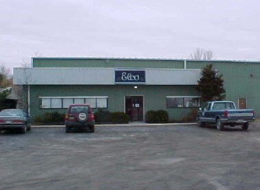
261 Upper North Rd
3200-087.008-0001-002.100-0000
Raymond Constantino Surv
Warehouse
Ulster
X
New York
36027C0264E
2.100
2025
1.20 AC
2024
Newburgh/Kingston
953700
Other Market Areas
18,500 SF
Kingston, NY
DEMOGRAPHICS near 261 Upper North Rd
1 Mile
3 Mile
5 Mile
2024 Total Population
401
14,778
65,501
2029 Population
401
14,746
65,446
Pop Growth 2024-2029
0.00%
(0.22%)
(0.08%)
Average Age
43
37
40
2024 Total Households
155
4,393
24,858
HH Growth 2024-2029
0.00%
(0.32%)
(0.02%)
Median Household Inc
$113,793
$87,428
$63,465
Avg Household Size
2.40
2.30
2.30
2024 Avg HH Vehicles
2.00
2.00
2.00
Median Home Value
$331,481
$284,545
$264,322
Median Year Built
1965
1966
1963
Nearby Places
Map Layers
Map Styles
 Street
 Aerial
- Restaurants
- Banks
- Shops
- Fitness
- Groceries
PUBLIC TRANSPORTATION
COMMUTER RAIL
Poughkeepsie Station (Hudson Line - Metro-North Commuter Railroad Company (Metro-North))
DRIVE
WALK
Distance
Poughkeepsie Station (Hudson Line - Metro-North Commuter Railroad Company (Metro-North))
14 min
6.1 mi
AIRPORT
New York Stewart International
DRIVE
WALK
Distance
New York Stewart International
36 min
24.6 mi
SALE & LEASE HISTORY
LISTING DATE
SALE/LEASE

Sep 25, 2016
For Lease
Jun 27, 2017
For Sale
Jan 31, 2017
For Sale
Nearby Properties
Address
Land Use
TOTAL SIZE
Lot Size
Zoning
Address
Land Use
TOTAL SIZE
Lot Size
Zoning
4.99 AC
R2A
Address
Land Use
TOTAL SIZE
Lot Size
Zoning
246,913 SF
43.93 AC
IN
Address
Land Use
TOTAL SIZE
Lot Size
Zoning
181,295 SF
20.48 AC
IN
Address
Land Use
TOTAL SIZE
Lot Size
Zoning
317,644 SF
35.25 AC
CIA
Address
Land Use
TOTAL SIZE
Lot Size
Zoning
103,108 SF
24.31 AC
HRDD
Address
Land Use
TOTAL SIZE
Lot Size
Zoning
82,739 SF
6.16 AC
IN
Address
Land Use
TOTAL SIZE
Lot Size
Zoning
59,499 SF
0.97 AC
IN
Address
Land Use
TOTAL SIZE
Lot Size
Zoning
82,000 SF
1.27 AC
IN
Address
Land Use
TOTAL SIZE
Lot Size
Zoning
15.50 AC
N
Address
Land Use
TOTAL SIZE
Lot Size
Zoning
123,218 SF
15.07 AC
FC
Address
Land Use
TOTAL SIZE
Lot Size
Zoning
89.30 AC
R2
Address
Land Use
TOTAL SIZE
Lot Size
Zoning
61,987 SF
3.80 AC
IN
Address
Land Use
TOTAL SIZE
Lot Size
Zoning
830,000 SF
3.49 AC
Address
Land Use
TOTAL SIZE
Lot Size
Zoning
77,190 SF
9.71 AC
FC
Address
Land Use
TOTAL SIZE
Lot Size
Zoning
124,668 SF
29.60 AC
Address
Land Use
TOTAL SIZE
Lot Size
Zoning
6,636 SF
16.90 AC
GB
Address
Land Use
TOTAL SIZE
Lot Size
Zoning
5,665 SF
510.60 AC
R40
Address
Land Use
TOTAL SIZE
Lot Size
Zoning
Address
Land Use
TOTAL SIZE
Lot Size
Zoning
26,000 SF
12.67 AC
IN
Address
Land Use
TOTAL SIZE
Lot Size
Zoning
265.20 AC
R1
Address
Land Use
TOTAL SIZE
Lot Size
Zoning
59,792 SF
2.70 AC
CIA
Address
Land Use
TOTAL SIZE
Lot Size
Zoning
93,048 SF
2.58 AC
IN
Address
Land Use
TOTAL SIZE
Lot Size
Zoning
59,424 SF
15.41 AC
TCHD
Address
Land Use
TOTAL SIZE
Lot Size
Zoning
48,285 SF
2.85 AC
IN
Address
Land Use
TOTAL SIZE
Lot Size
Zoning
32,644 SF
1.97 AC
IN
Address
Land Use
TOTAL SIZE
Lot Size
Zoning
64,351 SF
24.40 AC
R20
Address
Land Use
TOTAL SIZE
Lot Size
Zoning
3.50 AC
R2
Address
Land Use
TOTAL SIZE
Lot Size
Zoning
97,100 SF
5.80 AC
LI
Address
Land Use
TOTAL SIZE
Lot Size
Zoning
132,561 SF
15 AC
TCHD
Address
Land Use
TOTAL SIZE
Lot Size
Zoning
21,440 SF
33.20 AC
WF
The World's #1 Commercial Real Estate Marketplace
Connect with us
© 2025 CoStar Group
The information above has been obtained from sources believed reliable. While we do not doubt its accuracy we have not verified it and make no guarantee, warranty or representation about it. It is your responsibility to independently confirm its accuracy and completeness. Any projections, opinions, assumptions, or estimates used are for example only and do not represent the current or future performance of the property. The value of this transaction to you depends on tax and other factors which should be evaluated by your tax, financial, and legal advisors. You and your advisors should conduct a careful, independent investigation of the property to determine to your satisfaction the suitability of the property for your needs.