Property Record
2710 E 57Th Ave, Spokane, WA 99223

Property Detail
2710 E 57Th Ave
34044.0136
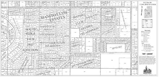
NORTH 80 FT OF TRACT 19
Commercialnec
Spokane
CC
Washington
B and X Area of moderate flood hazard, usually the area between the limits of the 100-year and 500-year floods.
0.62 AC
2025
South Hill
2025
Spokane
004900
Spokane-Spokane Valley, WA
6,875 SF
NEARBY LISTINGS FOR SALE OR LEASE
DEMOGRAPHICS near 2710 E 57Th Ave
1 mile
3 mile
5 mile
2025 Total Population
13,545
56,180
113,684
2030 Population
13,835
57,228
116,065
Pop Growth 2025-2030
+ 2.14%
+ 1.87%
+ 2.09%
Average Age
41
42
41
2025 Total Households
6,033
23,287
48,065
HH Growth 2025-2030
+ 2.11%
+ 1.89%
+ 2.34%
Median Household Inc
$79,172
$94,083
$72,831
Avg Household Size
2.20
2.30
2.20
2025 Avg HH Vehicles
2.00
2.00
2.00
Median Home Value
$557,933
$489,431
$465,385
Median Year Built
1994
1982
1975
Nearby Places
Map Layers
Map Styles
 Street
 Aerial
Layers
 Traffic
 Biking
Places
Listings with unknown addresses are not visible on the map
- Restaurants
- Banks
- Shops
- Fitness
- Groceries
PUBLIC TRANSPORTATION
COMMUTER RAIL
Drive
Walk
Distance
15 min
5.7 mi
AIRPORT
Spokane International
Drive
Walk
Distance
Spokane International
21 min
12.0 mi
Nearby Properties
Address
Land Use
TOTAL SIZE
Lot Size
Zoning
Address
Land Use
TOTAL SIZE
Lot Size
Zoning
226,702 SF
49.25 AC
RSF
Address
Land Use
TOTAL SIZE
Lot Size
Zoning
365,804 SF
16.13 AC
RSF
Address
Land Use
TOTAL SIZE
Lot Size
Zoning
270,262 SF
29.10 AC
Address
Land Use
TOTAL SIZE
Lot Size
Zoning
218,684 SF
13.29 AC
RMF
Address
Land Use
TOTAL SIZE
Lot Size
Zoning
124,234 SF
13.54 AC
RSF
Address
Land Use
TOTAL SIZE
Lot Size
Zoning
210,277 SF
19.18 AC
RMF
Address
Land Use
TOTAL SIZE
Lot Size
Zoning
289,573 SF
7.73 AC
RMF
Address
Land Use
TOTAL SIZE
Lot Size
Zoning
135,715 SF
4.73 AC
RMF
Address
Land Use
TOTAL SIZE
Lot Size
Zoning
119,933 SF
5.61 AC
Address
Land Use
TOTAL SIZE
Lot Size
Zoning
159,720 SF
6.84 AC
RMF
Address
Land Use
TOTAL SIZE
Lot Size
Zoning
78,990 SF
5.58 AC
RSF
Address
Land Use
TOTAL SIZE
Lot Size
Zoning
173,714 SF
9.98 AC
HDR
Address
Land Use
TOTAL SIZE
Lot Size
Zoning
142,500 SF
6.86 AC
RMF
Address
Land Use
TOTAL SIZE
Lot Size
Zoning
172,388 SF
13.59 AC
RSF
Address
Land Use
TOTAL SIZE
Lot Size
Zoning
59,826 SF
6.79 AC
RSF
Address
Land Use
TOTAL SIZE
Lot Size
Zoning
55,623 SF
4.46 AC
MU
Address
Land Use
TOTAL SIZE
Lot Size
Zoning
75,680 SF
3.93 AC
RSF
Address
Land Use
TOTAL SIZE
Lot Size
Zoning
130,878 SF
5.57 AC
CC2
Address
Land Use
TOTAL SIZE
Lot Size
Zoning
144,382 SF
5.43 AC
CC2
Address
Land Use
TOTAL SIZE
Lot Size
Zoning
105,728 SF
4.53 AC
RMF
Address
Land Use
TOTAL SIZE
Lot Size
Zoning
121,962 SF
3.80 AC
RMF
Address
Land Use
TOTAL SIZE
Lot Size
Zoning
108,609 SF
4.11 AC
MU
Address
Land Use
TOTAL SIZE
Lot Size
Zoning
50,179 SF
5.54 AC
RSF
Address
Land Use
TOTAL SIZE
Lot Size
Zoning
175,671 SF
10.89 AC
RSF
Address
Land Use
TOTAL SIZE
Lot Size
Zoning
117,668 SF
7.52 AC
CC2
Address
Land Use
TOTAL SIZE
Lot Size
Zoning
111,808 SF
5.65 AC
RMF
Address
Land Use
TOTAL SIZE
Lot Size
Zoning
164,592 SF
12.01 AC
RMF
Address
Land Use
TOTAL SIZE
Lot Size
Zoning
265,644 SF
8.45 AC
RMF
Address
Land Use
TOTAL SIZE
Lot Size
Zoning
134,016 SF
8.01 AC
CC2
Address
Land Use
TOTAL SIZE
Lot Size
Zoning
91,833 SF
9.48 AC
MU
The World's #1 Commercial Real Estate Marketplace
Connect with us
© 2026 CoStar Group
The information above has been obtained from sources believed reliable. While we do not doubt its accuracy we have not verified it and make no guarantee, warranty or representation about it. It is your responsibility to independently confirm its accuracy and completeness. Any projections, opinions, assumptions, or estimates used are for example only and do not represent the current or future performance of the property. The value of this transaction to you depends on tax and other factors which should be evaluated by your tax, financial, and legal advisors. You and your advisors should conduct a careful, independent investigation of the property to determine to your satisfaction the suitability of the property for your needs.