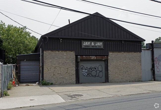
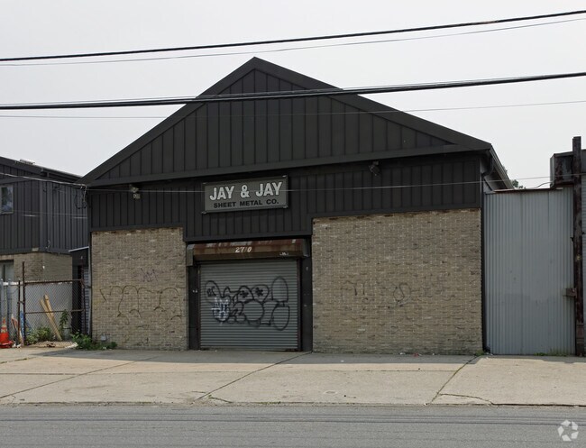
Property Record
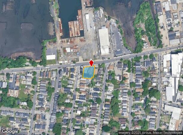
2710 Richmond Ter, Staten Island, NY 10303
NEARBY LISTINGS FOR SALE OR LEASE
Property Detail
2710 Richmond Ter
01160-0055
Staten Island
Warehouse
New York
X
55
3604970169F
0.25 AC
2024
Staten Island
2025
Long Island (New York)
022300
New York-Jersey City-White Plains, NY-NJ
5,517 SF
DEMOGRAPHICS near 2710 Richmond Ter
1 Mile
3 Mile
5 Mile
2024 Total Population
32,492
214,354
520,894
2029 Population
31,675
207,975
507,917
Pop Growth 2024-2029
(2.51%)
(2.98%)
(2.49%)
Average Age
37
39
39
2024 Total Households
9,989
72,752
182,071
HH Growth 2024-2029
(2.54%)
(3.14%)
(2.57%)
Median Household Inc
$69,792
$75,526
$70,199
Avg Household Size
3.10
2.80
2.70
2024 Avg HH Vehicles
1.00
1.00
1.00
Median Home Value
$438,518
$546,982
$539,611
Median Year Built
1958
1963
1964
Nearby Places
- Restaurants
- Banks
- Shops
- Fitness
- Groceries
PUBLIC TRANSPORTATION
COMMUTER RAIL
Tompkinsville (Staten Island Railway - New York MTA Subway (The Subway))
DRIVE
WALK
Distance
Tompkinsville (Staten Island Railway - New York MTA Subway (The Subway))
12 min
5.3 mi
Elizabeth (North Jersey Coast Line - NJ Transit Commuter Rail (NJ Transit), Northeast Corridor Line - NJ Transit Commuter Rail (NJ Transit))
DRIVE
WALK
Distance
Elizabeth (North Jersey Coast Line - NJ Transit Commuter Rail (NJ Transit), Northeast Corridor Line - NJ Transit Commuter Rail (NJ Transit))
12 min
6.3 mi
AIRPORT
Newark Liberty International
DRIVE
WALK
Distance
Newark Liberty International
18 min
11.4 mi
LaGuardia
DRIVE
WALK
Distance
LaGuardia
44 min
26.5 mi
John F Kennedy International
DRIVE
WALK
Distance
John F Kennedy International
43 min
29.2 mi
Freight Ports
New York Container Terminal
DRIVE
WALK
Distance
New York Container Terminal
4 min
2.1 mi
Nearby Properties
Address
Land Use
TOTAL SIZE
Lot Size
Zoning
Address
Land Use
TOTAL SIZE
Lot Size
Zoning
28.40 AC
Address
Land Use
TOTAL SIZE
Lot Size
Zoning
113.19 AC
Address
Land Use
TOTAL SIZE
Lot Size
Zoning
633,280 SF
202.90 AC
R3-2
Address
Land Use
TOTAL SIZE
Lot Size
Zoning
Address
Land Use
TOTAL SIZE
Lot Size
Zoning
4,450,000 SF
95.24 AC
Address
Land Use
TOTAL SIZE
Lot Size
Zoning
22.49 AC
HC
Address
Land Use
TOTAL SIZE
Lot Size
Zoning
Address
Land Use
TOTAL SIZE
Lot Size
Zoning
70.39 AC
Address
Land Use
TOTAL SIZE
Lot Size
Zoning
16.63 AC
Address
Land Use
TOTAL SIZE
Lot Size
Zoning
2.21 AC
Address
Land Use
TOTAL SIZE
Lot Size
Zoning
1.01 AC
Address
Land Use
TOTAL SIZE
Lot Size
Zoning
51.62 AC
Address
Land Use
TOTAL SIZE
Lot Size
Zoning
20,000 SF
30.36 AC
Address
Land Use
TOTAL SIZE
Lot Size
Zoning
91,760 SF
210.43 AC
M3-1
Address
Land Use
TOTAL SIZE
Lot Size
Zoning
Address
Land Use
TOTAL SIZE
Lot Size
Zoning
3,500,000 SF
11.97 AC
MRC2
Address
Land Use
TOTAL SIZE
Lot Size
Zoning
3.27 AC
Address
Land Use
TOTAL SIZE
Lot Size
Zoning
51.61 AC
Address
Land Use
TOTAL SIZE
Lot Size
Zoning
39.64 AC
Address
Land Use
TOTAL SIZE
Lot Size
Zoning
566,000 SF
103.31 AC
R3-2
Address
Land Use
TOTAL SIZE
Lot Size
Zoning
28.47 AC
I-H
Address
Land Use
TOTAL SIZE
Lot Size
Zoning
6,188,000 SF
8.18 AC
Address
Land Use
TOTAL SIZE
Lot Size
Zoning
11.96 AC
Address
Land Use
TOTAL SIZE
Lot Size
Zoning
5,400,000 SF
35.22 AC
Address
Land Use
TOTAL SIZE
Lot Size
Zoning
1 SF
20 AC
Address
Land Use
TOTAL SIZE
Lot Size
Zoning
74.35 AC
TDD
Address
Land Use
TOTAL SIZE
Lot Size
Zoning
11.14 AC
Address
Land Use
TOTAL SIZE
Lot Size
Zoning
30.70 AC
Address
Land Use
TOTAL SIZE
Lot Size
Zoning
855,000 SF
48.74 AC
M3-1
Address
Land Use
TOTAL SIZE
Lot Size
Zoning
10 SF
9.18 AC
The World's #1 Commercial Real Estate Marketplace
Connect with us
© 2025 CoStar Group
The information above has been obtained from sources believed reliable. While we do not doubt its accuracy we have not verified it and make no guarantee, warranty or representation about it. It is your responsibility to independently confirm its accuracy and completeness. Any projections, opinions, assumptions, or estimates used are for example only and do not represent the current or future performance of the property. The value of this transaction to you depends on tax and other factors which should be evaluated by your tax, financial, and legal advisors. You and your advisors should conduct a careful, independent investigation of the property to determine to your satisfaction the suitability of the property for your needs.