Property Record
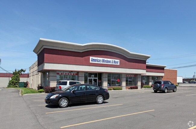
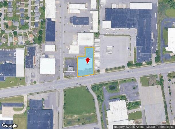
2710 Walden Ave, Buffalo, NY 14225
NEARBY LISTINGS FOR SALE OR LEASE
Property Detail
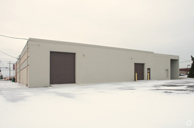
2710 Walden Ave
143089-103-100-0007-008-100
125' EAST OF BENBRO DRIVE
Storesoffices
Erie
X
New York
36029C0236H
8.100
2025
0.89 AC
2024
East
010803
Buffalo/Niagara Falls
13,500 SF
Buffalo-Cheektowaga-Niagara Falls, NY
DEMOGRAPHICS near 2710 Walden Ave
1 Mile
3 Mile
5 Mile
2024 Total Population
6,488
76,152
237,028
2029 Population
6,396
75,164
233,730
Pop Growth 2024-2029
(1.42%)
(1.30%)
(1.39%)
Average Age
44
43
41
2024 Total Households
2,860
34,671
102,212
HH Growth 2024-2029
(1.50%)
(1.35%)
(1.41%)
Median Household Inc
$60,892
$62,179
$59,960
Avg Household Size
2.20
2.10
2.20
2024 Avg HH Vehicles
2.00
2.00
2.00
Median Home Value
$153,120
$150,003
$166,210
Median Year Built
1963
1961
1957
Nearby Places
Map Layers
Map Styles
 Street
 Aerial
- Restaurants
- Banks
- Shops
- Fitness
- Groceries
PUBLIC TRANSPORTATION
COMMUTER RAIL
DRIVE
WALK
Distance
2 min
14 min
0.7 mi
SALE & LEASE HISTORY
LISTING DATE
SALE/LEASE

Sep 25, 2016
For Lease
Nearby Properties
Address
Land Use
TOTAL SIZE
Lot Size
Zoning
Address
Land Use
TOTAL SIZE
Lot Size
Zoning
462,256 SF
568.62 AC
05C
Address
Land Use
TOTAL SIZE
Lot Size
Zoning
461,943 SF
21.10 AC
Address
Land Use
TOTAL SIZE
Lot Size
Zoning
262,560 SF
26.40 AC
05C
Address
Land Use
TOTAL SIZE
Lot Size
Zoning
610,311 SF
33.66 AC
05C
Address
Land Use
TOTAL SIZE
Lot Size
Zoning
82,802 SF
12.80 AC
05C
Address
Land Use
TOTAL SIZE
Lot Size
Zoning
420,205 SF
34.42 AC
05
Address
Land Use
TOTAL SIZE
Lot Size
Zoning
82.29 AC
05C
Address
Land Use
TOTAL SIZE
Lot Size
Zoning
216,724 SF
66.09 AC
05C
Address
Land Use
TOTAL SIZE
Lot Size
Zoning
31,608 SF
4.36 AC
05C
Address
Land Use
TOTAL SIZE
Lot Size
Zoning
94,165 SF
24.34 AC
05C
Address
Land Use
TOTAL SIZE
Lot Size
Zoning
9,999 SF
27.02 AC
05C
Address
Land Use
TOTAL SIZE
Lot Size
Zoning
722,642 SF
46.80 AC
05C
Address
Land Use
TOTAL SIZE
Lot Size
Zoning
7,200 SF
20.20 AC
03RA
Address
Land Use
TOTAL SIZE
Lot Size
Zoning
140,786 SF
11.88 AC
05C
Address
Land Use
TOTAL SIZE
Lot Size
Zoning
257,248 SF
61.44 AC
05C
Address
Land Use
TOTAL SIZE
Lot Size
Zoning
7,242 SF
18 AC
03RA
Address
Land Use
TOTAL SIZE
Lot Size
Zoning
35,000 SF
30.13 AC
Address
Land Use
TOTAL SIZE
Lot Size
Zoning
6,720 SF
11.10 AC
03RA
Address
Land Use
TOTAL SIZE
Lot Size
Zoning
87,289 SF
11.55 AC
05C
Address
Land Use
TOTAL SIZE
Lot Size
Zoning
175,542 SF
12.70 AC
05C
Address
Land Use
TOTAL SIZE
Lot Size
Zoning
119,040 SF
19.17 AC
Address
Land Use
TOTAL SIZE
Lot Size
Zoning
323,590 SF
7.43 AC
05C
Address
Land Use
TOTAL SIZE
Lot Size
Zoning
265,787 SF
21.40 AC
Address
Land Use
TOTAL SIZE
Lot Size
Zoning
150,539 SF
14.65 AC
05C
Address
Land Use
TOTAL SIZE
Lot Size
Zoning
92,350 SF
9.20 AC
05C
Address
Land Use
TOTAL SIZE
Lot Size
Zoning
69,255 SF
8.56 AC
05C
Address
Land Use
TOTAL SIZE
Lot Size
Zoning
1,760 SF
41.19 AC
05C
Address
Land Use
TOTAL SIZE
Lot Size
Zoning
70,480 SF
4.07 AC
05C
Address
Land Use
TOTAL SIZE
Lot Size
Zoning
Address
Land Use
TOTAL SIZE
Lot Size
Zoning
189,326 SF
17.10 AC
The World's #1 Commercial Real Estate Marketplace
Connect with us
© 2025 CoStar Group
The information above has been obtained from sources believed reliable. While we do not doubt its accuracy we have not verified it and make no guarantee, warranty or representation about it. It is your responsibility to independently confirm its accuracy and completeness. Any projections, opinions, assumptions, or estimates used are for example only and do not represent the current or future performance of the property. The value of this transaction to you depends on tax and other factors which should be evaluated by your tax, financial, and legal advisors. You and your advisors should conduct a careful, independent investigation of the property to determine to your satisfaction the suitability of the property for your needs.