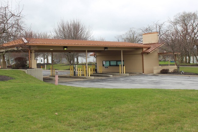
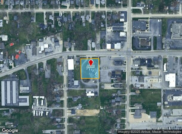
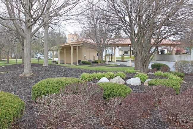
Property Record
2711 Lower Huntington Rd, Fort Wayne, IN 46809
NEARBY LISTINGS FOR SALE OR LEASE
Property Detail
2711 Lower Huntington Rd
Fort Wayne, IN
Waynedale
02-12-28-476-003.000-074
N 220 LOTS 37 THRU 39 EX N 25 WAYNEDALE ORIG PLAT
Vehiclerentalsvehiclesales
Allen
X
Indiana
18003C0293G
37-39
2023
0.81 AC
2024
South Fort Wayne
003800
Fort Wayne
601 SF
DEMOGRAPHICS near 2711 Lower Huntington Rd
1 Mile
3 Mile
5 Mile
2024 Total Population
6,373
40,589
119,366
2029 Population
6,597
42,139
124,996
Pop Growth 2024-2029
+ 3.51%
+ 3.82%
+ 4.72%
Average Age
40
37
36
2024 Total Households
3,018
16,740
47,994
HH Growth 2024-2029
+ 3.55%
+ 3.81%
+ 4.78%
Median Household Inc
$44,081
$48,740
$45,035
Avg Household Size
2.10
2.40
2.40
2024 Avg HH Vehicles
2.00
2.00
2.00
Median Home Value
$111,150
$122,019
$121,044
Median Year Built
1962
1958
1961
Nearby Places
Map Layers
Map Styles
 Street
 Aerial
- Restaurants
- Banks
- Shops
- Fitness
- Groceries
PUBLIC TRANSPORTATION
AIRPORT
Fort Wayne International
DRIVE
WALK
Distance
Fort Wayne International
11 min
5.2 mi
Freight Ports
Port of Toledo
DRIVE
WALK
Distance
Port of Toledo
144 min
109.5 mi
SALE & LEASE HISTORY
LISTING DATE
SALE/LEASE

Apr 12, 2017
For Sale
Nearby Properties
Address
Land Use
TOTAL SIZE
Lot Size
Zoning
Address
Land Use
TOTAL SIZE
Lot Size
Zoning
629,415 SF
136.60 AC
Address
Land Use
TOTAL SIZE
Lot Size
Zoning
337,548 SF
39.17 AC
Address
Land Use
TOTAL SIZE
Lot Size
Zoning
703,208 SF
41.90 AC
Address
Land Use
TOTAL SIZE
Lot Size
Zoning
385,470 SF
36.44 AC
Address
Land Use
TOTAL SIZE
Lot Size
Zoning
270,448 SF
41.83 AC
Address
Land Use
TOTAL SIZE
Lot Size
Zoning
140,400 SF
11.88 AC
Address
Land Use
TOTAL SIZE
Lot Size
Zoning
300,402 SF
25.96 AC
Address
Land Use
TOTAL SIZE
Lot Size
Zoning
306,088 SF
24.29 AC
Address
Land Use
TOTAL SIZE
Lot Size
Zoning
150,600 SF
20.36 AC
Address
Land Use
TOTAL SIZE
Lot Size
Zoning
174,432 SF
35.29 AC
Address
Land Use
TOTAL SIZE
Lot Size
Zoning
217,151 SF
20.72 AC
Address
Land Use
TOTAL SIZE
Lot Size
Zoning
71,290 SF
23.80 AC
Address
Land Use
TOTAL SIZE
Lot Size
Zoning
97,125 SF
15.21 AC
Address
Land Use
TOTAL SIZE
Lot Size
Zoning
167,836 SF
4.30 AC
Address
Land Use
TOTAL SIZE
Lot Size
Zoning
169,011 SF
17.14 AC
Address
Land Use
TOTAL SIZE
Lot Size
Zoning
70,935 SF
20.46 AC
Address
Land Use
TOTAL SIZE
Lot Size
Zoning
43,122 SF
11.44 AC
Address
Land Use
TOTAL SIZE
Lot Size
Zoning
187,552 SF
16.34 AC
Address
Land Use
TOTAL SIZE
Lot Size
Zoning
140,921 SF
15.55 AC
Address
Land Use
TOTAL SIZE
Lot Size
Zoning
189,430 SF
19.38 AC
Address
Land Use
TOTAL SIZE
Lot Size
Zoning
150,600 SF
21.03 AC
Address
Land Use
TOTAL SIZE
Lot Size
Zoning
172,656 SF
16.05 AC
Address
Land Use
TOTAL SIZE
Lot Size
Zoning
178,278 SF
10.59 AC
Address
Land Use
TOTAL SIZE
Lot Size
Zoning
88,674 SF
26.60 AC
Address
Land Use
TOTAL SIZE
Lot Size
Zoning
77,504 SF
5.92 AC
Address
Land Use
TOTAL SIZE
Lot Size
Zoning
126,622 SF
8 AC
Address
Land Use
TOTAL SIZE
Lot Size
Zoning
159,728 SF
36.38 AC
Address
Land Use
TOTAL SIZE
Lot Size
Zoning
112,000 SF
7.23 AC
Address
Land Use
TOTAL SIZE
Lot Size
Zoning
156,593 SF
12.15 AC
Address
Land Use
TOTAL SIZE
Lot Size
Zoning
174,206 SF
10.42 AC
The World's #1 Commercial Real Estate Marketplace
Connect with us
© 2025 CoStar Group
The information above has been obtained from sources believed reliable. While we do not doubt its accuracy we have not verified it and make no guarantee, warranty or representation about it. It is your responsibility to independently confirm its accuracy and completeness. Any projections, opinions, assumptions, or estimates used are for example only and do not represent the current or future performance of the property. The value of this transaction to you depends on tax and other factors which should be evaluated by your tax, financial, and legal advisors. You and your advisors should conduct a careful, independent investigation of the property to determine to your satisfaction the suitability of the property for your needs.