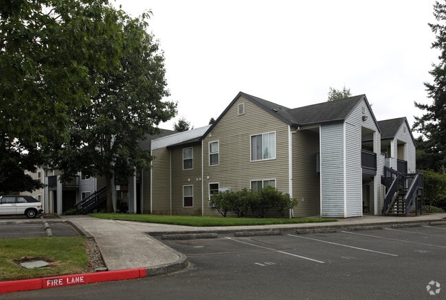
Property Record
2711 Wi W Powell Blvd, Gresham, OR 97030

Property Detail
2711 Wi W Powell Blvd
R483762
SECTION 08 1S 3E, TL 201 0.17 ACRES
Residentialacreage
MULTNOMAH
LDR
Oregon
B and X Area of moderate flood hazard, usually the area between the limits of the 100-year and 500-year floods.
0.05 AC
2025
Gresham-Northwest
2025
Portland
010001
Portland-Vancouver-Hillsboro, OR-WA
NEARBY LISTINGS FOR SALE OR LEASE
DEMOGRAPHICS near 2711 Wi W Powell Blvd
1 mile
3 mile
5 mile
2024 Total Population
16,771
125,677
279,688
2029 Population
16,404
123,629
276,136
Pop Growth 2024-2029
(2.19%)
(1.63%)
(1.27%)
Average Age
40
39
40
2024 Total Households
6,069
44,454
98,033
HH Growth 2024-2029
(2.46%)
(1.93%)
(1.60%)
Median Household Inc
$80,351
$67,025
$73,076
Avg Household Size
2.60
2.70
2.70
2024 Avg HH Vehicles
2.00
2.00
2.00
Median Home Value
$453,089
$438,574
$454,292
Median Year Built
1979
1979
1981
Nearby Places
Map Layers
Map Styles
 Street
 Aerial
Transit
 Traffic
 Biking
Places
Listings with unknown addresses are not visible on the map
- Restaurants
- Banks
- Shops
- Fitness
- Groceries
PUBLIC TRANSPORTATION
AIRPORT
Portland International
Drive
Walk
Distance
Portland International
24 min
13.4 mi
Freight Ports
Port of Portland
Drive
Walk
Distance
Port of Portland
31 min
18.8 mi
Nearby Properties
Address
Land Use
TOTAL SIZE
Lot Size
Zoning
Address
Land Use
TOTAL SIZE
Lot Size
Zoning
Address
Land Use
TOTAL SIZE
Lot Size
Zoning
3.20 AC
DEM
Address
Land Use
TOTAL SIZE
Lot Size
Zoning
137.54 AC
GI
Address
Land Use
TOTAL SIZE
Lot Size
Zoning
260,995 SF
6.49 AC
RTC
Address
Land Use
TOTAL SIZE
Lot Size
Zoning
109,231 SF
7.87 AC
HI
Address
Land Use
TOTAL SIZE
Lot Size
Zoning
75,850 SF
11.55 AC
LDR-5
Address
Land Use
TOTAL SIZE
Lot Size
Zoning
123,716 SF
20.03 AC
LDR-5
Address
Land Use
TOTAL SIZE
Lot Size
Zoning
8.69 AC
NULL
Address
Land Use
TOTAL SIZE
Lot Size
Zoning
237,815 SF
22.70 AC
TLDR
Address
Land Use
TOTAL SIZE
Lot Size
Zoning
191,466 SF
34.68 AC
R/CSP
Address
Land Use
TOTAL SIZE
Lot Size
Zoning
129,462 SF
15.90 AC
R7
Address
Land Use
TOTAL SIZE
Lot Size
Zoning
118,460 SF
28.10 AC
BP
Address
Land Use
TOTAL SIZE
Lot Size
Zoning
85,380 SF
5.04 AC
TD
Address
Land Use
TOTAL SIZE
Lot Size
Zoning
258,564 SF
20.56 AC
LDR7
Address
Land Use
TOTAL SIZE
Lot Size
Zoning
86,138 SF
5.93 AC
R7
Address
Land Use
TOTAL SIZE
Lot Size
Zoning
238,492 SF
13.10 AC
CMF
Address
Land Use
TOTAL SIZE
Lot Size
Zoning
254,580 SF
4.76 AC
TDHC
Address
Land Use
TOTAL SIZE
Lot Size
Zoning
733,232 SF
37.41 AC
NULL
Address
Land Use
TOTAL SIZE
Lot Size
Zoning
222,022 SF
11.64 AC
CMF
Address
Land Use
TOTAL SIZE
Lot Size
Zoning
121,144 SF
2.30 AC
RM3
Address
Land Use
TOTAL SIZE
Lot Size
Zoning
83,072 SF
9.58 AC
LDR-5
Address
Land Use
TOTAL SIZE
Lot Size
Zoning
219,292 SF
10.43 AC
GI
Address
Land Use
TOTAL SIZE
Lot Size
Zoning
95,642 SF
5.30 AC
HI
Address
Land Use
TOTAL SIZE
Lot Size
Zoning
61,524 SF
7.31 AC
LDR-5
Address
Land Use
TOTAL SIZE
Lot Size
Zoning
235,728 SF
6.64 AC
MDR-24
Address
Land Use
TOTAL SIZE
Lot Size
Zoning
141,899 SF
13.51 AC
DMU
Address
Land Use
TOTAL SIZE
Lot Size
Zoning
19.55 AC
GI
Address
Land Use
TOTAL SIZE
Lot Size
Zoning
87,429 SF
0.95 AC
DTM
Address
Land Use
TOTAL SIZE
Lot Size
Zoning
60,000 SF
1.55 AC
RTC
Address
Land Use
TOTAL SIZE
Lot Size
Zoning
194,991 SF
5.56 AC
TCC
The World's #1 Commercial Real Estate Marketplace
Connect with us
© 2026 CoStar Group
The information above has been obtained from sources believed reliable. While we do not doubt its accuracy we have not verified it and make no guarantee, warranty or representation about it. It is your responsibility to independently confirm its accuracy and completeness. Any projections, opinions, assumptions, or estimates used are for example only and do not represent the current or future performance of the property. The value of this transaction to you depends on tax and other factors which should be evaluated by your tax, financial, and legal advisors. You and your advisors should conduct a careful, independent investigation of the property to determine to your satisfaction the suitability of the property for your needs.