Property Record
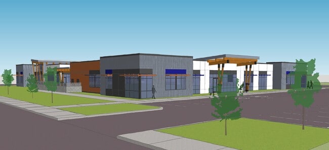
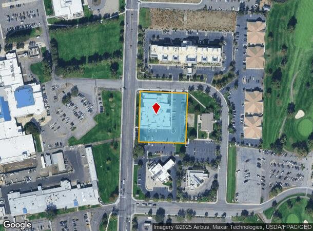
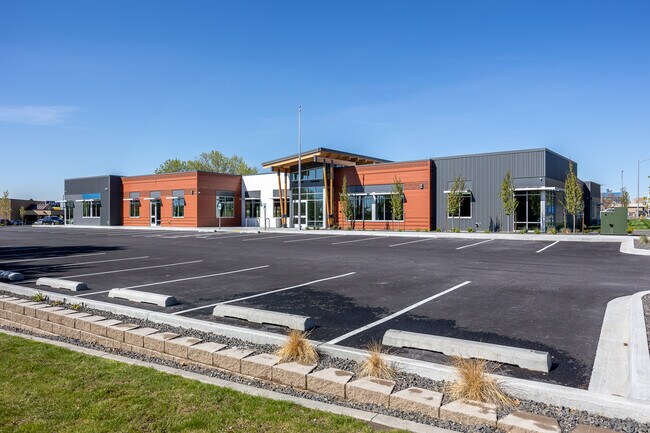
2713 N 20Th Ave, Pasco, WA 99301

Current Lease Availabilities
NEARBY LISTINGS FOR SALE OR LEASE
Property Detail
2713 N 20Th Ave
Other Market Areas
98-4 Bsp
Kennewick-Richland, WA
PTN GOVT LOTS 1 & 2 19-9-30 DAF: BINDING SITE PLAN 98-4 LOT 1 LESS S60 THEREOF
113-300-160
Franklin
Commercialnec
Washington
2025
1,2
2025
1.51 AC
020300
Yakima/Kennewick
32,864 SF
DEMOGRAPHICS near 2713 N 20Th Ave
1 Mile
3 Mile
5 Mile
2024 Total Population
8,848
56,507
136,375
2029 Population
9,440
60,677
146,606
Pop Growth 2024-2029
+ 6.69%
+ 7.38%
+ 7.50%
Average Age
34
34
35
2024 Total Households
2,604
17,012
44,468
HH Growth 2024-2029
+ 6.80%
+ 7.32%
+ 7.45%
Median Household Inc
$62,757
$75,818
$69,194
Avg Household Size
3.20
3.20
3.00
2024 Avg HH Vehicles
2.00
2.00
2.00
Median Home Value
$186,992
$277,532
$281,356
Median Year Built
1968
1980
1979
Nearby Places
Map Layers
Map Styles
 Street
 Aerial
- Restaurants
- Banks
- Shops
- Fitness
- Groceries
PUBLIC TRANSPORTATION
COMMUTER RAIL
Pasco Amtrak Station (Empire Builder - Amtrak)
DRIVE
WALK
Distance
Pasco Amtrak Station (Empire Builder - Amtrak)
5 min
2.7 mi
AIRPORT
Tri-Cities
DRIVE
WALK
Distance
Tri-Cities
1 min
0.7 mi
Freight Ports
Port of Tacoma
DRIVE
WALK
Distance
Port of Tacoma
270 min
236.9 mi
Nearby Properties
Address
Land Use
TOTAL SIZE
Lot Size
Zoning
Address
Land Use
TOTAL SIZE
Lot Size
Zoning
277,478 SF
27.86 AC
Address
Land Use
TOTAL SIZE
Lot Size
Zoning
53,980 SF
25.90 AC
Address
Land Use
TOTAL SIZE
Lot Size
Zoning
32.48 AC
Address
Land Use
TOTAL SIZE
Lot Size
Zoning
2,863,808 SF
28.33 AC
Address
Land Use
TOTAL SIZE
Lot Size
Zoning
375,317 SF
17.68 AC
Address
Land Use
TOTAL SIZE
Lot Size
Zoning
189,054 SF
28.48 AC
Address
Land Use
TOTAL SIZE
Lot Size
Zoning
444,084 SF
58 AC
Address
Land Use
TOTAL SIZE
Lot Size
Zoning
204,680 SF
39.50 AC
Address
Land Use
TOTAL SIZE
Lot Size
Zoning
254,856 SF
10.47 AC
Address
Land Use
TOTAL SIZE
Lot Size
Zoning
161,465 SF
24.12 AC
Address
Land Use
TOTAL SIZE
Lot Size
Zoning
214,102 SF
9.88 AC
Address
Land Use
TOTAL SIZE
Lot Size
Zoning
163,900 SF
11.90 AC
Address
Land Use
TOTAL SIZE
Lot Size
Zoning
153,320 SF
7.37 AC
Address
Land Use
TOTAL SIZE
Lot Size
Zoning
114,673 SF
6.58 AC
Address
Land Use
TOTAL SIZE
Lot Size
Zoning
84,951 SF
4.39 AC
Address
Land Use
TOTAL SIZE
Lot Size
Zoning
64,936 SF
Address
Land Use
TOTAL SIZE
Lot Size
Zoning
84,680 SF
3 AC
Address
Land Use
TOTAL SIZE
Lot Size
Zoning
181,290 SF
33.52 AC
Address
Land Use
TOTAL SIZE
Lot Size
Zoning
67,635 SF
5.95 AC
Address
Land Use
TOTAL SIZE
Lot Size
Zoning
278,800 SF
110.64 AC
Address
Land Use
TOTAL SIZE
Lot Size
Zoning
241,912 SF
12.99 AC
Address
Land Use
TOTAL SIZE
Lot Size
Zoning
85,104 SF
3 AC
Address
Land Use
TOTAL SIZE
Lot Size
Zoning
20,919 SF
58.49 AC
KENNEWICK
Address
Land Use
TOTAL SIZE
Lot Size
Zoning
88,510 SF
14.04 AC
Address
Land Use
TOTAL SIZE
Lot Size
Zoning
103,750 SF
14.97 AC
Address
Land Use
TOTAL SIZE
Lot Size
Zoning
58,701 SF
11.34 AC
Address
Land Use
TOTAL SIZE
Lot Size
Zoning
80,604 SF
4.30 AC
Address
Land Use
TOTAL SIZE
Lot Size
Zoning
91,608 SF
6.60 AC
Address
Land Use
TOTAL SIZE
Lot Size
Zoning
75,542 SF
6.36 AC
Address
Land Use
TOTAL SIZE
Lot Size
Zoning
125,508 SF
3.49 AC
The World's #1 Commercial Real Estate Marketplace
Connect with us
© 2026 CoStar Group
The information above has been obtained from sources believed reliable. While we do not doubt its accuracy we have not verified it and make no guarantee, warranty or representation about it. It is your responsibility to independently confirm its accuracy and completeness. Any projections, opinions, assumptions, or estimates used are for example only and do not represent the current or future performance of the property. The value of this transaction to you depends on tax and other factors which should be evaluated by your tax, financial, and legal advisors. You and your advisors should conduct a careful, independent investigation of the property to determine to your satisfaction the suitability of the property for your needs.