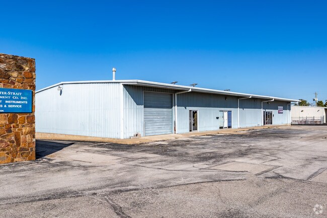
Property Record
2714 N Sheridan Rd, Tulsa, OK 74115
NEARBY LISTINGS FOR SALE OR LEASE
Property Detail
2714 N Sheridan Rd
90322-03-22-24970
Unplatted
Lightindustrial
BEG 937.2N & 30W SECR SE TH N55 W630 S55 E630 POB LESS E20 FOR RD SEC 22 20 13 .770ACS
X
Tulsa
40143C0234L
Oklahoma
2025
0.77 AC
2025
Northeast Tulsa
011300
Tulsa
12,000 SF
Tulsa, OK
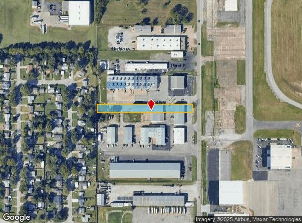
DEMOGRAPHICS near 2714 N Sheridan Rd
1 Mile
3 Mile
5 Mile
2024 Total Population
1,819
40,807
122,720
2029 Population
1,901
42,456
128,186
Pop Growth 2024-2029
+ 4.51%
+ 4.04%
+ 4.45%
Average Age
37
35
36
2024 Total Households
678
14,504
48,004
HH Growth 2024-2029
+ 4.57%
+ 4.07%
+ 4.57%
Median Household Inc
$29,181
$38,564
$41,399
Avg Household Size
2.60
2.70
2.40
2024 Avg HH Vehicles
2.00
2.00
2.00
Median Home Value
$56,489
$67,088
$99,062
Median Year Built
1958
1955
1957
Nearby Places
Map Layers
Map Styles
 Street
 Aerial
- Restaurants
- Banks
- Shops
- Fitness
- Groceries
PUBLIC TRANSPORTATION
AIRPORT
Tulsa International
DRIVE
WALK
Distance
Tulsa International
6 min
2.5 mi
SALE & LEASE HISTORY
LISTING DATE
SALE/LEASE

Nov 09, 2017
For Lease
Apr 14, 2017
For Lease
Nearby Properties
Address
Land Use
TOTAL SIZE
Lot Size
Zoning
Address
Land Use
TOTAL SIZE
Lot Size
Zoning
609,418 SF
177.77 AC
IM
Address
Land Use
TOTAL SIZE
Lot Size
Zoning
353.75 AC
IL
Address
Land Use
TOTAL SIZE
Lot Size
Zoning
94,115 SF
15.18 AC
IM
Address
Land Use
TOTAL SIZE
Lot Size
Zoning
1 SF
207.77 AC
IM
Address
Land Use
TOTAL SIZE
Lot Size
Zoning
228.59 AC
IL
Address
Land Use
TOTAL SIZE
Lot Size
Zoning
195,492 SF
17.11 AC
RM1
Address
Land Use
TOTAL SIZE
Lot Size
Zoning
42,665 SF
493.63 AC
RS3
Address
Land Use
TOTAL SIZE
Lot Size
Zoning
110.77 AC
IL
Address
Land Use
TOTAL SIZE
Lot Size
Zoning
103,248 SF
8.87 AC
IL
Address
Land Use
TOTAL SIZE
Lot Size
Zoning
36,962 SF
1.23 AC
CH
Address
Land Use
TOTAL SIZE
Lot Size
Zoning
97.68 AC
CH
Address
Land Use
TOTAL SIZE
Lot Size
Zoning
29,584 SF
2.99 AC
IM
Address
Land Use
TOTAL SIZE
Lot Size
Zoning
41,874 SF
35.70 AC
RS3
Address
Land Use
TOTAL SIZE
Lot Size
Zoning
139.39 AC
IM
Address
Land Use
TOTAL SIZE
Lot Size
Zoning
34,356 SF
35.67 AC
RS3
Address
Land Use
TOTAL SIZE
Lot Size
Zoning
19,708 SF
21.04 AC
IL
Address
Land Use
TOTAL SIZE
Lot Size
Zoning
92,364 SF
8.58 AC
RM1
Address
Land Use
TOTAL SIZE
Lot Size
Zoning
187,351 SF
218.26 AC
IL
Address
Land Use
TOTAL SIZE
Lot Size
Zoning
185,649 SF
56.23 AC
IL
Address
Land Use
TOTAL SIZE
Lot Size
Zoning
41,728 SF
10.07 AC
RS3
Address
Land Use
TOTAL SIZE
Lot Size
Zoning
55,425 SF
2.96 AC
IL
Address
Land Use
TOTAL SIZE
Lot Size
Zoning
36,450 SF
30.52 AC
RS3
Address
Land Use
TOTAL SIZE
Lot Size
Zoning
513.99 AC
RS3
Address
Land Use
TOTAL SIZE
Lot Size
Zoning
44,195 SF
5.07 AC
RS3
Address
Land Use
TOTAL SIZE
Lot Size
Zoning
49,953 SF
2.36 AC
OL
Address
Land Use
TOTAL SIZE
Lot Size
Zoning
147,683 SF
9.19 AC
IL
Address
Land Use
TOTAL SIZE
Lot Size
Zoning
43,225 SF
9.30 AC
RS3
Address
Land Use
TOTAL SIZE
Lot Size
Zoning
63,675 SF
3.26 AC
CH
Address
Land Use
TOTAL SIZE
Lot Size
Zoning
53.24 AC
IM
The World's #1 Commercial Real Estate Marketplace
Connect with us
© 2025 CoStar Group
The information above has been obtained from sources believed reliable. While we do not doubt its accuracy we have not verified it and make no guarantee, warranty or representation about it. It is your responsibility to independently confirm its accuracy and completeness. Any projections, opinions, assumptions, or estimates used are for example only and do not represent the current or future performance of the property. The value of this transaction to you depends on tax and other factors which should be evaluated by your tax, financial, and legal advisors. You and your advisors should conduct a careful, independent investigation of the property to determine to your satisfaction the suitability of the property for your needs.