Property Record
4605 W Walnut St, Soquel, CA 95073


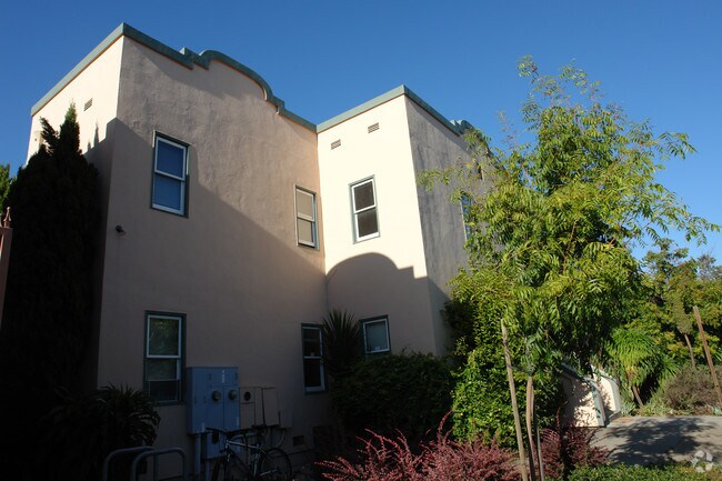
Property Detail
4605 W Walnut St
Storesoffices
SANTA CRUZ
C-2-GH
California
AE The base floodplain where base flood elevations are provided. AE Zones are now used on new format FIRMs instead of A1-A30 Zones.
0.66 AC
2024
Mid-County
2025
Santa Cruz/Watsonville
122005
Santa Cruz-Watsonville, CA
2,574 SF
030-142-15-000
NEARBY LISTINGS FOR SALE OR LEASE
DEMOGRAPHICS near 4605 W Walnut St
1 mile
3 mile
5 mile
2025 Total Population
15,775
65,476
118,610
2030 Population
15,568
64,747
117,324
Pop Growth 2025-2030
(1.31%)
(1.11%)
(1.08%)
Average Age
45
45
44
2025 Total Households
6,756
27,186
48,108
HH Growth 2025-2030
(1.38%)
(1.28%)
(1.27%)
Median Household Inc
$100,564
$107,643
$110,773
Avg Household Size
2.30
2.30
2.30
2025 Avg HH Vehicles
2.00
2.00
2.00
Median Home Value
$932,010
$1,025,510
$1,057,584
Median Year Built
1975
1973
1972
Nearby Places
Map Layers
Map Styles
 Street
 Aerial
Layers
 Traffic
 Biking
Places
Listings with unknown addresses are not visible on the map
- Restaurants
- Banks
- Shops
- Fitness
- Groceries
PUBLIC TRANSPORTATION
AIRPORT
Norman Y Mineta San Jose International
Drive
Walk
Distance
Norman Y Mineta San Jose International
48 min
34.9 mi
Monterey Regional
Drive
Walk
Distance
Monterey Regional
49 min
39.0 mi
Freight Ports
Port of Redwood City
Drive
Walk
Distance
Port of Redwood City
67 min
50.8 mi
Nearby Properties
Address
Land Use
TOTAL SIZE
Lot Size
Zoning
Address
Land Use
TOTAL SIZE
Lot Size
Zoning
18.67 AC
PF
Address
Land Use
TOTAL SIZE
Lot Size
Zoning
135,803 SF
56.45 AC
PR
Address
Land Use
TOTAL SIZE
Lot Size
Zoning
3.46 AC
PF
Address
Land Use
TOTAL SIZE
Lot Size
Zoning
82,820 SF
4.64 AC
RM-3
Address
Land Use
TOTAL SIZE
Lot Size
Zoning
53,988 SF
2.36 AC
C-1
Address
Land Use
TOTAL SIZE
Lot Size
Zoning
133,825 SF
8.22 AC
Address
Land Use
TOTAL SIZE
Lot Size
Zoning
84,533 SF
2.62 AC
RM-2.5
Address
Land Use
TOTAL SIZE
Lot Size
Zoning
70,818 SF
6.38 AC
C-2
Address
Land Use
TOTAL SIZE
Lot Size
Zoning
60,052 SF
3 AC
PA
Address
Land Use
TOTAL SIZE
Lot Size
Zoning
50,511 SF
2.54 AC
RM-3-H
Address
Land Use
TOTAL SIZE
Lot Size
Zoning
2,571 SF
14.40 AC
C-2
Address
Land Use
TOTAL SIZE
Lot Size
Zoning
128,853 SF
3.54 AC
Address
Land Use
TOTAL SIZE
Lot Size
Zoning
1,535 SF
10.11 AC
C-2
Address
Land Use
TOTAL SIZE
Lot Size
Zoning
52,804 SF
4.17 AC
C-2
Address
Land Use
TOTAL SIZE
Lot Size
Zoning
75,000 SF
5.99 AC
Address
Land Use
TOTAL SIZE
Lot Size
Zoning
55,012 SF
6.77 AC
Address
Land Use
TOTAL SIZE
Lot Size
Zoning
19,652 SF
2.53 AC
PA
Address
Land Use
TOTAL SIZE
Lot Size
Zoning
10.05 AC
Address
Land Use
TOTAL SIZE
Lot Size
Zoning
59,950 SF
1.16 AC
Address
Land Use
TOTAL SIZE
Lot Size
Zoning
66,513 SF
5.53 AC
RM-3-MH
Address
Land Use
TOTAL SIZE
Lot Size
Zoning
102,976 SF
2.06 AC
C-4
Address
Land Use
TOTAL SIZE
Lot Size
Zoning
82,075 SF
4.59 AC
Address
Land Use
TOTAL SIZE
Lot Size
Zoning
174,153 SF
3.72 AC
RM-2.5
Address
Land Use
TOTAL SIZE
Lot Size
Zoning
2.59 AC
Address
Land Use
TOTAL SIZE
Lot Size
Zoning
41,289 SF
4.11 AC
C-4
Address
Land Use
TOTAL SIZE
Lot Size
Zoning
52,118 SF
2.18 AC
Address
Land Use
TOTAL SIZE
Lot Size
Zoning
13,793 SF
7.42 AC
Address
Land Use
TOTAL SIZE
Lot Size
Zoning
3.62 AC
VA
Address
Land Use
TOTAL SIZE
Lot Size
Zoning
39,038 SF
1.79 AC
Address
Land Use
TOTAL SIZE
Lot Size
Zoning
67,536 SF
2.09 AC
The World's #1 Commercial Real Estate Marketplace
Connect with us
© 2026 CoStar Group
The information above has been obtained from sources believed reliable. While we do not doubt its accuracy we have not verified it and make no guarantee, warranty or representation about it. It is your responsibility to independently confirm its accuracy and completeness. Any projections, opinions, assumptions, or estimates used are for example only and do not represent the current or future performance of the property. The value of this transaction to you depends on tax and other factors which should be evaluated by your tax, financial, and legal advisors. You and your advisors should conduct a careful, independent investigation of the property to determine to your satisfaction the suitability of the property for your needs.